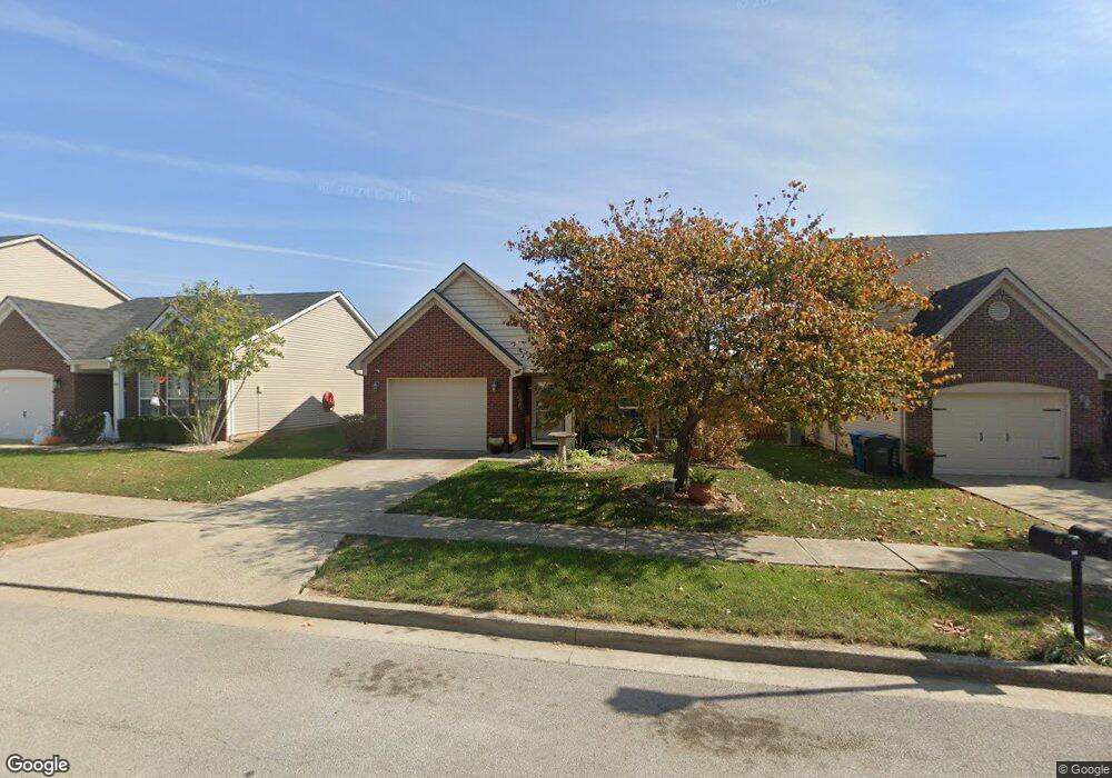
83 Brookford Way Georgetown, KY 40324
Southeast Scott County NeighborhoodEstimated Value: $276,036 - $296,000
3
Beds
2
Baths
1,402
Sq Ft
$206/Sq Ft
Est. Value
About This Home
This home is located at 83 Brookford Way, Georgetown, KY 40324 and is currently estimated at $289,009, approximately $206 per square foot. 83 Brookford Way is a home located in Scott County with nearby schools including Creekside Elementary School, Eastern Elementary School, and Scott County Middle School.
Ownership History
Date
Name
Owned For
Owner Type
Purchase Details
Closed on
Jun 11, 2010
Sold by
Ball Homes Llc
Bought by
Bowen William V and Bowen Medra Blair
Current Estimated Value
Home Financials for this Owner
Home Financials are based on the most recent Mortgage that was taken out on this home.
Original Mortgage
$145,418
Outstanding Balance
$97,459
Interest Rate
4.97%
Mortgage Type
VA
Estimated Equity
$191,550
Create a Home Valuation Report for This Property
The Home Valuation Report is an in-depth analysis detailing your home's value as well as a comparison with similar homes in the area
Home Values in the Area
Average Home Value in this Area
Purchase History
| Date | Buyer | Sale Price | Title Company |
|---|---|---|---|
| Bowen William V | $145,418 | Vgt Title Services Llc |
Source: Public Records
Mortgage History
| Date | Status | Borrower | Loan Amount |
|---|---|---|---|
| Open | Bowen William V | $145,418 |
Source: Public Records
Tax History Compared to Growth
Tax History
| Year | Tax Paid | Tax Assessment Tax Assessment Total Assessment is a certain percentage of the fair market value that is determined by local assessors to be the total taxable value of land and additions on the property. | Land | Improvement |
|---|---|---|---|---|
| 2024 | $1,994 | $221,700 | $0 | $0 |
| 2023 | $1,903 | $209,900 | $37,500 | $172,400 |
| 2022 | $1,280 | $191,100 | $35,000 | $156,100 |
| 2021 | $1,238 | $171,900 | $35,000 | $136,900 |
| 2020 | $1,076 | $164,500 | $35,000 | $129,500 |
| 2019 | $1,011 | $155,100 | $0 | $0 |
| 2018 | $975 | $149,900 | $0 | $0 |
| 2017 | $953 | $146,940 | $0 | $0 |
| 2016 | $856 | $143,248 | $0 | $0 |
| 2015 | $844 | $105,500 | $0 | $0 |
| 2014 | $882 | $106,400 | $0 | $0 |
| 2011 | $69 | $111,418 | $0 | $0 |
Source: Public Records
Map
Nearby Homes
- 191 Johnstone Trail
- 101 Dunn Cir
- 208 Johnstone Trail
- 206 Johnstone Trail
- 173 Waterside Dr
- 204 Johnstone Trail
- 105 Oxford Landing Dr
- 144 Limestone Ln
- 139 Limestone Ln
- 124 Amick Way
- 115 Oxford Landing Dr
- 3140 Paris Pike
- 117 Oxford Landing Dr
- 119 Oxford Landing Dr
- 127 Amick Way
- 118 Oxford Landing Dr
- 176 Oxford Landing Dr
- 123 Oxford Landing Dr
- 120 Oxford Landing Dr
- 121 Limestone Ln
- 85 Brookford Way
- 81 Brookford Way
- 79 Brookford Way
- 87 Brookford Way
- 115 Dalton Rd
- 117 Dalton Rd
- 113 Dalton Rd
- 119 Dalton Rd
- 77 Brookford Way
- 84 Brookford Way
- 82 Brookford Way
- 86 Brookford Way
- 121 Dalton Rd
- 121 Dalton Rd Unit 88RC
- 80 Brookford Way
- 109 Dalton Rd
- 88 Brookford Way
- 75 Brookford Way
- 91 Brookford Way
- 78 Brookford Way