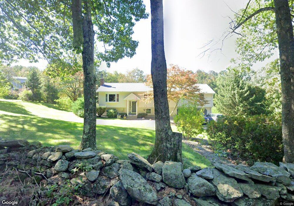
83 Davis Rd Westminster, MA 01473
Estimated Value: $515,299 - $651,000
4
Beds
2
Baths
1,614
Sq Ft
$374/Sq Ft
Est. Value
About This Home
This home is located at 83 Davis Rd, Westminster, MA 01473 and is currently estimated at $603,075, approximately $373 per square foot. 83 Davis Rd is a home located in Worcester County with nearby schools including Oakmont Regional High School.
Ownership History
Date
Name
Owned For
Owner Type
Purchase Details
Closed on
Aug 19, 2021
Sold by
Macdonald Timothy J
Bought by
T J Macdonald 2021 Irt
Current Estimated Value
Purchase Details
Closed on
Jan 30, 1998
Sold by
Jones Ora D and Jones Marion J
Bought by
Macdonald Timothy J and Macdonald Virginia C
Home Financials for this Owner
Home Financials are based on the most recent Mortgage that was taken out on this home.
Original Mortgage
$144,000
Interest Rate
7.02%
Mortgage Type
Purchase Money Mortgage
Purchase Details
Closed on
Mar 30, 1987
Sold by
Trama Robert J
Bought by
Jones O D
Create a Home Valuation Report for This Property
The Home Valuation Report is an in-depth analysis detailing your home's value as well as a comparison with similar homes in the area
Home Values in the Area
Average Home Value in this Area
Purchase History
| Date | Buyer | Sale Price | Title Company |
|---|---|---|---|
| T J Macdonald 2021 Irt | -- | None Available | |
| V C Macdonald 2021 Irt | -- | None Available | |
| Macdonald Timothy J | -- | None Available | |
| Macdonald Timothy J | -- | None Available | |
| Macdonald Timothy J | $160,000 | -- | |
| Jones O D | $155,900 | -- |
Source: Public Records
Mortgage History
| Date | Status | Borrower | Loan Amount |
|---|---|---|---|
| Previous Owner | Jones O D | $118,209 | |
| Previous Owner | Jones O D | $144,000 | |
| Previous Owner | Jones O D | $107,000 |
Source: Public Records
Tax History
| Year | Tax Paid | Tax Assessment Tax Assessment Total Assessment is a certain percentage of the fair market value that is determined by local assessors to be the total taxable value of land and additions on the property. | Land | Improvement |
|---|---|---|---|---|
| 2025 | $5,315 | $432,100 | $121,600 | $310,500 |
| 2024 | $5,087 | $414,900 | $121,600 | $293,300 |
| 2023 | $5,093 | $390,000 | $112,300 | $277,700 |
| 2022 | $4,945 | $313,000 | $97,700 | $215,300 |
| 2021 | $4,859 | $289,900 | $86,400 | $203,500 |
| 2020 | $4,735 | $269,800 | $78,400 | $191,400 |
| 2019 | $4,676 | $256,200 | $64,800 | $191,400 |
| 2018 | $4,519 | $243,600 | $64,800 | $178,800 |
| 2017 | $4,287 | $235,700 | $64,800 | $170,900 |
| 2016 | $4,297 | $228,800 | $53,900 | $174,900 |
| 2015 | $4,300 | $226,900 | $53,900 | $173,000 |
| 2014 | $4,307 | $226,900 | $53,900 | $173,000 |
Source: Public Records
Map
Nearby Homes
- 21 Davis Rd
- 0 Minott Rd
- 97 Worcester Rd
- 38 Knower Rd
- 84 Minott Rd
- 224 Worcester Rd Unit B
- 224 Worcester Rd
- 9 Knower Rd
- 17 Leominster St
- 0 Worcester Rd Unit 73326124
- 2 Seaver St
- 3 Linda Dr
- Lot 0 Narrows Rd
- 3 Woods Rd
- 20 Battles Rd
- 100A W Main St
- 169 Narrows Rd
- 2 Roberts Way
- 49 Greene Rd
- Lot 6 Shady Ave
Your Personal Tour Guide
Ask me questions while you tour the home.