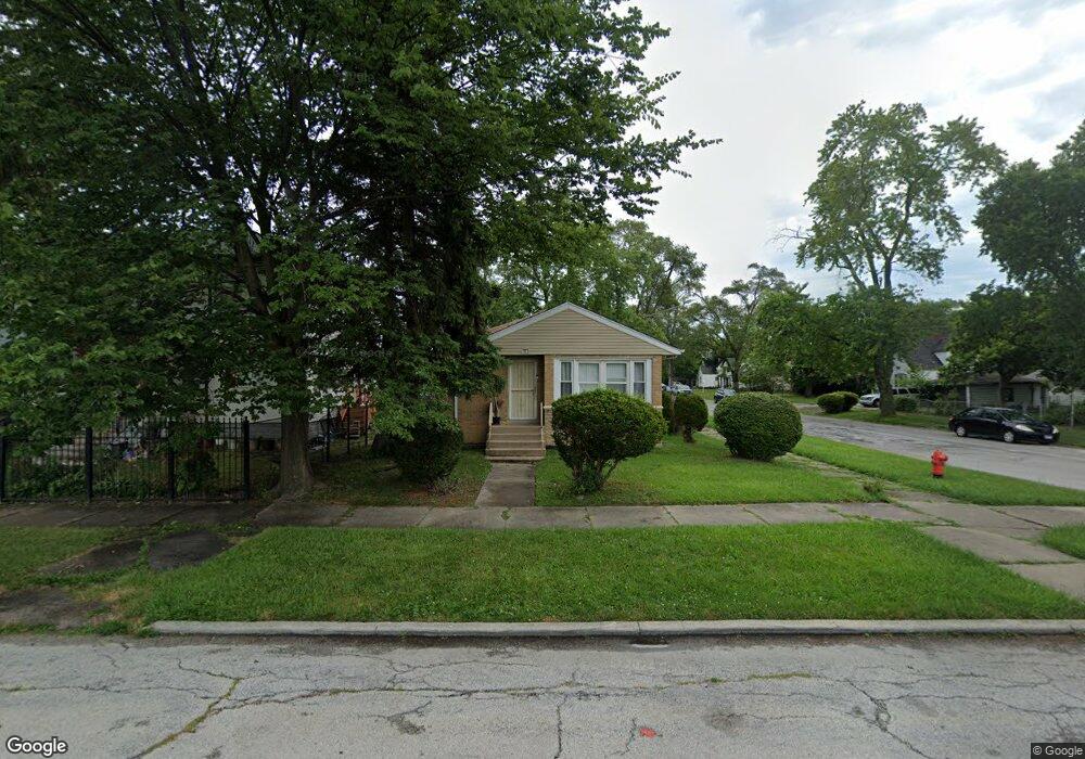
83 E 151st St Harvey, IL 60426
Estimated Value: $51,000 - $143,000
2
Beds
1
Bath
888
Sq Ft
$107/Sq Ft
Est. Value
About This Home
This home is located at 83 E 151st St, Harvey, IL 60426 and is currently estimated at $95,364, approximately $107 per square foot. 83 E 151st St is a home located in Cook County with nearby schools including Whittier Elementary School, Brooks Middle School, and Thornton Township High School.
Ownership History
Date
Name
Owned For
Owner Type
Purchase Details
Closed on
Jan 15, 2004
Sold by
Bank Of New York
Bought by
Simmons James Lee
Current Estimated Value
Purchase Details
Closed on
Jul 31, 2003
Sold by
Boyd Carolyn
Bought by
Bank Of New York
Purchase Details
Closed on
Oct 24, 2000
Sold by
Woods Michael D
Bought by
Boyd Carolyn and Moore Antwoine
Home Financials for this Owner
Home Financials are based on the most recent Mortgage that was taken out on this home.
Original Mortgage
$52,720
Interest Rate
15.87%
Purchase Details
Closed on
Aug 14, 2000
Sold by
Va
Bought by
Woods Michael D
Create a Home Valuation Report for This Property
The Home Valuation Report is an in-depth analysis detailing your home's value as well as a comparison with similar homes in the area
Home Values in the Area
Average Home Value in this Area
Purchase History
| Date | Buyer | Sale Price | Title Company |
|---|---|---|---|
| Simmons James Lee | $24,000 | First American Title Ins | |
| Bank Of New York | -- | -- | |
| Boyd Carolyn | $66,000 | -- | |
| Woods Michael D | -- | -- |
Source: Public Records
Mortgage History
| Date | Status | Borrower | Loan Amount |
|---|---|---|---|
| Previous Owner | Boyd Carolyn | $52,720 | |
| Closed | Boyd Carolyn | $9,885 |
Source: Public Records
Tax History
| Year | Tax Paid | Tax Assessment Tax Assessment Total Assessment is a certain percentage of the fair market value that is determined by local assessors to be the total taxable value of land and additions on the property. | Land | Improvement |
|---|---|---|---|---|
| 2025 | $3,791 | $5,517 | $1,066 | $4,451 |
| 2024 | $3,791 | $5,517 | $1,066 | $4,451 |
| 2023 | $3,606 | $5,800 | $1,066 | $4,734 |
| 2022 | $3,606 | $4,436 | $1,066 | $3,370 |
| 2021 | $3,483 | $4,434 | $1,065 | $3,369 |
| 2020 | $3,579 | $4,434 | $1,065 | $3,369 |
| 2019 | $3,893 | $5,017 | $968 | $4,049 |
| 2018 | $3,799 | $5,017 | $968 | $4,049 |
| 2017 | $3,712 | $5,017 | $968 | $4,049 |
| 2016 | $3,116 | $4,814 | $871 | $3,943 |
| 2015 | $1,362 | $4,814 | $871 | $3,943 |
| 2014 | $1,954 | $5,720 | $871 | $4,849 |
| 2013 | $1,615 | $5,284 | $871 | $4,413 |
Source: Public Records
Map
Nearby Homes
- 36 E 151st St
- 72 E 152nd St
- 15117 Vine Ave
- 15218 Turlington Ave
- 15246 Lexington Ave
- 15240 Turlington Ave
- 14900 Vine Ave
- 15125 Marshfield Ave
- 15128 Marshfield Ave
- 15213 Marshfield Ave
- 36 W 151st St
- 15033 Paulina St
- 15240 Ashland Ave
- 15342 Loomis Ave
- 14735 Myrtle Ave
- 14902 Paulina St
- 15015 Wood St
- 14807 Paulina St
- 14801 Paulina St
- 14910 S Wood St
- 81 E 151st St
- 79 E 151st St
- 15032 Loomis Ave
- 85 E 151st St
- 73 E 151st St
- 89 E 151st St
- 71 E 151st St
- 15028 Loomis Ave
- 93 E 151st St
- 15033 Loomis Ave
- 15022 Loomis Ave
- 15022 Loomis Ave
- 15031 Loomis Ave
- 97 E 151st St
- 15029 Loomis Ave
- 15018 Loomis Ave
- 99 E 151st St
- 15025 Loomis Ave
- 15033 Myrtle Ave
- 61 E 151st St
Your Personal Tour Guide
Ask me questions while you tour the home.