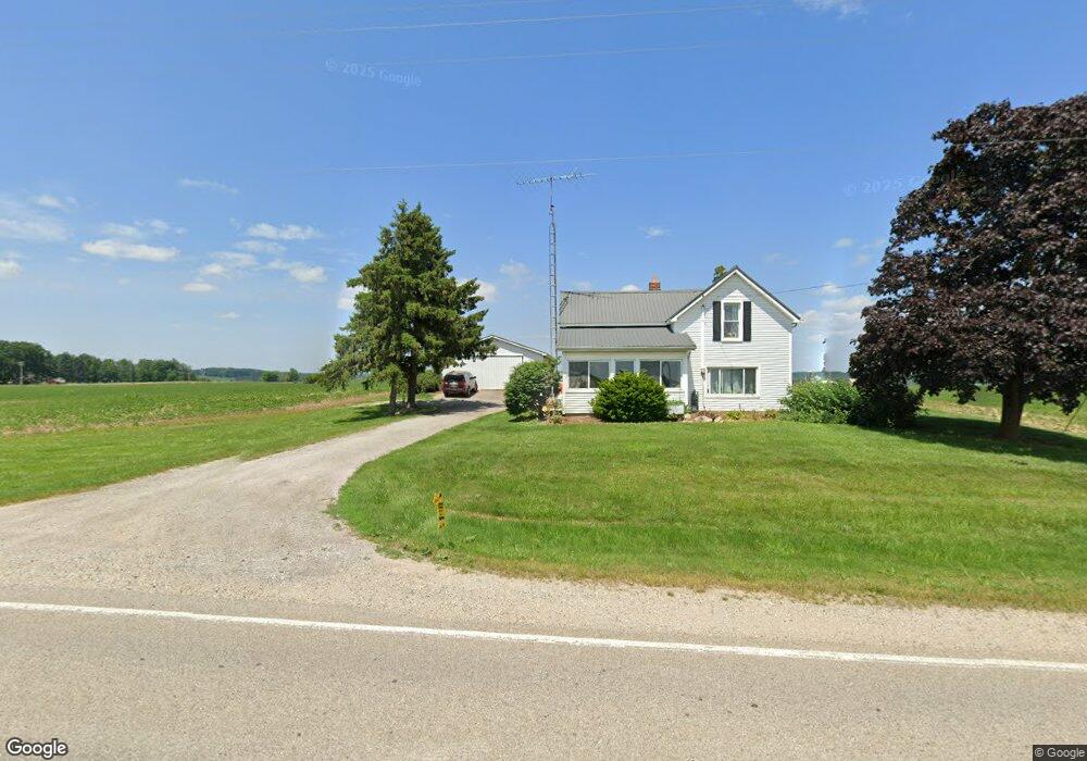
83 E State Rd West Branch, MI 48661
Estimated Value: $190,000 - $332,000
--
Bed
1
Bath
1,168
Sq Ft
$223/Sq Ft
Est. Value
About This Home
This home is located at 83 E State Rd, West Branch, MI 48661 and is currently estimated at $261,000, approximately $223 per square foot. 83 E State Rd is a home located in Ogemaw County with nearby schools including Surline Elementary School, Surline Middle School, and Ogemaw Heights High School.
Ownership History
Date
Name
Owned For
Owner Type
Purchase Details
Closed on
Aug 9, 2018
Sold by
Ann Twite
Bought by
W & W Land Company Llc
Current Estimated Value
Create a Home Valuation Report for This Property
The Home Valuation Report is an in-depth analysis detailing your home's value as well as a comparison with similar homes in the area
Home Values in the Area
Average Home Value in this Area
Purchase History
| Date | Buyer | Sale Price | Title Company |
|---|---|---|---|
| W & W Land Company Llc | $150,000 | -- |
Source: Public Records
Tax History Compared to Growth
Tax History
| Year | Tax Paid | Tax Assessment Tax Assessment Total Assessment is a certain percentage of the fair market value that is determined by local assessors to be the total taxable value of land and additions on the property. | Land | Improvement |
|---|---|---|---|---|
| 2025 | $1,978 | $92,417 | $0 | $0 |
| 2024 | $9 | $82,400 | $0 | $0 |
| 2023 | $903 | $73,900 | $0 | $0 |
| 2022 | $1,809 | $76,600 | $0 | $0 |
| 2021 | $1,682 | $71,600 | $0 | $0 |
| 2020 | $1,734 | $68,300 | $0 | $0 |
| 2019 | $1,583 | $67,300 | $0 | $0 |
| 2018 | $1,181 | $60,500 | $0 | $0 |
| 2017 | $1,087 | $56,500 | $0 | $0 |
| 2016 | $1,060 | $63,500 | $0 | $0 |
| 2015 | $1,057 | $64,100 | $0 | $0 |
| 2014 | $1,053 | $70,500 | $0 | $0 |
Source: Public Records
Map
Nearby Homes
- 409 S Morrison Rd
- 1380 S Campbell Rd
- 1240 Quigley Rd
- 3086 Gradowski R#3 Dr
- 358 E Esmond Rd
- x Oleskie Trail
- 2249 W State Rd
- 0 Whitetail Ct Unit 165
- 2301 Birchcrest Dr
- 2190 Fox Run
- 2249 Fox Run
- 2388 Dam Rd
- 2371 Pilatus Ct
- 1820 N Ogemaw Trail
- 0 Jonathan Ct Unit 11 1926460
- 0 Jonathan Ct Unit 12 1926461
- 0 Jonathan Ct Unit 1926470
- 0 Jonathan Ct Unit 10 1926458
- Parcel 1 M-76
- Parcel 2 M-76