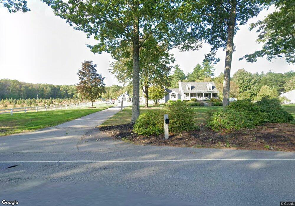
83 Groton Rd Shirley, MA 01464
Estimated Value: $796,000 - $999,000
4
Beds
3
Baths
3,136
Sq Ft
$276/Sq Ft
Est. Value
About This Home
This home is located at 83 Groton Rd, Shirley, MA 01464 and is currently estimated at $866,387, approximately $276 per square foot. 83 Groton Rd is a home located in Middlesex County with nearby schools including Page Hilltop School, Lura A. White Elementary School, and Ayer Shirley Regional Middle School.
Ownership History
Date
Name
Owned For
Owner Type
Purchase Details
Closed on
Jul 21, 2025
Sold by
Chase Debra J and Gould Joan C
Bought by
Harrod Gregory W and Baldino Karyn A
Current Estimated Value
Purchase Details
Closed on
Oct 19, 2020
Sold by
Keiran-Harrod Linda
Bought by
Harrod Gregory W and Baldino Karyn A
Home Financials for this Owner
Home Financials are based on the most recent Mortgage that was taken out on this home.
Original Mortgage
$495,000
Interest Rate
2.8%
Mortgage Type
New Conventional
Purchase Details
Closed on
Nov 18, 2014
Sold by
Harrod Gregory W
Bought by
Harrod Linda K
Create a Home Valuation Report for This Property
The Home Valuation Report is an in-depth analysis detailing your home's value as well as a comparison with similar homes in the area
Home Values in the Area
Average Home Value in this Area
Purchase History
| Date | Buyer | Sale Price | Title Company |
|---|---|---|---|
| Harrod Gregory W | $80,000 | -- | |
| Harrod Gregory W | $80,000 | -- | |
| Harrod Gregory W | $550,000 | None Available | |
| Harrod Gregory W | $550,000 | None Available | |
| Harrod Linda K | -- | -- | |
| Harrod Linda K | -- | -- | |
| Harrod Linda K | -- | -- |
Source: Public Records
Mortgage History
| Date | Status | Borrower | Loan Amount |
|---|---|---|---|
| Previous Owner | Harrod Gregory W | $495,000 | |
| Previous Owner | Harrod Linda K | $104,000 | |
| Previous Owner | Harrod Linda K | $112,800 | |
| Previous Owner | Harrod Linda K | $111,000 |
Source: Public Records
Tax History Compared to Growth
Tax History
| Year | Tax Paid | Tax Assessment Tax Assessment Total Assessment is a certain percentage of the fair market value that is determined by local assessors to be the total taxable value of land and additions on the property. | Land | Improvement |
|---|---|---|---|---|
| 2025 | $95 | $734,872 | $142,272 | $592,600 |
| 2024 | $9,130 | $672,832 | $130,232 | $542,600 |
| 2023 | $8,915 | $628,712 | $130,312 | $498,400 |
| 2022 | $8,550 | $552,328 | $126,328 | $426,000 |
| 2021 | $8,511 | $514,852 | $114,352 | $400,500 |
| 2020 | $8,137 | $505,108 | $114,308 | $390,800 |
| 2019 | $7,842 | $487,706 | $114,306 | $373,400 |
| 2018 | $7,783 | $474,010 | $109,510 | $364,500 |
| 2017 | $6,793 | $411,210 | $106,310 | $304,900 |
| 2016 | $6,492 | $393,190 | $106,290 | $286,900 |
| 2015 | $6,332 | $365,790 | $104,690 | $261,100 |
Source: Public Records
Map
Nearby Homes
- 22 Townsend Rd
- 43 Longley Rd
- 59 Squannacook Rd
- 111 Squannacook Rd
- 37 Pepperell Rd
- 55 W Main St
- 65 W Main St
- 49 Parker Rd
- 346 Townsend Rd
- 354 Townsend Rd
- 1790 Massachusetts Ave Unit 25
- 1790 Mass Ave Unit 3
- 1790 Massachusetts Ave Unit 22
- Lot 10 Christian Cir
- 166 Elmwood Rd
- 124 Hazen Rd
- 21 Magnolia Ln
- 49 Magnolia Ln Unit 49
- 601 Flat Hill Rd
- 147 Shirley St