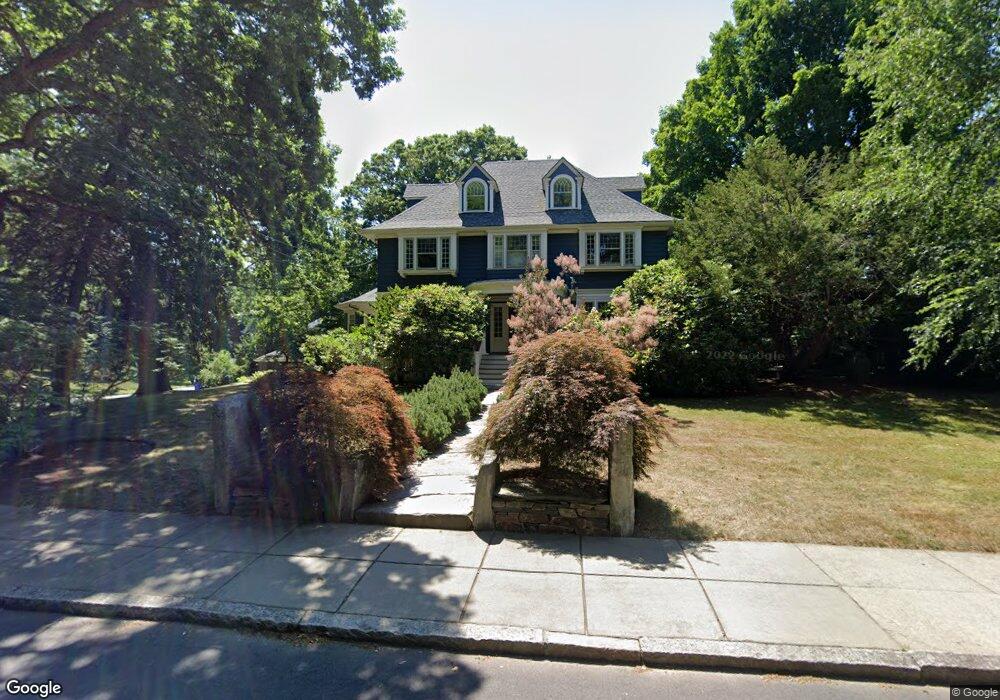
83 Kirkstall Rd Newtonville, MA 02460
Newtonville NeighborhoodEstimated Value: $2,815,349 - $3,403,000
6
Beds
4
Baths
4,294
Sq Ft
$718/Sq Ft
Est. Value
About This Home
This home is located at 83 Kirkstall Rd, Newtonville, MA 02460 and is currently estimated at $3,082,337, approximately $717 per square foot. 83 Kirkstall Rd is a home located in Middlesex County with nearby schools including Cabot Elementary School, F.A. Day Middle School, and Newton North High School.
Ownership History
Date
Name
Owned For
Owner Type
Purchase Details
Closed on
May 12, 2003
Sold by
Lietzke Barbara C and Lietzke Keith R
Bought by
Applbaum Arthur I and Rubin Sally L
Current Estimated Value
Home Financials for this Owner
Home Financials are based on the most recent Mortgage that was taken out on this home.
Original Mortgage
$1,190,000
Outstanding Balance
$522,467
Interest Rate
5.93%
Mortgage Type
Purchase Money Mortgage
Estimated Equity
$2,559,870
Purchase Details
Closed on
Jun 26, 1998
Sold by
Chasin Judith G
Bought by
Lietzke Barbara C and Lietzke Keith R
Home Financials for this Owner
Home Financials are based on the most recent Mortgage that was taken out on this home.
Original Mortgage
$227,000
Interest Rate
7.09%
Mortgage Type
Purchase Money Mortgage
Create a Home Valuation Report for This Property
The Home Valuation Report is an in-depth analysis detailing your home's value as well as a comparison with similar homes in the area
Home Values in the Area
Average Home Value in this Area
Purchase History
| Date | Buyer | Sale Price | Title Company |
|---|---|---|---|
| Applbaum Arthur I | $1,700,000 | -- | |
| Lietzke Barbara C | $755,000 | -- |
Source: Public Records
Mortgage History
| Date | Status | Borrower | Loan Amount |
|---|---|---|---|
| Open | Applbaum Arthur I | $1,190,000 | |
| Previous Owner | Lietzke Barbara C | $298,300 | |
| Previous Owner | Lietzke Barbara C | $227,000 | |
| Closed | Lietzke Barbara C | $100,000 |
Source: Public Records
Tax History Compared to Growth
Tax History
| Year | Tax Paid | Tax Assessment Tax Assessment Total Assessment is a certain percentage of the fair market value that is determined by local assessors to be the total taxable value of land and additions on the property. | Land | Improvement |
|---|---|---|---|---|
| 2025 | $26,966 | $2,751,600 | $1,360,700 | $1,390,900 |
| 2024 | $26,074 | $2,671,500 | $1,321,100 | $1,350,400 |
| 2023 | $24,970 | $2,452,800 | $1,026,200 | $1,426,600 |
| 2022 | $23,892 | $2,271,100 | $950,200 | $1,320,900 |
| 2021 | $23,053 | $2,142,500 | $896,400 | $1,246,100 |
| 2020 | $22,368 | $2,142,500 | $896,400 | $1,246,100 |
| 2019 | $21,737 | $2,080,100 | $870,300 | $1,209,800 |
| 2018 | $20,900 | $1,931,600 | $777,000 | $1,154,600 |
| 2017 | $20,264 | $1,822,300 | $733,000 | $1,089,300 |
| 2016 | $19,381 | $1,703,100 | $685,000 | $1,018,100 |
| 2015 | $18,480 | $1,591,700 | $640,200 | $951,500 |
Source: Public Records
Map
Nearby Homes
- 127-129 Withington Rd Unit 1
- 300 Cabot St
- 44 Blake St Unit 2
- 3 Cedar St
- 110 Harvard St Unit A
- 10 Washington Park
- 10 Washington Park Unit 2
- 10 Washington Park Unit 1
- 34 Morton Rd
- 22 Walnut Place Unit 1
- 887 Commonwealth Ave
- 48 Harvard St Unit 1
- 73 Elmore St
- 61 Lakeview Ave
- 911 Washington St
- 77 Court St Unit 205
- 1004 Centre St
- 935 Washington St Unit 8
- 957 Washington St Unit 1
- 60 Chapin Rd
- 223 Upland Rd
- 77 Kirkstall Rd
- 231 Upland Rd
- 15 Pheasant Rd
- 74 Kirkstall Rd
- 235 Upland Rd
- 99 Kirkstall Rd
- 82 Kirkstall Rd
- 234 Upland Rd
- 64 Kirkstall Rd
- 98 Kirkstall Rd
- 59 Kirkstall Rd
- 243 Upland Rd
- 214 Upland Rd
- 240 Upland Rd
- 15 Charlesden Park
- 111 Kirkstall Rd
- 106 Kirkstall Rd
- 191 Upland Rd
- 249 Upland Rd