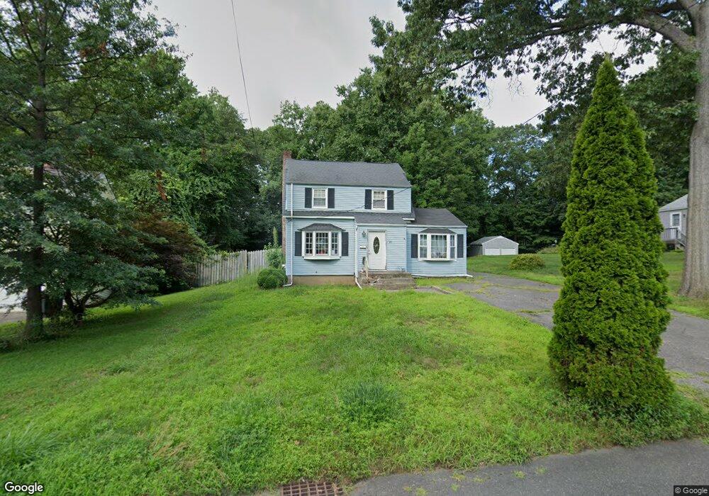
83 Lycett St Bridgeport, CT 06606
North End NeighborhoodEstimated Value: $414,000 - $482,000
2
Beds
2
Baths
1,432
Sq Ft
$315/Sq Ft
Est. Value
About This Home
This home is located at 83 Lycett St, Bridgeport, CT 06606 and is currently estimated at $451,709, approximately $315 per square foot. 83 Lycett St is a home located in Fairfield County with nearby schools including John Winthrop School, Central High School, and St Andrew School.
Ownership History
Date
Name
Owned For
Owner Type
Purchase Details
Closed on
Jun 10, 2004
Sold by
Rodriguez Jaime
Bought by
Dolor Cheron
Current Estimated Value
Purchase Details
Closed on
Apr 12, 1996
Sold by
North Park Mortgage
Bought by
Rodriguez Jaime A and Rodriguez Elizabeth
Create a Home Valuation Report for This Property
The Home Valuation Report is an in-depth analysis detailing your home's value as well as a comparison with similar homes in the area
Home Values in the Area
Average Home Value in this Area
Purchase History
| Date | Buyer | Sale Price | Title Company |
|---|---|---|---|
| Dolor Cheron | $252,000 | -- | |
| Dolor Cheron | $252,000 | -- | |
| Rodriguez Jaime A | $114,900 | -- | |
| Rodriguez Jaime A | $114,900 | -- |
Source: Public Records
Mortgage History
| Date | Status | Borrower | Loan Amount |
|---|---|---|---|
| Open | Rodriguez Jaime A | $246,750 | |
| Closed | Rodriguez Jaime A | $249,000 |
Source: Public Records
Tax History Compared to Growth
Tax History
| Year | Tax Paid | Tax Assessment Tax Assessment Total Assessment is a certain percentage of the fair market value that is determined by local assessors to be the total taxable value of land and additions on the property. | Land | Improvement |
|---|---|---|---|---|
| 2025 | $6,952 | $160,010 | $84,730 | $75,280 |
| 2024 | $6,952 | $160,010 | $84,730 | $75,280 |
| 2023 | $6,952 | $160,010 | $84,730 | $75,280 |
| 2022 | $6,952 | $160,010 | $84,730 | $75,280 |
| 2021 | $6,952 | $160,010 | $84,730 | $75,280 |
| 2020 | $7,491 | $138,740 | $66,370 | $72,370 |
| 2019 | $7,491 | $138,740 | $66,370 | $72,370 |
| 2018 | $7,543 | $138,740 | $66,370 | $72,370 |
| 2017 | $7,543 | $138,740 | $66,370 | $72,370 |
| 2016 | $7,543 | $138,740 | $66,370 | $72,370 |
| 2015 | $6,969 | $165,150 | $72,770 | $92,380 |
| 2014 | $6,969 | $165,150 | $72,770 | $92,380 |
Source: Public Records
Map
Nearby Homes
- 2851 Old Town Rd
- 394 Anton Dr
- 90 Sequoia Rd
- 64 Dobson St
- 87 Oliver St
- 65 Dobson St
- 66 Loftus Cir
- 87 Parkway Dr
- 153 Seaver Cir
- 173 Anton Dr
- 50 Greenhouse Rd Unit 65D
- 50 Greenhouse Rd Unit 42C
- 344 Cambridge St
- 44 Lance Cir Unit 44
- 81 Lance Cir
- 715 Frenchtown Rd Unit 31
- 114 Oxford St
- 45 Frenchtown Rd
- 84 Oxford St
- 291 Frenchtown Rd
- 69 Lycett St
- 93 Lycett St
- 50 Sunnydale Rd
- 72 Sunnydale Rd
- 55 Lycett St
- 55/55R Lycett St
- 99 Lycett St
- 61 Sunnydale Rd
- 100 Sunnydale Rd
- 2864 Old Town Rd
- 2810 Old Town Rd
- 85 Sunnydale Rd
- 41 Lycett St
- 76 Lycett St
- 2830 Old Town Rd
- 2880 Old Town Rd
- 92 Lycett St
- 35 Gorham Place
- 33 Gorham Place
- 110 Sunnydale Rd