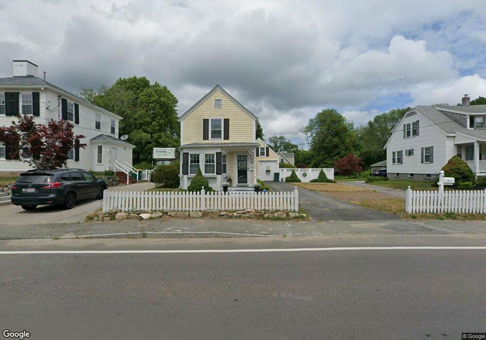
83 Main St Unit 83R Kingston, MA 02364
Estimated Value: $502,000 - $716,000
3
Beds
2
Baths
1,701
Sq Ft
$359/Sq Ft
Est. Value
About This Home
This home is located at 83 Main St Unit 83R, Kingston, MA 02364 and is currently estimated at $610,027, approximately $358 per square foot. 83 Main St Unit 83R is a home located in Plymouth County with nearby schools including Kingston Elementary School, Silver Lake Regional High School, and Kingston Intermediate School.
Ownership History
Date
Name
Owned For
Owner Type
Purchase Details
Closed on
Feb 18, 2021
Sold by
Mclaughlin Chris
Bought by
83 Main St Unit B Rt and Mclaughlin
Current Estimated Value
Purchase Details
Closed on
Mar 16, 2020
Sold by
83 Main Street Unit B Rt and Mclaughlin
Bought by
Mclaughlin Chris
Purchase Details
Closed on
Nov 15, 2011
Sold by
Kenney Richard E and Kenney Susan E
Bought by
83 Main St Unit B King and Mclaughlin
Create a Home Valuation Report for This Property
The Home Valuation Report is an in-depth analysis detailing your home's value as well as a comparison with similar homes in the area
Home Values in the Area
Average Home Value in this Area
Purchase History
| Date | Buyer | Sale Price | Title Company |
|---|---|---|---|
| 83 Main St Unit B Rt | -- | None Available | |
| 83 Main St Unit B Rt | -- | None Available | |
| Mclaughlin Chris | -- | None Available | |
| Mclaughlin Chris | -- | None Available | |
| 83 Main St Unit B King | $285,000 | -- | |
| 83 Main St Unit B King | $285,000 | -- |
Source: Public Records
Mortgage History
| Date | Status | Borrower | Loan Amount |
|---|---|---|---|
| Previous Owner | 83 Main St Unit B King | $10,100 | |
| Previous Owner | 83 Main St Unit B King | $176,000 |
Source: Public Records
Tax History Compared to Growth
Tax History
| Year | Tax Paid | Tax Assessment Tax Assessment Total Assessment is a certain percentage of the fair market value that is determined by local assessors to be the total taxable value of land and additions on the property. | Land | Improvement |
|---|---|---|---|---|
| 2025 | $6,327 | $487,800 | $0 | $487,800 |
| 2024 | $6,200 | $487,800 | $0 | $487,800 |
| 2023 | $4,906 | $367,200 | $0 | $367,200 |
| 2022 | $5,354 | $367,200 | $0 | $367,200 |
| 2021 | $5,345 | $332,400 | $0 | $332,400 |
| 2020 | $5,027 | $308,800 | $0 | $308,800 |
| 2019 | $5,149 | $312,800 | $0 | $312,800 |
| 2018 | $4,887 | $297,100 | $0 | $297,100 |
| 2017 | $3,957 | $239,800 | $0 | $239,800 |
| 2016 | $4,753 | $269,900 | $0 | $269,900 |
| 2015 | $4,572 | $269,900 | $0 | $269,900 |
| 2014 | $4,502 | $269,900 | $0 | $269,900 |
Source: Public Records
Map
Nearby Homes
- 94 Main St
- 17 Howlands Ln
- Lot 17-3 Howlands Ln
- 22 Main St Unit A
- 17 Thomas St
- 12 Rome Ave
- 20 Orchard Ave
- 62 Spooner St
- 393 Court St Unit 4
- 393 Court St Unit 7
- 393 Court St Unit 5
- 393 Court St Unit 1
- 5-7 Forest Ave
- 16 Copper Beech Dr Marion Dr
- 35 River St
- 38 Cedar Ln
- 19 Holmes Ave
- 3 Jones River Dr
- 4 S Spooner St Unit 6
- 4 S Spooner St Unit 7