Estimated Value: $548,000 - $822,000
3
Beds
2
Baths
1,510
Sq Ft
$454/Sq Ft
Est. Value
About This Home
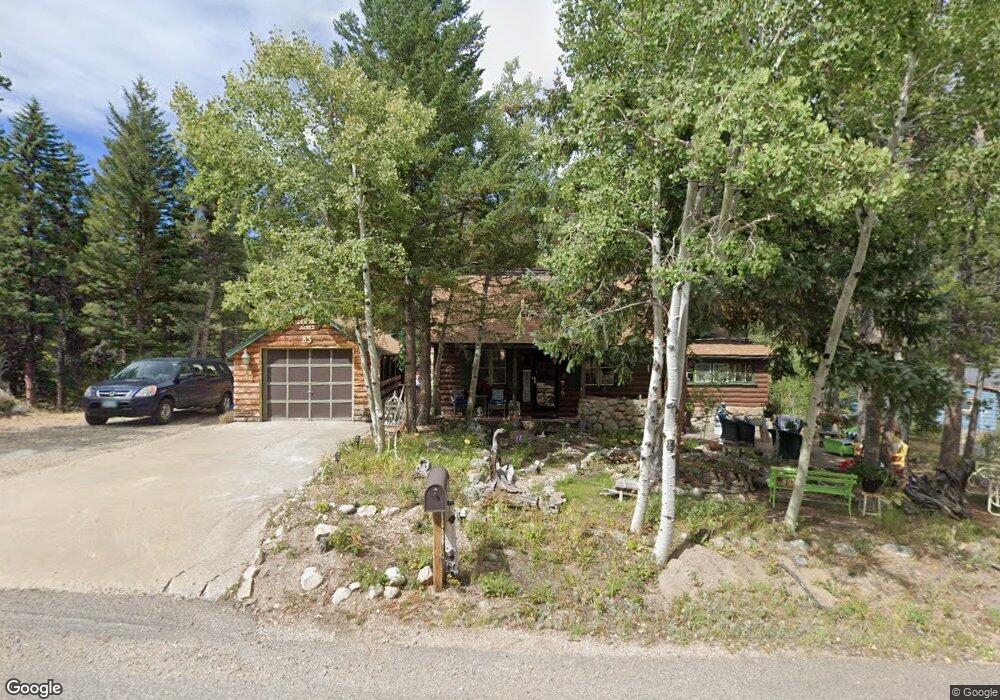
This home is located at 83 Peaceful Valley Rd, Lyons, CO 80540 and is currently estimated at $686,174, approximately $454 per square foot. 83 Peaceful Valley Rd is a home located in Boulder County with nearby schools including Lyons Elementary School and Lyons Middle/Senior High School.
Ownership History
Date
Name
Owned For
Owner Type
Purchase Details
Closed on
Aug 27, 2008
Sold by
Cramalot Inn Llc
Bought by
Anderson Darrel L
Current Estimated Value
Home Financials for this Owner
Home Financials are based on the most recent Mortgage that was taken out on this home.
Original Mortgage
$265,500
Outstanding Balance
$174,639
Interest Rate
6.29%
Mortgage Type
Unknown
Estimated Equity
$511,535
Purchase Details
Closed on
Apr 21, 1971
Bought by
Anderson Darrel L and Anderson Carol D
Purchase Details
Closed on
Feb 5, 1971
Bought by
Anderson Darrel L and Anderson Carol D
Create a Home Valuation Report for This Property
The Home Valuation Report is an in-depth analysis detailing your home's value as well as a comparison with similar homes in the area
Home Values in the Area
Average Home Value in this Area
Purchase History
| Date | Buyer | Sale Price | Title Company |
|---|---|---|---|
| Anderson Darrel L | $295,000 | None Available | |
| Anderson Darrel L | -- | -- | |
| Anderson Darrel L | $15,000 | -- |
Source: Public Records
Mortgage History
| Date | Status | Borrower | Loan Amount |
|---|---|---|---|
| Open | Anderson Darrel L | $265,500 |
Source: Public Records
Tax History Compared to Growth
Tax History
| Year | Tax Paid | Tax Assessment Tax Assessment Total Assessment is a certain percentage of the fair market value that is determined by local assessors to be the total taxable value of land and additions on the property. | Land | Improvement |
|---|---|---|---|---|
| 2025 | $3,120 | $32,775 | $1,556 | $31,219 |
| 2024 | $3,120 | $32,775 | $1,556 | $31,219 |
| 2023 | $3,074 | $35,142 | $1,340 | $37,487 |
| 2022 | $2,548 | $27,678 | $1,487 | $26,191 |
| 2021 | $2,578 | $28,474 | $1,530 | $26,944 |
| 2020 | $2,201 | $24,388 | $2,431 | $21,957 |
| 2019 | $2,167 | $24,388 | $2,431 | $21,957 |
| 2018 | $1,796 | $20,397 | $2,304 | $18,093 |
| 2017 | $1,776 | $22,551 | $2,547 | $20,004 |
| 2016 | $1,786 | $20,131 | $3,423 | $16,708 |
| 2015 | $1,695 | $17,162 | $2,547 | $14,615 |
| 2014 | $1,484 | $17,162 | $2,547 | $14,615 |
Source: Public Records
Map
Nearby Homes
- 0 Pine Cone Cir Unit REC9444416
- 0 Pine Cone Cir Unit RECIR1037889
- 46525 Highway 72
- 3154 Riverside Dr
- 2426 Riverside Dr
- 1115 County Road 100
- 2248 Riverside Dr
- 0 Rock Lake Rd Unit 12 REC6560566
- 84 Ranch Rd
- 575 Ranch Rd
- 24 Hickok Trail
- 190 Hard Way
- 398 Overland Dr
- 839 Ski Rd
- 470 Big John Rd
- 254 Arrowood Dr
- 357 Big John Rd
- 212 Valley Rd
- 57 Nelson St
- 104 Utica St
- 103 Peaceful Valley Rd
- 25 Peaceful Valley Rd
- 50108 State Highway 72
- 50148 State Highway 72
- 50150 State Highway 72
- 50153 State Highway 72
- 78 Peaceful Valley Rd
- 111 Peaceful Valley Rd
- 110 Peaceful Valley Rd
- 52 Peaceful Valley Rd
- 50152 State Highway 72
- 32 Peaceful Valley Rd
- 24 Peaceful Valley Rd
- 60 Kansas Hill Rd
- 155 Peaceful Valley Rd
- 58 Kansas Hill Rd
- 97 Kansas Hill Rd
- 101 Kansas Hill Rd
- 77 Kansas Hill Rd
- 30 Kansas Hill Rd