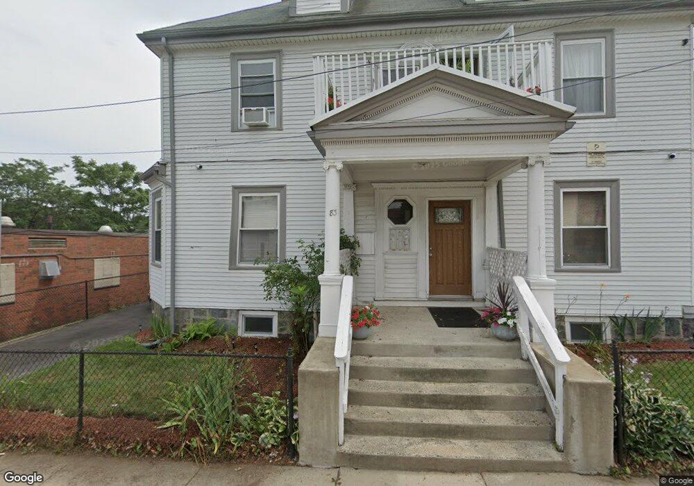
83 Regis Rd Mattapan, MA 02126
Mattapan Square NeighborhoodEstimated Value: $1,099,000 - $1,253,013
11
Beds
3
Baths
3,770
Sq Ft
$306/Sq Ft
Est. Value
About This Home
This home is located at 83 Regis Rd, Mattapan, MA 02126 and is currently estimated at $1,154,503, approximately $306 per square foot. 83 Regis Rd is a home located in Suffolk County with nearby schools including KIPP Academy Boston Charter School and Berea Seventh-day Adventist Academy.
Ownership History
Date
Name
Owned For
Owner Type
Purchase Details
Closed on
Jul 23, 2004
Sold by
Earl Foster
Bought by
Crawford Vallier and Crawford Symone N
Current Estimated Value
Home Financials for this Owner
Home Financials are based on the most recent Mortgage that was taken out on this home.
Original Mortgage
$427,350
Outstanding Balance
$214,335
Interest Rate
6.28%
Mortgage Type
Purchase Money Mortgage
Estimated Equity
$940,168
Create a Home Valuation Report for This Property
The Home Valuation Report is an in-depth analysis detailing your home's value as well as a comparison with similar homes in the area
Home Values in the Area
Average Home Value in this Area
Purchase History
| Date | Buyer | Sale Price | Title Company |
|---|---|---|---|
| Crawford Vallier | $555,000 | -- |
Source: Public Records
Mortgage History
| Date | Status | Borrower | Loan Amount |
|---|---|---|---|
| Open | Crawford Vallier | $9,325 | |
| Open | Crawford Vallier | $427,350 |
Source: Public Records
Tax History Compared to Growth
Tax History
| Year | Tax Paid | Tax Assessment Tax Assessment Total Assessment is a certain percentage of the fair market value that is determined by local assessors to be the total taxable value of land and additions on the property. | Land | Improvement |
|---|---|---|---|---|
| 2025 | $7,722 | $666,800 | $225,000 | $441,800 |
| 2024 | $6,664 | $611,400 | $242,400 | $369,000 |
| 2023 | $6,377 | $593,800 | $235,400 | $358,400 |
| 2022 | $6,150 | $565,300 | $224,100 | $341,200 |
| 2021 | $5,856 | $548,800 | $217,600 | $331,200 |
| 2020 | $5,616 | $531,800 | $207,900 | $323,900 |
| 2019 | $5,096 | $483,500 | $158,700 | $324,800 |
| 2018 | $4,871 | $464,800 | $158,700 | $306,100 |
| 2017 | $4,600 | $434,400 | $158,700 | $275,700 |
| 2016 | $4,466 | $406,000 | $158,700 | $247,300 |
| 2015 | $4,565 | $377,000 | $116,600 | $260,400 |
| 2014 | $4,392 | $349,100 | $116,600 | $232,500 |
Source: Public Records
Map
Nearby Homes
- 1465 Blue Hill Ave
- 95 Woodhaven St
- 4 Crossman St Unit 4
- 11 French St
- 10 Brockton St
- 12 Hiawatha Rd
- 770 Cummins Hwy Unit 1
- 770 Cummins Hwy Unit 22
- 24 Constitution Rd
- 32 Violet St
- 20 Monterey Ave
- 60 and 64 Monterey Ave
- 116 Almont St
- 48-50 Rockdale St
- 10 Briarcliff Terrace
- 157 Delhi St
- 100 Itasca St
- 45 1st Ave Unit 111
- 710 Walk Hill St
- 58 Mattapan St
- 79 Regis Rd
- 71 Regis Rd
- 1537 Blue Hill Ave Unit 2
- 1537 Blue Hill Ave
- 93 Chester Park Unit 2
- 78 Regis Rd
- 1525 Blue Hill Ave Unit 2
- 1525 Blue Hill Ave
- 11 Rexford St
- 67 Regis Rd
- 76 Regis Rd
- 1539-1551 Blue Hill Ave
- 1539 Blue Hill Ave Unit 2
- 1539 Blue Hill Ave Unit B
- 1539 Blue Hill Ave Unit C
- 1539 Blue Hill Ave Unit A
- 1539 Blue Hill Ave
- 5 Chester Park
- 1 Chester Park Unit 2
- 15 Rexford St