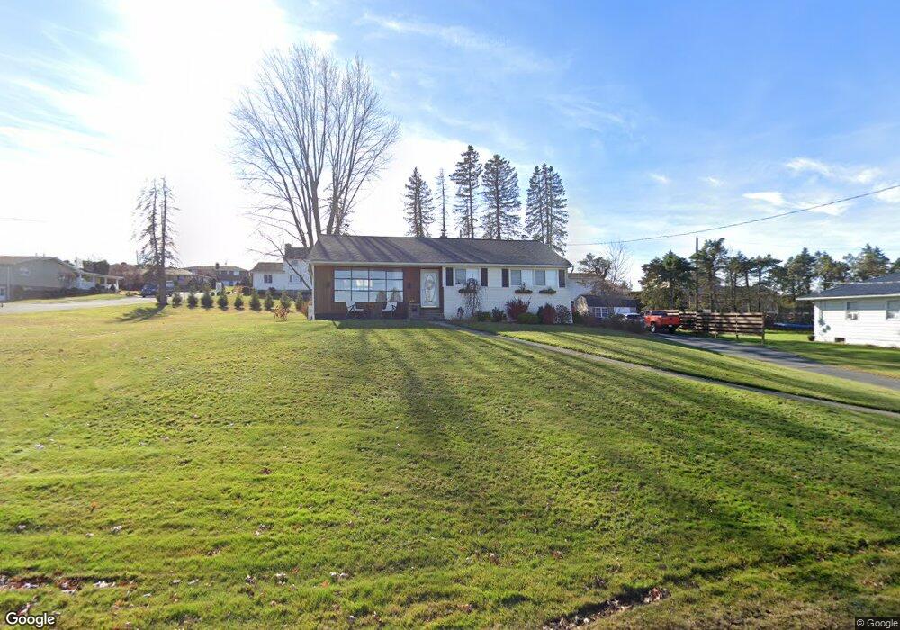
83 Rock St Hughestown, PA 18640
Estimated Value: $141,000 - $196,976
3
Beds
1
Bath
1,262
Sq Ft
$140/Sq Ft
Est. Value
About This Home
This home is located at 83 Rock St, Hughestown, PA 18640 and is currently estimated at $176,494, approximately $139 per square foot. 83 Rock St is a home located in Luzerne County with nearby schools including Pittston City Intermediate Center, Pittston Area Middle School, and Frederick County Middle School.
Ownership History
Date
Name
Owned For
Owner Type
Purchase Details
Closed on
Jun 15, 2018
Sold by
Duffy Mary Pat and Estate Of Helen Jean Dougherty
Bought by
White Phillip F and White Catherine J
Current Estimated Value
Purchase Details
Closed on
Sep 25, 1958
Bought by
Dougherty Helen
Create a Home Valuation Report for This Property
The Home Valuation Report is an in-depth analysis detailing your home's value as well as a comparison with similar homes in the area
Home Values in the Area
Average Home Value in this Area
Purchase History
| Date | Buyer | Sale Price | Title Company |
|---|---|---|---|
| White Phillip F | $95,000 | None Available | |
| Dougherty Helen | $400 | -- |
Source: Public Records
Tax History Compared to Growth
Tax History
| Year | Tax Paid | Tax Assessment Tax Assessment Total Assessment is a certain percentage of the fair market value that is determined by local assessors to be the total taxable value of land and additions on the property. | Land | Improvement |
|---|---|---|---|---|
| 2025 | $2,661 | $105,200 | $32,000 | $73,200 |
| 2024 | $2,661 | $105,200 | $32,000 | $73,200 |
| 2023 | $2,661 | $105,200 | $32,000 | $73,200 |
| 2022 | $2,642 | $105,200 | $32,000 | $73,200 |
| 2021 | $2,589 | $105,200 | $32,000 | $73,200 |
| 2020 | $2,530 | $105,200 | $32,000 | $73,200 |
| 2019 | $2,510 | $105,200 | $32,000 | $73,200 |
| 2018 | $2,430 | $105,200 | $32,000 | $73,200 |
| 2017 | $2,376 | $105,200 | $32,000 | $73,200 |
| 2016 | -- | $105,200 | $32,000 | $73,200 |
| 2015 | $1,923 | $105,200 | $32,000 | $73,200 |
| 2014 | $1,923 | $105,200 | $32,000 | $73,200 |
Source: Public Records
Map
Nearby Homes