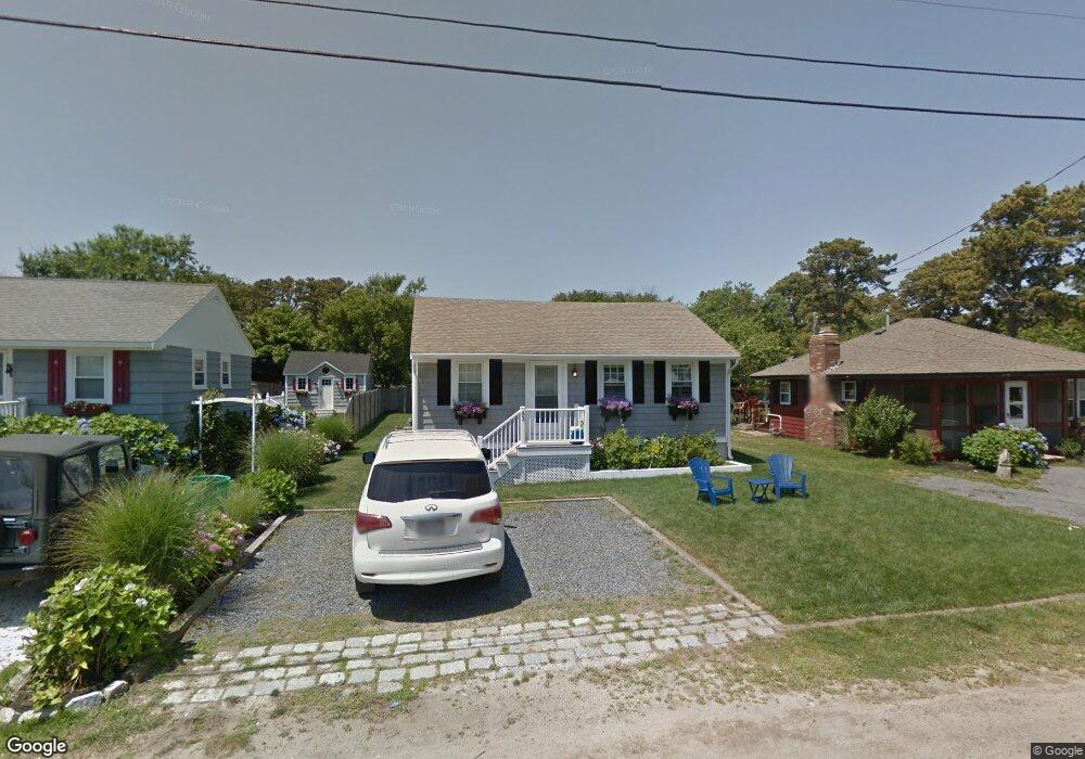
83 Uncle Rolf Rd Dennis Port, MA 02639
Dennis Port NeighborhoodEstimated Value: $604,000 - $729,000
3
Beds
1
Bath
842
Sq Ft
$816/Sq Ft
Est. Value
About This Home
This home is located at 83 Uncle Rolf Rd, Dennis Port, MA 02639 and is currently estimated at $686,915, approximately $815 per square foot. 83 Uncle Rolf Rd is a home located in Barnstable County with nearby schools including Dennis-Yarmouth Regional High School and St. Pius X. School.
Ownership History
Date
Name
Owned For
Owner Type
Purchase Details
Closed on
Mar 19, 2010
Sold by
Powers Anthony J and Powers Maureen P
Bought by
Maling Russell P and Maling Melissa L
Current Estimated Value
Home Financials for this Owner
Home Financials are based on the most recent Mortgage that was taken out on this home.
Original Mortgage
$230,000
Outstanding Balance
$152,971
Interest Rate
5.05%
Mortgage Type
Purchase Money Mortgage
Estimated Equity
$533,944
Purchase Details
Closed on
Mar 5, 2004
Sold by
Lowrie Ericka and Lowrie Stephen J
Bought by
Powers Anthony J and Powers Maureen P
Home Financials for this Owner
Home Financials are based on the most recent Mortgage that was taken out on this home.
Original Mortgage
$248,000
Interest Rate
5.62%
Mortgage Type
Purchase Money Mortgage
Purchase Details
Closed on
Jan 3, 2000
Sold by
Campia Darlene
Bought by
Lowrie Stephen J and Lowrie Ericka
Home Financials for this Owner
Home Financials are based on the most recent Mortgage that was taken out on this home.
Original Mortgage
$124,000
Interest Rate
7.71%
Mortgage Type
Purchase Money Mortgage
Create a Home Valuation Report for This Property
The Home Valuation Report is an in-depth analysis detailing your home's value as well as a comparison with similar homes in the area
Home Values in the Area
Average Home Value in this Area
Purchase History
| Date | Buyer | Sale Price | Title Company |
|---|---|---|---|
| Maling Russell P | $350,000 | -- | |
| Powers Anthony J | $310,000 | -- | |
| Lowrie Stephen J | $155,000 | -- |
Source: Public Records
Mortgage History
| Date | Status | Borrower | Loan Amount |
|---|---|---|---|
| Open | Maling Russell P | $230,000 | |
| Previous Owner | Powers Anthony J | $248,000 | |
| Previous Owner | Lowrie Stephen J | $124,000 |
Source: Public Records
Tax History Compared to Growth
Tax History
| Year | Tax Paid | Tax Assessment Tax Assessment Total Assessment is a certain percentage of the fair market value that is determined by local assessors to be the total taxable value of land and additions on the property. | Land | Improvement |
|---|---|---|---|---|
| 2025 | $2,685 | $620,100 | $302,500 | $317,600 |
| 2024 | $2,507 | $571,000 | $290,900 | $280,100 |
| 2023 | $2,439 | $522,300 | $264,500 | $257,800 |
| 2022 | $2,436 | $435,000 | $249,300 | $185,700 |
| 2021 | $4,056 | $405,600 | $244,400 | $161,200 |
| 2020 | $3,749 | $417,900 | $271,600 | $146,300 |
| 2019 | $2,464 | $399,400 | $266,300 | $133,100 |
| 2018 | $2,125 | $335,100 | $212,900 | $122,200 |
| 2017 | $2,037 | $331,300 | $213,000 | $118,300 |
| 2016 | $2,016 | $308,700 | $207,900 | $100,800 |
| 2015 | $1,976 | $308,700 | $207,900 | $100,800 |
| 2014 | $1,928 | $303,600 | $202,800 | $100,800 |
Source: Public Records
Map
Nearby Homes
- 112 Old Wharf Rd Unit E4
- 112 Old Wharf Rd Unit E1
- 64 Beaten Rd
- 120 Old Wharf Rd Unit 11
- 154 Old Wharf Rd Unit 26
- 154 Old Wharf Rd Unit 14
- 37 Ocean Dr Unit 2
- 217 Old Wharf Rd Unit 64
- 241 Old Wharf Rd Unit 82
- 241 Old Wharf Rd Unit 127
- 241 Old Wharf Rd Unit 90
- 262 Old Wharf Rd Unit 67
- 262 Old Wharf Rd Unit 5
- 262 Old Wharf Rd Unit 5
- 262 Old Wharf Rd Unit 20
- 262 Old Wharf Rd Unit 87
- 37 Beach Hills Rd
- 37-A Beach Hills Rd
- 80 Michaels Ave
- 31 Easy St
- 81 Uncle Rolf Rd
- 85 Uncle Rolf Rd
- 79 Uncle Rolf Rd
- 87 Uncle Rolf Rd
- 84 Bain Rd
- 80 Bain Rd
- 89 Uncle Rolf Rd
- 84 Uncle Rolf Rd
- 75 Uncle Rolf Rd
- 91 Uncle Rolf Rd
- 89,89A Uncle Rolf
- 88 Uncle Rolf Rd
- 78 Bain Rd
- 80 Uncle Rolf Rd
- 88 Bain Rd
- 90 Uncle Rolf Rd
- 73 Uncle Rolf Rd
- 93 Uncle Rolf Rd
- 78 Uncle Rolf Rd
- 74 Bain Rd