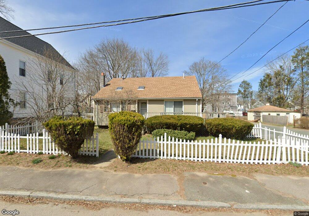
83 Upland Rd Brockton, MA 02301
Estimated Value: $486,000 - $620,000
3
Beds
2
Baths
1,360
Sq Ft
$408/Sq Ft
Est. Value
About This Home
This home is located at 83 Upland Rd, Brockton, MA 02301 and is currently estimated at $554,440, approximately $407 per square foot. 83 Upland Rd is a home located in Plymouth County with nearby schools including Louis F Angelo Elementary School, Raymond K-8 Elementary School, and Manthala George Jr. School.
Ownership History
Date
Name
Owned For
Owner Type
Purchase Details
Closed on
Mar 30, 2001
Sold by
Mcilvaine Guy A
Bought by
Louis Gerta Pierre
Current Estimated Value
Purchase Details
Closed on
Nov 16, 1989
Sold by
Pauline Robert F
Bought by
Barbozaa Wendell A
Create a Home Valuation Report for This Property
The Home Valuation Report is an in-depth analysis detailing your home's value as well as a comparison with similar homes in the area
Purchase History
| Date | Buyer | Sale Price | Title Company |
|---|---|---|---|
| Louis Gerta Pierre | $169,900 | -- | |
| Barbozaa Wendell A | $142,000 | -- |
Source: Public Records
Mortgage History
| Date | Status | Borrower | Loan Amount |
|---|---|---|---|
| Open | Barbozaa Wendell A | $251,923 | |
| Closed | Barbozaa Wendell A | $205,430 | |
| Closed | Barbozaa Wendell A | $14,000 |
Source: Public Records
Tax History
| Year | Tax Paid | Tax Assessment Tax Assessment Total Assessment is a certain percentage of the fair market value that is determined by local assessors to be the total taxable value of land and additions on the property. | Land | Improvement |
|---|---|---|---|---|
| 2025 | $5,517 | $455,600 | $140,000 | $315,600 |
| 2024 | $5,273 | $438,700 | $140,000 | $298,700 |
| 2023 | $4,996 | $384,900 | $104,100 | $280,800 |
| 2022 | $4,929 | $352,800 | $94,600 | $258,200 |
| 2021 | $4,454 | $307,200 | $78,500 | $228,700 |
| 2020 | $4,495 | $296,700 | $73,600 | $223,100 |
| 2019 | $4,095 | $263,500 | $71,800 | $191,700 |
| 2018 | $3,922 | $244,200 | $71,800 | $172,400 |
| 2017 | $3,429 | $213,000 | $71,800 | $141,200 |
| 2016 | $3,462 | $199,400 | $69,600 | $129,800 |
| 2015 | $3,298 | $181,700 | $69,600 | $112,100 |
| 2014 | $3,265 | $180,100 | $69,600 | $110,500 |
Source: Public Records
Map
Nearby Homes
- 0 Vine St
- 90 Cherry St
- 20 Johnson Ct
- 560 N Montello St
- 731 N Montello St Unit 6
- 737 N Montello St
- 24 Oak St
- 767 N Montello St
- 10 Fitzpatrick Ave
- 97 Huntington St
- 39 Huntington St
- 35 Huntington St
- 30 Intervale St
- 115 Ames St
- 24 E Ashland St
- 112 Ames St
- 178 Oak St
- 863 N Main St
- 17 Snell St
- 0 Prospect St
- 87 Upland Rd
- 87 Upland Rd Unit 1
- 75 Upland Rd
- 80 Vine St
- 84 Vine St
- 82 Upland Rd
- 82 Upland Rd Unit 2
- 41 Porter St
- 73 Upland Rd
- 37 Porter St
- 37 Porter St Unit 3
- 37 Porter St Unit 2
- 88 Upland Rd
- 70 Vine St
- 90 Upland Rd Unit 3
- 90 Upland Rd Unit 2
- 90 Upland Rd
- 88 Vine St Unit 2nd floor
- 88 Vine St Unit first floor
- 27 Porter St
Your Personal Tour Guide
Ask me questions while you tour the home.