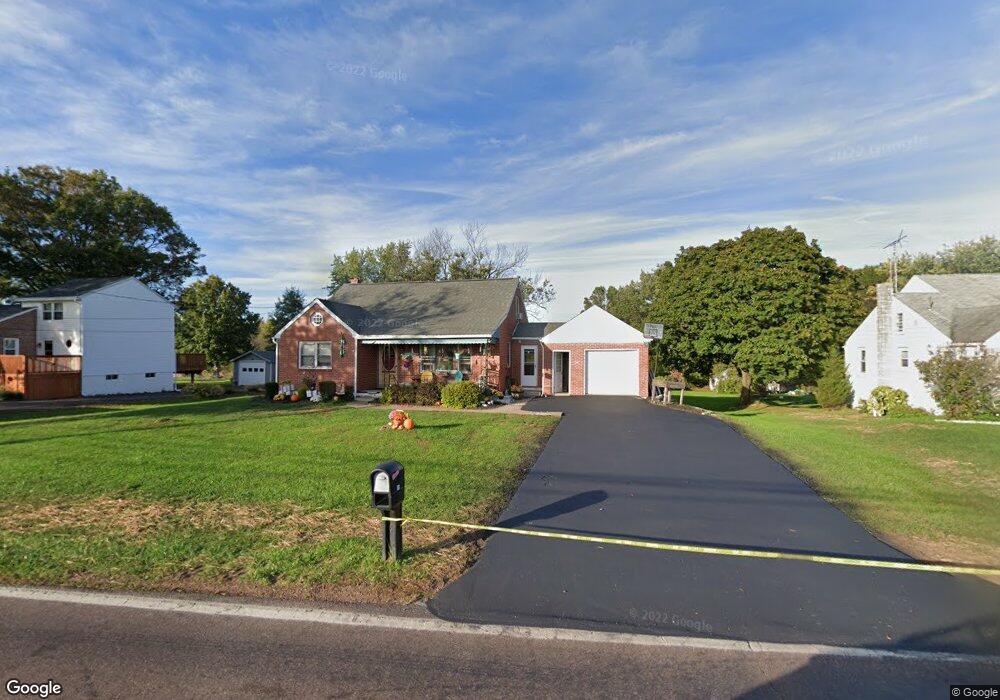
83 W Moyer Rd Pottstown, PA 19464
Estimated Value: $289,000 - $329,000
3
Beds
2
Baths
1,310
Sq Ft
$241/Sq Ft
Est. Value
About This Home
This home is located at 83 W Moyer Rd, Pottstown, PA 19464 and is currently estimated at $316,175, approximately $241 per square foot. 83 W Moyer Rd is a home located in Montgomery County with nearby schools including Lower Pottsgrove Elementary School, Pottsgrove Middle School, and Pottsgrove Senior High School.
Ownership History
Date
Name
Owned For
Owner Type
Purchase Details
Closed on
Jun 14, 2021
Sold by
Endy David B and Endy Harold S
Bought by
Zapien Adriane and Zapien George
Current Estimated Value
Home Financials for this Owner
Home Financials are based on the most recent Mortgage that was taken out on this home.
Original Mortgage
$200,640
Outstanding Balance
$181,655
Interest Rate
2.9%
Mortgage Type
New Conventional
Estimated Equity
$134,520
Purchase Details
Closed on
Jun 8, 2018
Sold by
David B Endy
Bought by
Endy David B and Endy Harold
Create a Home Valuation Report for This Property
The Home Valuation Report is an in-depth analysis detailing your home's value as well as a comparison with similar homes in the area
Home Values in the Area
Average Home Value in this Area
Purchase History
| Date | Buyer | Sale Price | Title Company |
|---|---|---|---|
| Zapien Adriane | $211,200 | None Available | |
| Endy David B | -- | None Available |
Source: Public Records
Mortgage History
| Date | Status | Borrower | Loan Amount |
|---|---|---|---|
| Open | Zapien Adriane | $200,640 |
Source: Public Records
Tax History Compared to Growth
Tax History
| Year | Tax Paid | Tax Assessment Tax Assessment Total Assessment is a certain percentage of the fair market value that is determined by local assessors to be the total taxable value of land and additions on the property. | Land | Improvement |
|---|---|---|---|---|
| 2025 | $5,078 | $103,560 | $33,070 | $70,490 |
| 2024 | $5,078 | $103,560 | $33,070 | $70,490 |
| 2023 | $4,920 | $103,560 | $33,070 | $70,490 |
| 2022 | $4,846 | $103,560 | $33,070 | $70,490 |
| 2021 | $4,777 | $103,560 | $33,070 | $70,490 |
| 2020 | $4,759 | $103,560 | $33,070 | $70,490 |
| 2019 | $4,734 | $103,560 | $33,070 | $70,490 |
| 2018 | $812 | $103,560 | $33,070 | $70,490 |
| 2017 | $4,750 | $103,560 | $33,070 | $70,490 |
| 2016 | $4,709 | $103,560 | $33,070 | $70,490 |
| 2015 | $4,601 | $103,560 | $33,070 | $70,490 |
| 2014 | $4,601 | $103,560 | $33,070 | $70,490 |
Source: Public Records
Map
Nearby Homes
- 2190 Gilbertsville Rd
- 2146 Gilbertsville Rd
- 290 Buchert Rd Unit 1
- 288 Buchert Rd Unit 2
- 1891 Detweiler Rd
- 540 Gilbertsville Rd
- 1822 Detweiler Rd
- 1506 Aspen Dr
- 108 Maugers Mill Rd
- 15 Thomas Ln
- 104 Maugers Mill Rd
- 126 Pine Ford Rd Unit 65
- 278 Haven Dr
- 1440 Farmington Ave Unit 11
- 284 Haven Dr
- 290 Haven Dr
- 318 Haven Dr
- 296 Haven Dr
- 302 Haven Dr
- 314 Haven Dr
- 89 W Moyer Rd
- 75 W Moyer Rd
- 97 W Moyer Rd
- 69 W Moyer Rd
- 103 W Moyer Rd
- 761 Gilbertsville Rd
- 757 Gilbertsville Rd
- 107 W Moyer Rd
- 113 W Moyer Rd
- 764 Gilbertsville Rd
- 2290 Gilbertsville Rd
- 718 Gilbertsville Rd
- 747 Gilbertsville Rd
- 125 W Moyer Rd
- 746 Gilbertsville Rd
- 2318 Ming Dr
- 2326 Ming Dr
- 725 Gilbertsville Rd
- 2306 Ming Dr
- 726 Gilbertsville Rd