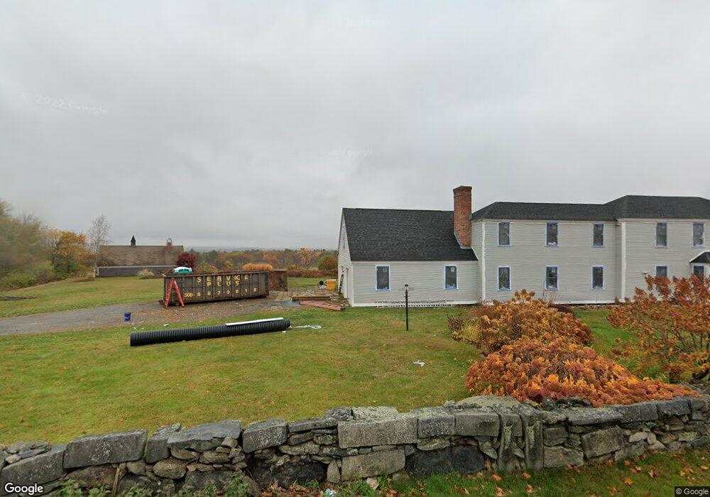
83 Wilder Rd Unit A Bolton, MA 01740
Estimated Value: $912,000 - $1,209,963
3
Beds
3
Baths
2,500
Sq Ft
$435/Sq Ft
Est. Value
About This Home
This home is located at 83 Wilder Rd Unit A, Bolton, MA 01740 and is currently estimated at $1,086,741, approximately $434 per square foot. 83 Wilder Rd Unit A is a home located in Worcester County with nearby schools including Florence Sawyer School, Nashoba Regional High School, and South Lancaster Academy.
Ownership History
Date
Name
Owned For
Owner Type
Purchase Details
Closed on
Apr 23, 2019
Sold by
Deutsche Bk Natl T Co Tr
Bought by
Custom Concepts Llc
Current Estimated Value
Purchase Details
Closed on
Jan 23, 2018
Sold by
Woodman Stephen W
Bought by
Deutsche Bk Natl T Co
Purchase Details
Closed on
Oct 25, 2004
Sold by
Bolton Home Rt and Faherty Dorothy
Bought by
Woodman Amy L and Woodman Stephen L
Home Financials for this Owner
Home Financials are based on the most recent Mortgage that was taken out on this home.
Original Mortgage
$999,999
Interest Rate
5.85%
Mortgage Type
Purchase Money Mortgage
Create a Home Valuation Report for This Property
The Home Valuation Report is an in-depth analysis detailing your home's value as well as a comparison with similar homes in the area
Home Values in the Area
Average Home Value in this Area
Purchase History
| Date | Buyer | Sale Price | Title Company |
|---|---|---|---|
| Custom Concepts Llc | $452,900 | -- | |
| Deutsche Bk Natl T Co | $801,000 | -- | |
| Woodman Amy L | $1,250,000 | -- |
Source: Public Records
Mortgage History
| Date | Status | Borrower | Loan Amount |
|---|---|---|---|
| Previous Owner | Woodman Amy L | $999,999 |
Source: Public Records
Tax History Compared to Growth
Tax History
| Year | Tax Paid | Tax Assessment Tax Assessment Total Assessment is a certain percentage of the fair market value that is determined by local assessors to be the total taxable value of land and additions on the property. | Land | Improvement |
|---|---|---|---|---|
| 2025 | $16,291 | $980,200 | $236,200 | $744,000 |
| 2024 | $14,841 | $912,700 | $226,200 | $686,500 |
| 2023 | $15,418 | $881,000 | $223,200 | $657,800 |
| 2022 | $15,397 | $774,900 | $203,200 | $571,700 |
| 2021 | $15,343 | $735,500 | $203,200 | $532,300 |
| 2020 | $14,777 | $724,700 | $203,200 | $521,500 |
| 2019 | $14,947 | $730,200 | $203,200 | $527,000 |
| 2018 | $14,941 | $723,200 | $196,200 | $527,000 |
| 2017 | $15,226 | $718,200 | $191,200 | $527,000 |
| 2016 | $14,476 | $692,300 | $176,200 | $516,100 |
| 2015 | $14,749 | $703,000 | $181,200 | $521,800 |
| 2014 | $15,133 | $713,800 | $186,200 | $527,600 |
Source: Public Records
Map
Nearby Homes
- 903 Main St
- 11 Pondside Ln Unit 11
- 3 Pondside Ln Unit 3
- 112 Nourse Rd
- 725 Main St
- 720 Main St
- 0 Wattaquadock Hill Rd
- 93 Fox Run Rd
- 15 Mallard Ln Unit 7
- 93 Vaughn Hill Rd
- 90 Harvard Rd
- 54 Main St
- 347 Green Rd
- 601 Main St
- 3 Old Harvard Rd
- 47 Sugar Rd
- 295 Vaughn Hill Rd
- 252 Sawyer Rd
- 107 Ridgefield Cir Unit D
- 103 Ridgefield Cir Unit B