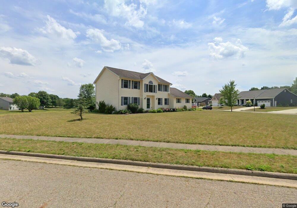
830 Glenbar St Louisville, OH 44641
Estimated Value: $323,000 - $383,992
3
Beds
3
Baths
2,316
Sq Ft
$153/Sq Ft
Est. Value
About This Home
This home is located at 830 Glenbar St, Louisville, OH 44641 and is currently estimated at $355,498, approximately $153 per square foot. 830 Glenbar St is a home located in Stark County with nearby schools including Louisville High School and St. Thomas Aquinas High School & Middle School.
Ownership History
Date
Name
Owned For
Owner Type
Purchase Details
Closed on
Jan 10, 2003
Sold by
Kauth Development Co Llc
Bought by
Maurer Craig E
Current Estimated Value
Home Financials for this Owner
Home Financials are based on the most recent Mortgage that was taken out on this home.
Original Mortgage
$150,468
Outstanding Balance
$70,073
Interest Rate
6.3%
Mortgage Type
Construction
Estimated Equity
$285,425
Create a Home Valuation Report for This Property
The Home Valuation Report is an in-depth analysis detailing your home's value as well as a comparison with similar homes in the area
Home Values in the Area
Average Home Value in this Area
Purchase History
| Date | Buyer | Sale Price | Title Company |
|---|---|---|---|
| Maurer Craig E | $41,900 | -- |
Source: Public Records
Mortgage History
| Date | Status | Borrower | Loan Amount |
|---|---|---|---|
| Open | Maurer Craig E | $150,468 |
Source: Public Records
Tax History Compared to Growth
Tax History
| Year | Tax Paid | Tax Assessment Tax Assessment Total Assessment is a certain percentage of the fair market value that is determined by local assessors to be the total taxable value of land and additions on the property. | Land | Improvement |
|---|---|---|---|---|
| 2025 | -- | $120,510 | $29,930 | $90,580 |
| 2024 | -- | $120,510 | $29,930 | $90,580 |
| 2023 | $5,561 | $81,480 | $24,080 | $57,400 |
| 2022 | $3,592 | $81,480 | $24,080 | $57,400 |
| 2021 | $3,602 | $81,480 | $24,080 | $57,400 |
| 2020 | $2,960 | $72,490 | $21,700 | $50,790 |
| 2019 | $2,975 | $76,970 | $26,180 | $50,790 |
| 2018 | $3,147 | $76,970 | $26,180 | $50,790 |
| 2017 | $2,892 | $68,250 | $22,050 | $46,200 |
| 2016 | $2,951 | $68,250 | $22,050 | $46,200 |
| 2015 | $3,034 | $69,970 | $22,050 | $47,920 |
| 2014 | $1,156 | $67,670 | $21,360 | $46,310 |
| 2013 | $1,582 | $67,670 | $21,360 | $46,310 |
Source: Public Records
Map
Nearby Homes
- 0 Brookridge Ave
- 0 Glenbar St
- 3580 Brookridge Ave Lot 15
- 614 Reno Dr
- 524 Glenbar St
- 5474 Ravenna Ave
- 1175 Sturbridge Dr
- 1149 Sturbridge Dr
- 300 Kennedy St
- 428 Honeycrisp Dr NE
- 3047 Mcintosh Dr NE
- 432 Honeycrisp Dr NE
- 2962 Mcintosh Dr NE
- 2963 Mcintosh Dr NE
- 430 Honeycrisp Dr NE
- 2957 Mcintosh Dr NE
- 316 E Reno Dr
- 910 Crosswyck Cir
- 1561 Noel St
- 1170 Winding Ridge Ave
- 1427 Brookridge Ave
- 1459 Brookridge Ave
- 1457 Brookridge Ave
- 3589 Glenbar St Lot 24 NW
- 827 Glenbar St
- 1461 Brookridge Ave
- 3575 Glenbar St Lot 10
- 3571 Glenbar St Lot 6
- 815 Glenbar St
- 732 Glenbar St
- 1471 Brookridge Ave
- 3585 Brookridge Ave Lot 20 Ave NW
- 1453 Brookridge Ave
- 1481 Brookridge Ave
- 805 Glenbar St
- 3578 Brookridge Ave Lot 13 NW
- 724 Glenbar St
- 1426 Brookridge Ave
- 1446 Brookridge Ave
- 801 Glenbar St