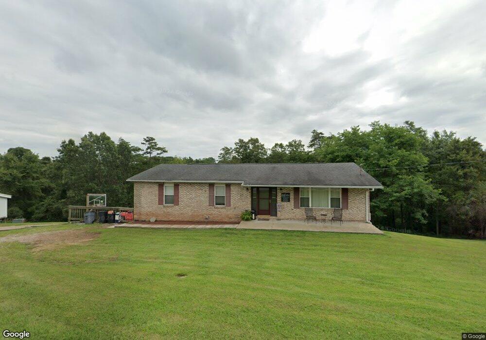
830 Mcgill Rd Vincent, OH 45784
Estimated Value: $273,000 - $326,000
About This Home
This home is located at 830 Mcgill Rd, Vincent, OH 45784 and is currently estimated at $301,025, approximately $199 per square foot. 830 Mcgill Rd is a home located in Washington County with nearby schools including Warren High School.
Ownership History
We collect this data history from publicly available records. To have your information removed, we recommend requesting removal directly through your county’s website.
Purchase Details
Home Financials for this Owner
Home Financials are based on the most recent Mortgage that was taken out on this home.Purchase Details
Purchase History
We collect this data history from publicly available records. To have your information removed, we recommend requesting removal directly through your county’s website.
| Date | Buyer | Sale Price | Title Company |
|---|---|---|---|
| $129,500 | Attorney | ||
| -- | -- | ||
| -- | -- |
Mortgage History
We collect this data history from publicly available records. To have your information removed, we recommend requesting removal directly through your county’s website.
| Date | Status | Borrower | Loan Amount |
|---|---|---|---|
| Open | $132,142 |
Tax History
We collect this data history from publicly available records. To have your information removed, we recommend requesting removal directly through your county’s website.
| Year | Tax Paid | Tax Assessment Tax Assessment Total Assessment is a certain percentage of the fair market value that is determined by local assessors to be the total taxable value of land and additions on the property. | Land | Improvement |
|---|---|---|---|---|
| 2025 | $4,055 | $103,560 | $18,860 | $84,700 |
| 2024 | $4,055 | $75,030 | $13,650 | $61,380 |
| 2023 | $3,062 | $75,030 | $13,650 | $61,380 |
| 2022 | $3,050 | $75,030 | $13,650 | $61,380 |
| 2021 | $2,648 | $61,760 | $11,790 | $49,970 |
| 2020 | $2,485 | $61,760 | $11,790 | $49,970 |
| 2019 | $2,451 | $61,760 | $11,790 | $49,970 |
| 2018 | $2,267 | $55,330 | $9,820 | $45,510 |
| 2017 | $2,255 | $55,330 | $9,820 | $45,510 |
| 2016 | $2,838 | $55,330 | $9,820 | $45,510 |
| 2015 | $1,759 | $47,730 | $9,460 | $38,270 |
| 2014 | $2,476 | $47,730 | $9,460 | $38,270 |
| 2013 | $1,520 | $47,730 | $9,460 | $38,270 |
Map
- 1421 Mcgill Rd
- 1556 Mcgill Rd
- 3747 State Route 339
- 4801 Veto Rd
- 85 Lane Rd
- 4795 State Route 339
- 645 Short Brook Rd
- 852 Wallace Rd
- 5550 State Route 339
- 11 Roberts Dr
- 715 Oxbow Rd
- 1375 Brackenridge Rd
- 80 Hannah Place Rd
- 116 Quail St
- 4731 State Route 555
- 21 Cherry Hills Dr
- 7 Quail St
- 2620 Burnett Rd
- 306 Barrett-South Rd
- 36 Suzanne St
Ask me questions while you tour the home.