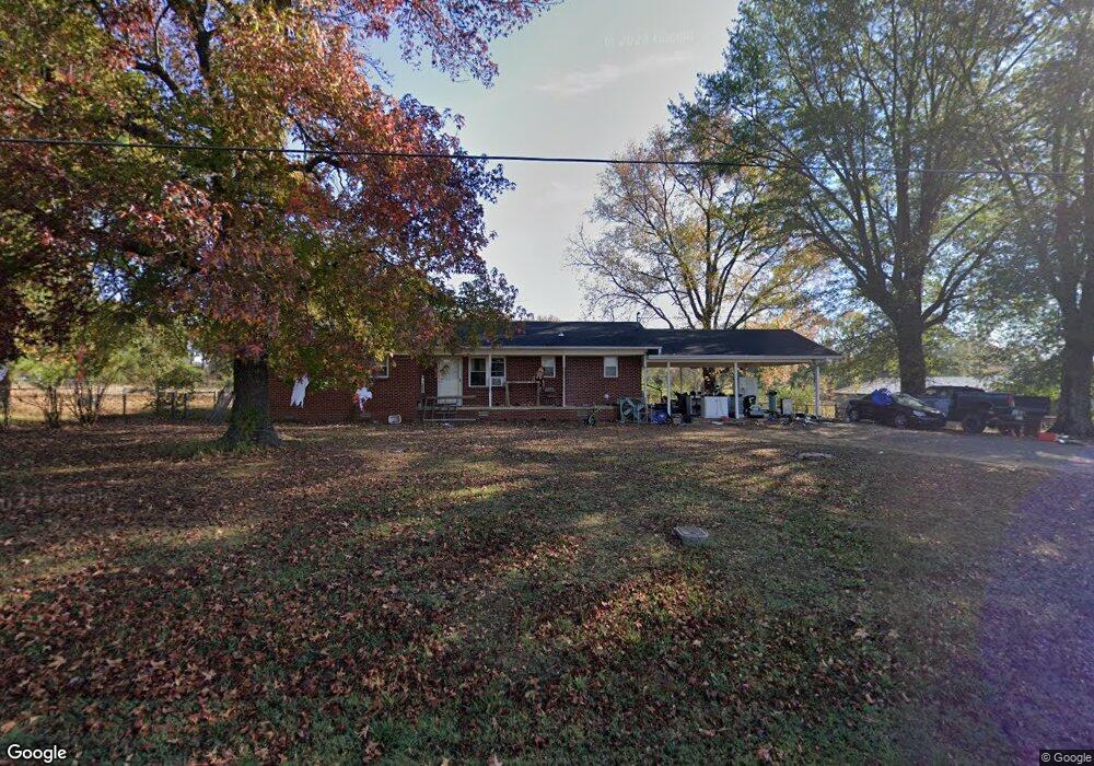
830 N Hamtown Rd Mulberry, AR 72947
Estimated Value: $152,000 - $228,000
--
Bed
2
Baths
1,743
Sq Ft
$105/Sq Ft
Est. Value
About This Home
This home is located at 830 N Hamtown Rd, Mulberry, AR 72947 and is currently estimated at $183,612, approximately $105 per square foot. 830 N Hamtown Rd is a home located in Crawford County with nearby schools including Marvin Primary School, Pleasant View Junior High School, and Mulberry High School.
Ownership History
Date
Name
Owned For
Owner Type
Purchase Details
Closed on
Oct 20, 2021
Sold by
Daulton Maranda
Bought by
Daulton Andrew
Current Estimated Value
Purchase Details
Closed on
Mar 28, 2019
Sold by
Rodman Danny Ray and Stonestreet Margie
Bought by
Daulton Andrew and Daulton Maranda
Home Financials for this Owner
Home Financials are based on the most recent Mortgage that was taken out on this home.
Original Mortgage
$109,360
Interest Rate
4.3%
Mortgage Type
VA
Purchase Details
Closed on
Dec 18, 2000
Bought by
Stonestreet-Stonestreet and Rod
Purchase Details
Closed on
Oct 17, 1996
Bought by
Smither-Stonestreet
Purchase Details
Closed on
Mar 30, 1994
Bought by
Smither-Smither
Create a Home Valuation Report for This Property
The Home Valuation Report is an in-depth analysis detailing your home's value as well as a comparison with similar homes in the area
Home Values in the Area
Average Home Value in this Area
Purchase History
| Date | Buyer | Sale Price | Title Company |
|---|---|---|---|
| Daulton Andrew | -- | None Listed On Document | |
| Daulton Andrew | $109,360 | Crawford County Abstract Co | |
| Stonestreet-Stonestreet | -- | -- | |
| Smither-Stonestreet | $81,000 | -- | |
| Smither-Smither | $65,000 | -- |
Source: Public Records
Mortgage History
| Date | Status | Borrower | Loan Amount |
|---|---|---|---|
| Previous Owner | Daulton Andrew | $109,360 |
Source: Public Records
Tax History Compared to Growth
Tax History
| Year | Tax Paid | Tax Assessment Tax Assessment Total Assessment is a certain percentage of the fair market value that is determined by local assessors to be the total taxable value of land and additions on the property. | Land | Improvement |
|---|---|---|---|---|
| 2025 | $792 | $24,080 | $2,800 | $21,280 |
| 2024 | $330 | $24,080 | $2,800 | $21,280 |
| 2023 | $367 | $24,080 | $2,800 | $21,280 |
| 2022 | $330 | $14,470 | $2,000 | $12,470 |
| 2021 | $330 | $14,470 | $2,000 | $12,470 |
| 2020 | $330 | $14,470 | $2,000 | $12,470 |
| 2019 | $258 | $14,470 | $2,000 | $12,470 |
| 2018 | $283 | $14,470 | $2,000 | $12,470 |
| 2017 | $259 | $12,990 | $2,000 | $10,990 |
| 2016 | $259 | $12,990 | $2,000 | $10,990 |
| 2015 | $259 | $12,990 | $2,000 | $10,990 |
| 2014 | $259 | $12,990 | $2,000 | $10,990 |
Source: Public Records
Map
Nearby Homes
- TBD (lot 29) Keystone Dr
- TBD (lot 30) Keystone Dr
- 3042 Mulberry Highway 64 W
- TBD Exsorbet Dr
- TBD Industrial Park Dr
- 3218 Mulberry Wire Rd
- 1321 Old Graphic St
- 3032 King Dr
- 2034 Mulberry Wire Rd
- 3819 Ridgemont Estate
- 10110 Booth Rd
- 2150 Old Graphic St
- TBD Goff Cir
- TBD Duncan Rd
- 5319 Chastain Rd
- 210 W 2nd St
- 519 Church Ave
- 36 W 8th St
- 770 Church Ave
- 8 W 10th St
- 809 N Hamtown Rd
- 919 N Hamtown Rd
- 2711 Mulberry Highway 64 W
- 735 N Hamtown Rd
- 2609 Mulberry Highway 64 W
- 2638 Mulberry Highway 64 W
- 705 N Hamtown Rd
- 2805 Mulberry Highway 64 W
- 705 N Rd
- 817 Wilkins Ln
- 901 Wilkins Ln
- 725 Wilkins Ln
- 2534 Mulberry Highway 64 W
- 915 Wilkins Ln
- 1020 N Hamtown Rd
- 645 N Hamtown Rd
- 2826 Mulberry Highway 64 W
- 2835 Mulberry Highway 64 W
- 2939 Mulberry Highway 64 W
- 2338 Connection Rd