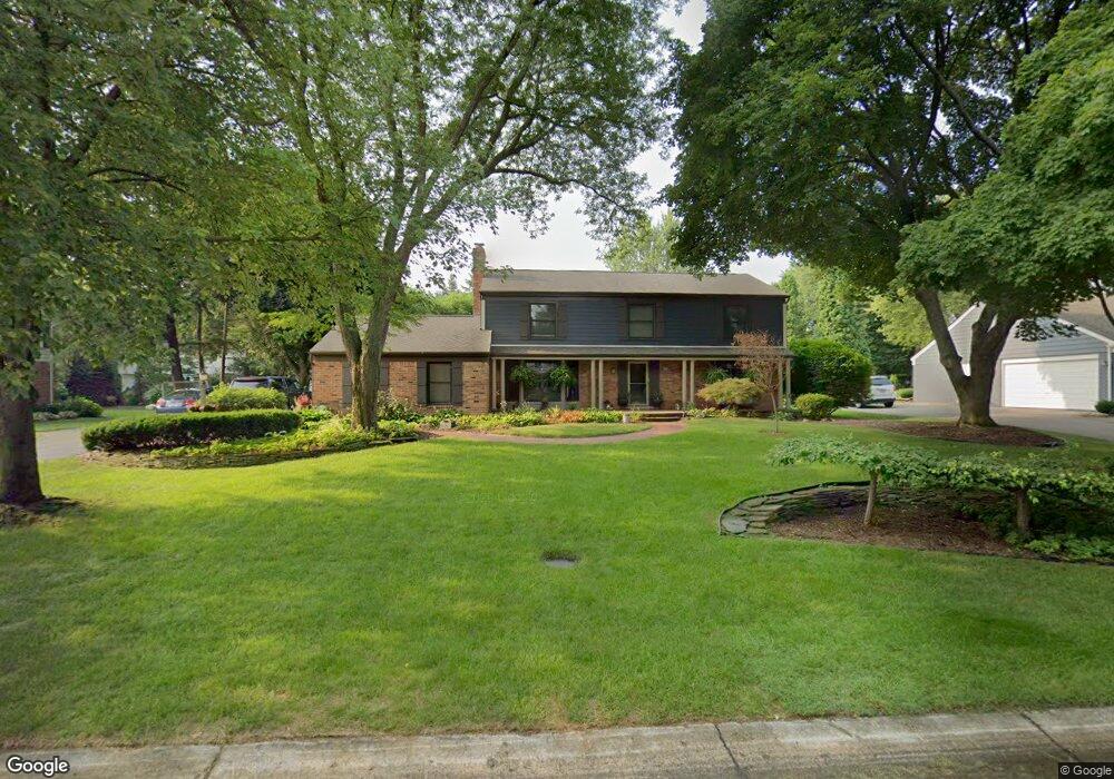
830 Thorntree Ct Bloomfield Hills, MI 48304
Estimated Value: $663,955 - $931,000
4
Beds
3
Baths
2,920
Sq Ft
$270/Sq Ft
Est. Value
About This Home
This home is located at 830 Thorntree Ct, Bloomfield Hills, MI 48304 and is currently estimated at $789,239, approximately $270 per square foot. 830 Thorntree Ct is a home located in Oakland County with nearby schools including Harlan Elementary School, Ernest W. Seaholm High School, and Roeper City and Country Upper.
Ownership History
Date
Name
Owned For
Owner Type
Purchase Details
Closed on
Jun 28, 2013
Sold by
Kacy Dennis and Kacy Marilyn
Bought by
Goldstein Janice
Current Estimated Value
Home Financials for this Owner
Home Financials are based on the most recent Mortgage that was taken out on this home.
Original Mortgage
$328,000
Outstanding Balance
$237,594
Interest Rate
3.83%
Mortgage Type
New Conventional
Estimated Equity
$551,645
Purchase Details
Closed on
Dec 14, 2005
Sold by
Kacy Dennis and Kacy Marilyn
Bought by
Kacy Dennis M
Create a Home Valuation Report for This Property
The Home Valuation Report is an in-depth analysis detailing your home's value as well as a comparison with similar homes in the area
Home Values in the Area
Average Home Value in this Area
Purchase History
| Date | Buyer | Sale Price | Title Company |
|---|---|---|---|
| Goldstein Janice | $410,000 | Seaver Title Agency Llc | |
| Kacy Dennis M | -- | None Available |
Source: Public Records
Mortgage History
| Date | Status | Borrower | Loan Amount |
|---|---|---|---|
| Open | Goldstein Janice | $328,000 |
Source: Public Records
Tax History Compared to Growth
Tax History
| Year | Tax Paid | Tax Assessment Tax Assessment Total Assessment is a certain percentage of the fair market value that is determined by local assessors to be the total taxable value of land and additions on the property. | Land | Improvement |
|---|---|---|---|---|
| 2024 | $5,015 | $297,280 | $0 | $0 |
| 2023 | $4,813 | $264,120 | $0 | $0 |
| 2022 | $8,147 | $247,900 | $0 | $0 |
| 2021 | $8,214 | $244,850 | $0 | $0 |
| 2020 | $4,623 | $245,830 | $0 | $0 |
| 2019 | $8,201 | $239,180 | $0 | $0 |
| 2018 | $8,140 | $227,000 | $0 | $0 |
| 2017 | $8,135 | $222,420 | $0 | $0 |
| 2016 | $8,524 | $215,530 | $0 | $0 |
| 2015 | -- | $193,730 | $0 | $0 |
| 2014 | -- | $194,120 | $0 | $0 |
| 2011 | -- | $146,890 | $0 | $0 |
Source: Public Records
Map
Nearby Homes
- 2991 Lanergan Dr
- 2840 Bolingbroke Dr
- 4731 Haddington Dr
- 1333 N Adams Rd
- 0000 Brookdale Rd
- 1330 Oxford Rd
- 680 Shepardbush St
- 654 Shepardbush St
- 3014 Caswell Dr
- 000 N Adams Rd
- 3036 Newport Ct
- 5554 Pine Brooke Ct
- 2650 Binbrooke Dr
- 928 Poppleton St
- 1225 Derby Rd Unit 1
- 850 N Adams Rd
- 878 Brooklawn Dr
- 2873 Summers Place
- 2154 Babcock Dr
- 4144 Rouge Circle Dr
- 816 Thorntree Ct
- 931 S Shady Hollow Cir
- 842 Thorntree Ct
- 923 S Shady Hollow Cir
- 829 Thorntree Ct
- 943 S Shady Hollow Cir
- 5053 Chain Bridge Rd
- 841 Thorntree Ct
- 807 Thorntree Ct
- 911 S Shady Hollow Cir
- 951 S Shady Hollow Cir
- 855 Thorntree Ct
- 764 N Shady Hollow Cir
- 930 S Shady Hollow Cir
- 922 S Shady Hollow Cir
- 750 N Shady Hollow Cir
- 778 N Shady Hollow Cir
- 5054 Chain Bridge Rd
- 870 Thorntree Ct
- 910 S Shady Hollow Cir