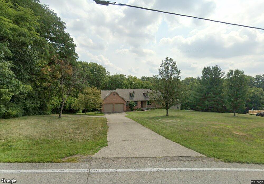
8300 Wuest Rd Cincinnati, OH 45247
Estimated Value: $385,000 - $479,000
3
Beds
3
Baths
2,118
Sq Ft
$199/Sq Ft
Est. Value
About This Home
This home is located at 8300 Wuest Rd, Cincinnati, OH 45247 and is currently estimated at $421,642, approximately $199 per square foot. 8300 Wuest Rd is a home located in Hamilton County with nearby schools including Colerain Elementary School, Colerain Middle School, and Colerain High School.
Ownership History
Date
Name
Owned For
Owner Type
Purchase Details
Closed on
May 31, 2000
Sold by
Wiesman David A and Wiesman Shirley
Bought by
Sparks John and Sparks Lynn
Current Estimated Value
Home Financials for this Owner
Home Financials are based on the most recent Mortgage that was taken out on this home.
Original Mortgage
$150,000
Interest Rate
8.14%
Create a Home Valuation Report for This Property
The Home Valuation Report is an in-depth analysis detailing your home's value as well as a comparison with similar homes in the area
Home Values in the Area
Average Home Value in this Area
Purchase History
| Date | Buyer | Sale Price | Title Company |
|---|---|---|---|
| Sparks John | $248,000 | L & D Title Agency Inc |
Source: Public Records
Mortgage History
| Date | Status | Borrower | Loan Amount |
|---|---|---|---|
| Closed | Sparks John | $150,000 |
Source: Public Records
Tax History
| Year | Tax Paid | Tax Assessment Tax Assessment Total Assessment is a certain percentage of the fair market value that is determined by local assessors to be the total taxable value of land and additions on the property. | Land | Improvement |
|---|---|---|---|---|
| 2025 | $7,102 | $123,197 | $19,390 | $103,807 |
| 2023 | $6,625 | $123,197 | $19,390 | $103,807 |
| 2022 | $6,601 | $100,153 | $18,305 | $81,848 |
| 2021 | $6,547 | $100,153 | $18,305 | $81,848 |
| 2020 | $6,610 | $100,153 | $18,305 | $81,848 |
| 2019 | $5,837 | $82,492 | $15,512 | $66,980 |
| 2018 | $5,236 | $82,492 | $15,512 | $66,980 |
| 2017 | $4,955 | $82,492 | $15,512 | $66,980 |
| 2016 | $5,406 | $88,690 | $15,505 | $73,185 |
| 2015 | $5,456 | $88,690 | $15,505 | $73,185 |
| 2014 | $5,466 | $88,690 | $15,505 | $73,185 |
| 2013 | $5,474 | $93,356 | $16,321 | $77,035 |
Source: Public Records
Map
Nearby Homes
- 3937 Olde Savannah Dr Unit 3937
- 3970 Olde Savannah Dr
- 8530 Wuest Rd
- 8261 Cheviot Rd
- 3701 W Galbraith Rd
- 3691 W Galbraith Rd
- 3693 W Galbraith Rd
- 3798 Philnoll Dr
- 4021 Hanley Rd
- 7630 Cheviot Rd
- 8747 Cheviot Rd
- 3408 Rocker Dr
- 8877 Wuest Rd
- 3727 Hanley Rd
- 3510 Banning Rd
- 6328 Oakcreek Dr
- 9111 Cobblechase Ct
- 3269 Warfield Ave
- 5613 Old Blue Rock Rd
- 3329 Alexis Rd
- 8290 Wuest Rd
- 8305 Wuest Rd
- 8287 Wuest Rd
- 8297 Wuest Rd
- 4135 Millies Ct
- 8273 Wuest Rd
- 8259 Wuest Rd
- 4118 Millies Ct
- 3984 W Galbraith Rd
- 8279 Wuest Rd
- 4151 Millies Ct
- 4130 Millies Ct
- 4144 Millies Ct
- 4165 Millies Ct
- 4298 Millies Ct
- 8245 Wuest Rd
- 8382 Wuest Rd
- 4160 Millies Ct
- 3980 W Galbraith Rd
- 4296 Millies Ct
Your Personal Tour Guide
Ask me questions while you tour the home.