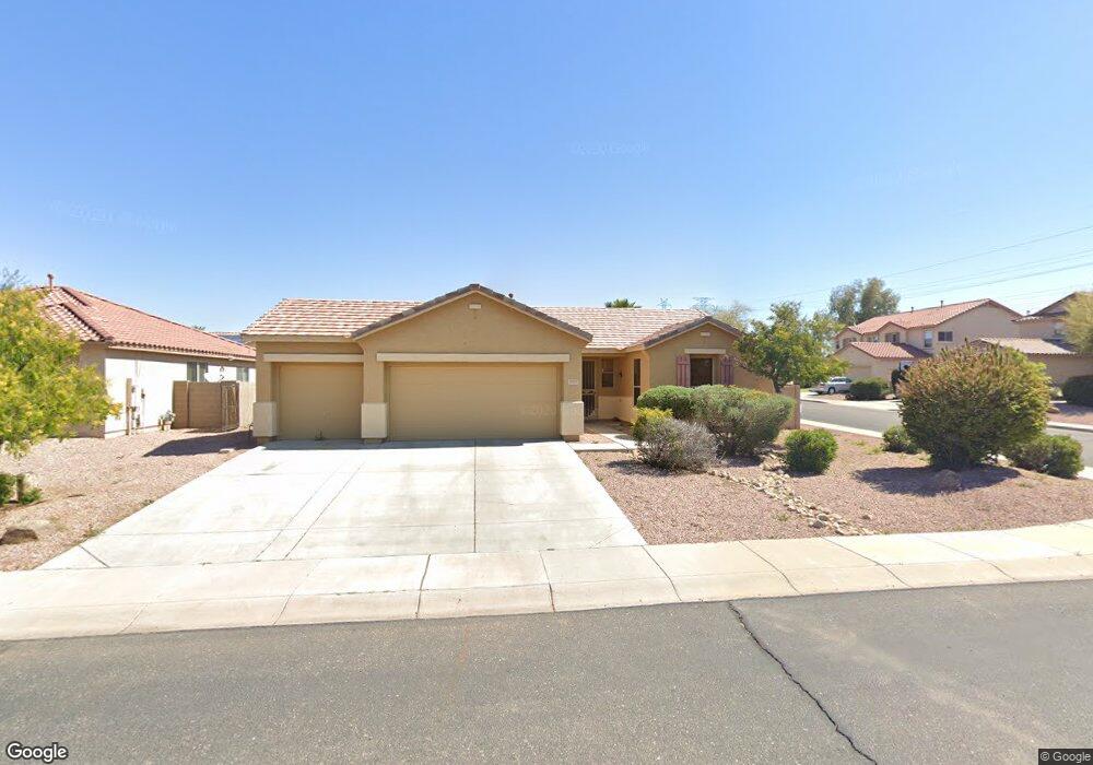
8301 N 97th Dr Peoria, AZ 85345
Estimated Value: $377,007 - $463,000
4
Beds
2
Baths
2,047
Sq Ft
$212/Sq Ft
Est. Value
About This Home
This home is located at 8301 N 97th Dr, Peoria, AZ 85345 and is currently estimated at $433,502, approximately $211 per square foot. 8301 N 97th Dr is a home located in Maricopa County with nearby schools including Sun Valley Elementary School, Raymond S. Kellis, and Brighton Charter School.
Ownership History
Date
Name
Owned For
Owner Type
Purchase Details
Closed on
Sep 22, 2023
Sold by
Wieland Randal J and Wieland Serena K
Bought by
Randerena Wieland Trust and Wieland
Current Estimated Value
Purchase Details
Closed on
Apr 25, 2023
Sold by
Wieland Randal J
Bought by
Beckman Serena K and Wieland Randal J
Purchase Details
Closed on
Jun 10, 2022
Sold by
Wieland Rentals Llc
Bought by
Wieland Randal J
Purchase Details
Closed on
Jan 12, 2017
Sold by
Wieland Randal J
Bought by
Wieland Rentals Llc
Purchase Details
Closed on
Dec 29, 2008
Sold by
Federal National Mortgage Association
Bought by
Wieland Randal J and Wieland Diane R
Home Financials for this Owner
Home Financials are based on the most recent Mortgage that was taken out on this home.
Original Mortgage
$110,250
Interest Rate
6.03%
Mortgage Type
New Conventional
Purchase Details
Closed on
Jan 8, 2008
Sold by
Sillin Jeffrey B
Bought by
Federal National Mortgage Association
Purchase Details
Closed on
Jan 12, 2006
Sold by
Solid Investment Group Llc
Bought by
Sillin Jeffrey
Home Financials for this Owner
Home Financials are based on the most recent Mortgage that was taken out on this home.
Original Mortgage
$276,000
Interest Rate
7.25%
Mortgage Type
Purchase Money Mortgage
Purchase Details
Closed on
Dec 15, 2005
Sold by
Buer John E
Bought by
Solid Investment Group Llc
Home Financials for this Owner
Home Financials are based on the most recent Mortgage that was taken out on this home.
Original Mortgage
$276,000
Interest Rate
7.25%
Mortgage Type
Purchase Money Mortgage
Purchase Details
Closed on
Mar 26, 2003
Sold by
Kb Home Sales Phoenix Inc
Bought by
Bauer John E
Home Financials for this Owner
Home Financials are based on the most recent Mortgage that was taken out on this home.
Original Mortgage
$147,315
Interest Rate
5.6%
Mortgage Type
New Conventional
Create a Home Valuation Report for This Property
The Home Valuation Report is an in-depth analysis detailing your home's value as well as a comparison with similar homes in the area
Home Values in the Area
Average Home Value in this Area
Purchase History
| Date | Buyer | Sale Price | Title Company |
|---|---|---|---|
| Randerena Wieland Trust | -- | None Listed On Document | |
| Beckman Serena K | -- | None Listed On Document | |
| Wieland Randal J | -- | None Listed On Document | |
| Wieland Rentals Llc | -- | None Available | |
| Wieland Randal J | $147,000 | Landamerica Title Agency | |
| Federal National Mortgage Association | $230,350 | First American Title | |
| Sillin Jeffrey | $345,000 | The Talon Group Tatum Garden | |
| Solid Investment Group Llc | $300,000 | Lawyers Title Ins | |
| Bauer John E | $184,144 | First American Title Ins Co | |
| Kb Home Sales Phoenix Inc | -- | First American Title Ins Co |
Source: Public Records
Mortgage History
| Date | Status | Borrower | Loan Amount |
|---|---|---|---|
| Previous Owner | Wieland Randal J | $110,250 | |
| Previous Owner | Sillin Jeffrey | $276,000 | |
| Previous Owner | Solid Investment Group Llc | $255,000 | |
| Previous Owner | Bauer John E | $147,315 | |
| Closed | Sillin Jeffrey | $69,000 |
Source: Public Records
Tax History Compared to Growth
Tax History
| Year | Tax Paid | Tax Assessment Tax Assessment Total Assessment is a certain percentage of the fair market value that is determined by local assessors to be the total taxable value of land and additions on the property. | Land | Improvement |
|---|---|---|---|---|
| 2025 | $1,637 | $17,516 | -- | -- |
| 2024 | $1,606 | $16,682 | -- | -- |
| 2023 | $1,606 | $32,470 | $6,490 | $25,980 |
| 2022 | $1,574 | $25,170 | $5,030 | $20,140 |
| 2021 | $1,693 | $23,370 | $4,670 | $18,700 |
| 2020 | $1,704 | $21,820 | $4,360 | $17,460 |
| 2019 | $1,653 | $20,570 | $4,110 | $16,460 |
| 2018 | $1,587 | $19,130 | $3,820 | $15,310 |
| 2017 | $1,585 | $17,610 | $3,520 | $14,090 |
| 2016 | $1,565 | $17,420 | $3,480 | $13,940 |
| 2015 | $1,458 | $16,900 | $3,380 | $13,520 |
Source: Public Records
Map
Nearby Homes
- 9791 W Butler Dr
- 9509 W Echo Ln
- 8676 N 96th Ln
- 9521 W Ruth Ave
- 9545 W Alice Ave
- 8301 N 103rd Ave Unit 177
- 8301 N 103rd Ave Unit 53
- 8601 N 103rd Ave Unit 72
- 8601 N 103rd Ave Unit 313
- 8601 N 103rd Ave Unit 166
- 9158 N 98th Dr
- 10001 W Deanita Ln
- 8828 N 102nd Ln
- 10221 W Puget Ave
- 10001 W Caron Dr Unit 8
- 10201 W Caron Dr
- 8435 N 104th Dr Unit 3
- 9450 W Mission Ln
- 8370 N 90th Ln
- 9519 W Sunnyslope Ln
- 8315 N 97th Dr
- 8304 N 97th Ave
- 8318 N 97th Ave
- 9719 W Las Palmaritas Dr
- 9746 W Las Palmaritas Dr
- 8329 N 97th Dr
- 9733 W Las Palmaritas Dr
- 9705 W Las Palmaritas Dr
- 8332 N 97th Ave
- 9747 W Las Palmaritas Dr
- 9747 W El Caminito Dr
- 9760 W Las Palmaritas Dr
- 8343 N 97th Dr
- 8346 N 97th Ave
- 9761 W Las Palmaritas Dr
- 9761 W El Caminito Dr
- 9644 W Las Palmaritas Dr
- 9774 W Las Palmaritas Dr
- 8357 N 97th Dr
- 9645 W El Caminito Dr