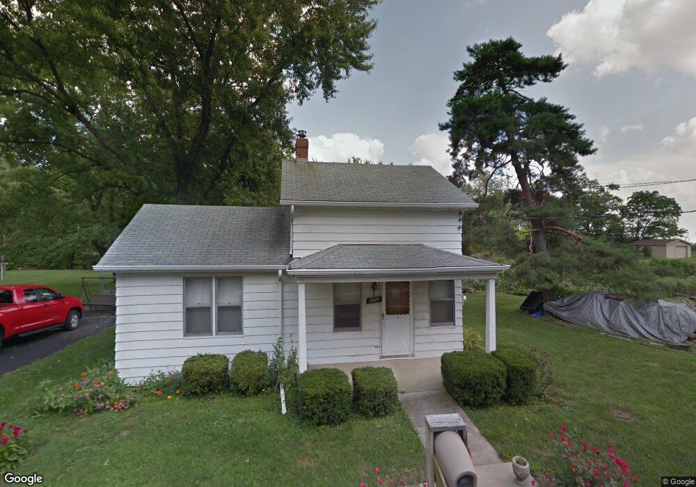
8302 Snider Rd Mason, OH 45040
Deerfield Township NeighborhoodEstimated Value: $259,842 - $455,000
3
Beds
1
Bath
1,161
Sq Ft
$289/Sq Ft
Est. Value
About This Home
This home is located at 8302 Snider Rd, Mason, OH 45040 and is currently estimated at $334,961, approximately $288 per square foot. 8302 Snider Rd is a home located in Warren County with nearby schools including Mason Intermediate Elementary School, Mason Middle School, and William Mason High School.
Ownership History
Date
Name
Owned For
Owner Type
Purchase Details
Closed on
Jul 31, 2018
Sold by
Vanover Hearl and Vanover Gertie
Bought by
Artisan Estate Homes Llc
Current Estimated Value
Home Financials for this Owner
Home Financials are based on the most recent Mortgage that was taken out on this home.
Original Mortgage
$199,200
Interest Rate
4.5%
Mortgage Type
New Conventional
Purchase Details
Closed on
Apr 17, 2006
Sold by
Vanover Hearl and Vanover Gertie
Bought by
Vanover Hearl and Vanover Gertie
Create a Home Valuation Report for This Property
The Home Valuation Report is an in-depth analysis detailing your home's value as well as a comparison with similar homes in the area
Home Values in the Area
Average Home Value in this Area
Purchase History
| Date | Buyer | Sale Price | Title Company |
|---|---|---|---|
| Artisan Estate Homes Llc | $250,000 | None Available | |
| Vanover Hearl | -- | None Available |
Source: Public Records
Mortgage History
| Date | Status | Borrower | Loan Amount |
|---|---|---|---|
| Closed | Artisan Estate Homes Llc | $199,200 |
Source: Public Records
Tax History Compared to Growth
Tax History
| Year | Tax Paid | Tax Assessment Tax Assessment Total Assessment is a certain percentage of the fair market value that is determined by local assessors to be the total taxable value of land and additions on the property. | Land | Improvement |
|---|---|---|---|---|
| 2024 | $1,940 | $44,560 | $19,950 | $24,610 |
| 2023 | $1,832 | $34,699 | $12,915 | $21,784 |
| 2022 | $1,801 | $34,699 | $12,915 | $21,784 |
| 2021 | $1,712 | $34,699 | $12,915 | $21,784 |
| 2020 | $1,643 | $28,210 | $10,500 | $17,710 |
| 2019 | $1,525 | $28,210 | $10,500 | $17,710 |
| 2018 | $1,028 | $28,210 | $10,500 | $17,710 |
| 2017 | $1,007 | $26,348 | $9,919 | $16,429 |
| 2016 | $1,036 | $26,348 | $9,919 | $16,429 |
| 2015 | $931 | $26,348 | $9,919 | $16,429 |
| 2014 | $931 | $23,320 | $8,780 | $14,540 |
| 2013 | $933 | $27,890 | $10,500 | $17,390 |
Source: Public Records
Map
Nearby Homes
- 5754 Trailside Ct
- 8421 Cameron Ct
- 5661 Baywatch Way
- 8659 Coveview Ct
- 5626 Baywatch Way
- 7911 Meadowbrook Dr
- 5369 N Shore Place
- 5532 Winding Cape Way
- 7839 Meadowbrook Dr
- 7725 Livingston Dr
- 5398 Harbourwatch Way
- 8881 Suncrest Ln
- 7693 Misty Springs Ct
- 6374 Hunters Green Dr
- 6439 Fox & Hound Ct
- 8900 Suncrest Ln
- 8851 Suncrest Ln
- 8905 Suncrest Ln
- Winslow Plan at Losh Landing - Masterpiece Collection
- Paxton Plan at Losh Landing - Masterpiece Collection
- 8276 Snider Rd
- 8301 Snider Rd
- 8339 Snider Rd
- 8253 Snider Rd
- 8260 Snider Rd
- 5908 Stone Trace Dr
- 5906 Stone Trace Dr
- 5907 Stone Trace Dr
- 5895 Windwood Ct
- 5902 Stone Trace Dr
- 5889 Windwood Ct
- 5901 Stone Trace Dr
- 5931 Socialville Foster Rd
- 5894 Windwood Ct
- 5894 Stone Trace Dr
- 5893 Stone Trace Dr
- 5881 Windwood Ct
- 5892 Windwood Ct
- 5884 Stone Trace Dr
- 5885 Stone Trace Dr