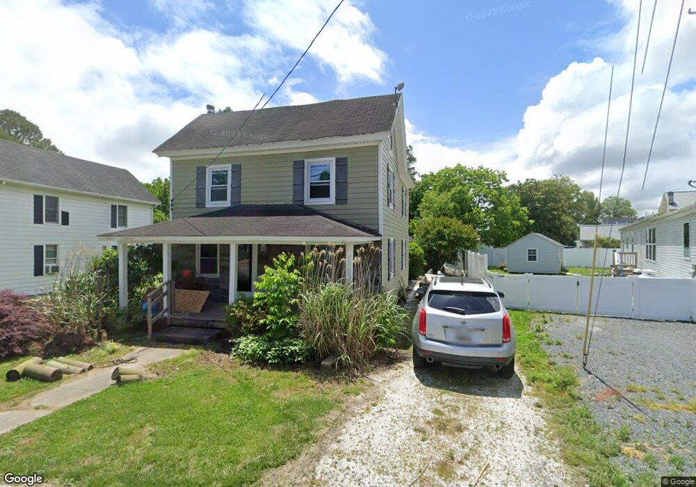
8304 Langmaid Rd Newark, MD 21841
Estimated Value: $167,133 - $265,000
3
Beds
2
Baths
1,600
Sq Ft
$142/Sq Ft
Est. Value
About This Home
This home is located at 8304 Langmaid Rd, Newark, MD 21841 and is currently estimated at $226,783, approximately $141 per square foot. 8304 Langmaid Rd is a home located in Worcester County with nearby schools including Snow Hill Elementary School, Snow Hill Middle School, and Snow Hill High School.
Ownership History
Date
Name
Owned For
Owner Type
Purchase Details
Closed on
Jul 12, 2016
Sold by
Barnes Ernest J and Barnes Lora
Bought by
Barnes Ernest J
Current Estimated Value
Purchase Details
Closed on
May 25, 2007
Sold by
Lee Henman Allen
Bought by
Barnes Ernest J and Dipasquale Lora A
Home Financials for this Owner
Home Financials are based on the most recent Mortgage that was taken out on this home.
Original Mortgage
$24,000
Interest Rate
6.27%
Mortgage Type
Purchase Money Mortgage
Purchase Details
Closed on
May 10, 2007
Sold by
Lee Henman Allen
Bought by
Barnes Ernest J and Dipasquale Lora A
Home Financials for this Owner
Home Financials are based on the most recent Mortgage that was taken out on this home.
Original Mortgage
$24,000
Interest Rate
6.27%
Mortgage Type
Purchase Money Mortgage
Create a Home Valuation Report for This Property
The Home Valuation Report is an in-depth analysis detailing your home's value as well as a comparison with similar homes in the area
Home Values in the Area
Average Home Value in this Area
Purchase History
| Date | Buyer | Sale Price | Title Company |
|---|---|---|---|
| Barnes Ernest J | -- | Attorney | |
| Barnes Ernest J | $120,000 | -- | |
| Barnes Ernest J | $120,000 | -- |
Source: Public Records
Mortgage History
| Date | Status | Borrower | Loan Amount |
|---|---|---|---|
| Closed | Barnes Ernest J | $24,000 | |
| Open | Barnes Ernest J | $96,000 | |
| Closed | Barnes Ernest J | $96,000 |
Source: Public Records
Tax History Compared to Growth
Tax History
| Year | Tax Paid | Tax Assessment Tax Assessment Total Assessment is a certain percentage of the fair market value that is determined by local assessors to be the total taxable value of land and additions on the property. | Land | Improvement |
|---|---|---|---|---|
| 2025 | $1,017 | $119,400 | $51,600 | $67,800 |
| 2024 | $1,017 | $106,700 | $0 | $0 |
| 2023 | $896 | $94,000 | $0 | $0 |
| 2022 | $775 | $81,300 | $51,600 | $29,700 |
| 2021 | $763 | $79,733 | $0 | $0 |
| 2020 | $748 | $78,167 | $0 | $0 |
| 2019 | $733 | $76,600 | $51,600 | $25,000 |
| 2018 | $724 | $76,600 | $51,600 | $25,000 |
| 2017 | $725 | $76,600 | $0 | $0 |
| 2016 | $759 | $80,100 | $0 | $0 |
| 2015 | $675 | $80,100 | $0 | $0 |
| 2014 | $675 | $80,100 | $0 | $0 |
Source: Public Records
Map
Nearby Homes
- 8422 Newark Rd
- Lot 5 Newark Rd
- Lot 4 Newark Rd
- Lot 3 Newark Rd
- 7109 Daffodil Ln Rd
- 0 Newark Rd Unit MDWO2032424
- 0 Newark Rd Unit MDWO2014316
- 0 Worcester Hwy Unit MDWO2031236
- 7613 Acorn Rd
- 6629 Bowden Rd
- 6744 Basket Switch Rd
- 0 Patey Woods Rd Unit MDWO2031602
- 6019 Basket Switch Rd
- 0 E Shire Dr
- 0 Evans Rd Unit MDWO2011414
- 0 Cedartown Rd
- 0 Newport Bay Dr Unit MDWO102088
- 10720 Windmill Creek Ln
- 11334 Newport Bay Dr
- 6513 Hampton Rd
- 8308 Langmaid Rd
- 8420 Newark Rd
- 8404 Newark Rd
- 8309 Langmaid Rd
- 8402 Newark Rd
- 8405 Newark Rd
- 8401 Newark Rd
- 8318 Langmaid Rd
- 8313 Langmaid Rd
- 8422 Newark Rd
- 8415 Newark Rd
- 8359 Newark Rd
- 8315 Langmaid Rd
- 8354 Newark Rd
- 8400 Newark Rd
- 7203 Mill St
- 7110 Arcadia Cir
- 8424 Newark Rd
- 7108 Arcadia Cir
- 8355 Newark Rd