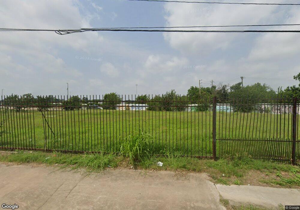
8305 Veterans Memorial Dr Houston, TX 77088
Acres Homes NeighborhoodEstimated Value: $320,000
--
Bed
--
Bath
--
Sq Ft
0.76
Acres
About This Home
This home is located at 8305 Veterans Memorial Dr, Houston, TX 77088 and is currently priced at $320,000. 8305 Veterans Memorial Dr is a home located in Harris County with nearby schools including Osborne Elementary School, Williams Middle, and Booker T Washington Sr High.
Ownership History
Date
Name
Owned For
Owner Type
Purchase Details
Closed on
Dec 22, 2014
Sold by
8200 V Memorial Llc
Bought by
Diaz Pedro
Current Estimated Value
Home Financials for this Owner
Home Financials are based on the most recent Mortgage that was taken out on this home.
Original Mortgage
$85,000
Outstanding Balance
$65,396
Interest Rate
4.04%
Purchase Details
Closed on
Dec 31, 2012
Sold by
Rawls Hardy and Rawls Hardy
Bought by
8200 Veterans Memorial Llc
Purchase Details
Closed on
Oct 7, 1993
Sold by
Vaughan Scott
Bought by
Rawls Hardy
Create a Home Valuation Report for This Property
The Home Valuation Report is an in-depth analysis detailing your home's value as well as a comparison with similar homes in the area
Home Values in the Area
Average Home Value in this Area
Purchase History
| Date | Buyer | Sale Price | Title Company |
|---|---|---|---|
| Diaz Pedro | -- | Alamo Title Co | |
| 8200 Veterans Memorial Llc | -- | None Available | |
| Rawls Hardy | -- | -- |
Source: Public Records
Mortgage History
| Date | Status | Borrower | Loan Amount |
|---|---|---|---|
| Open | Diaz Pedro | $85,000 |
Source: Public Records
Tax History Compared to Growth
Tax History
| Year | Tax Paid | Tax Assessment Tax Assessment Total Assessment is a certain percentage of the fair market value that is determined by local assessors to be the total taxable value of land and additions on the property. | Land | Improvement |
|---|---|---|---|---|
| 2025 | $5,389 | $257,540 | $257,540 | -- |
| 2024 | $5,389 | $257,540 | $257,540 | -- |
| 2023 | $5,389 | $257,540 | $257,540 | $0 |
| 2022 | $4,726 | $214,617 | $214,617 | $0 |
| 2021 | $4,002 | $171,694 | $171,694 | $0 |
| 2020 | $3,118 | $128,770 | $128,770 | $0 |
| 2019 | $3,258 | $128,770 | $128,770 | $0 |
| 2018 | $2,715 | $107,309 | $107,309 | $0 |
| 2017 | $2,713 | $107,309 | $107,309 | $0 |
| 2016 | $3,131 | $123,818 | $123,818 | $0 |
| 2015 | $3,183 | $123,818 | $123,818 | $0 |
| 2014 | $3,183 | $123,818 | $123,818 | $0 |
Source: Public Records
Map
Nearby Homes
- 0 Marjorie
- 769 Marjorie St
- 765 Enterprise St Unit D
- 854 Junell St
- 766 Fortune St
- 8602 De Priest St
- 8314 De Priest St
- 776 Fair St
- 798 Fair St
- 905 Ferguson Way
- 813 Fortune St
- 907 Ferguson Way
- 8310 Williamsdell St
- 8320 Williamsdell St
- 8322 Williamsdell St
- 8324 Williamsdell St
- 0 Marcolin St
- 830 Ringold St
- 829 Fair St
- 958 Ringold St
- 8206 Whitecastle Ln
- 8210 Whitecastle Ln
- 8202 Whitecastle Ln
- 8214 Whitecastle Ln
- 8218 Whitecastle Ln
- 8207 Whitecastle Ln
- 8211 Whitecastle Ln
- 8215 Whitecastle Ln
- 8222 Whitecastle Ln
- 8206 Avert Ct
- 8210 Avert Ct
- 8226 Whitecastle Ln
- 8214 Avert Ct
- 8218 Avert Ct
- 8230 Whitecastle Ln
- 8202 Avert Ct
- 0 Conklin Lt 323 St Unit 67939439
- 8234 Whitecastle Ln
- 8235 Whitecastle Ln
- 8207 Avert Ct
