Estimated Value: $129,797 - $168,000
3
Beds
1
Bath
1,394
Sq Ft
$109/Sq Ft
Est. Value
About This Home
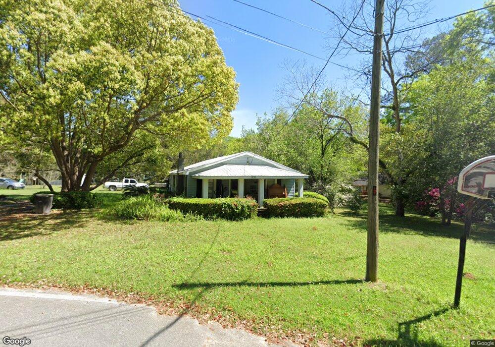
This home is located at 831 1st St SE, Cairo, GA 39828 and is currently estimated at $152,449, approximately $109 per square foot. 831 1st St SE is a home located in Grady County with nearby schools including Cairo High School.
Ownership History
Date
Name
Owned For
Owner Type
Purchase Details
Closed on
May 19, 2017
Sold by
Miller Heath
Bought by
Mullete Farms Llc
Current Estimated Value
Purchase Details
Closed on
Dec 30, 2016
Sold by
Phillip C
Bought by
Miller Heath and Miller Jennifer
Purchase Details
Closed on
Jun 3, 2005
Sold by
Cranford Eddie W
Bought by
Hudson Justin W and Hudson Deanna D
Purchase Details
Closed on
Jan 25, 1974
Bought by
Cranford Eddie W
Create a Home Valuation Report for This Property
The Home Valuation Report is an in-depth analysis detailing your home's value as well as a comparison with similar homes in the area
Purchase History
| Date | Buyer | Sale Price | Title Company |
|---|---|---|---|
| Mullete Farms Llc | -- | -- | |
| Miller Heath | $660,800 | -- | |
| Hudson Justin W | $55,000 | -- | |
| Cranford Eddie W | -- | -- |
Source: Public Records
Tax History
| Year | Tax Paid | Tax Assessment Tax Assessment Total Assessment is a certain percentage of the fair market value that is determined by local assessors to be the total taxable value of land and additions on the property. | Land | Improvement |
|---|---|---|---|---|
| 2024 | $1,282 | $44,218 | $3,820 | $40,398 |
| 2023 | $1,066 | $30,469 | $10,819 | $19,650 |
| 2022 | $1,116 | $30,589 | $10,819 | $19,770 |
| 2021 | $1,119 | $30,589 | $10,819 | $19,770 |
| 2020 | $1,122 | $30,589 | $10,819 | $19,770 |
| 2019 | $1,122 | $30,589 | $10,819 | $19,770 |
| 2018 | $1,067 | $30,589 | $10,819 | $19,770 |
| 2017 | $1,027 | $30,589 | $10,819 | $19,770 |
| 2016 | $941 | $27,540 | $10,819 | $16,721 |
| 2015 | $931 | $27,540 | $10,819 | $16,721 |
| 2014 | $932 | $27,540 | $10,819 | $16,721 |
| 2013 | -- | $25,801 | $10,819 | $14,982 |
Source: Public Records
Map
Nearby Homes
- 1193 S Broad St
- 306 Midland Place
- 112 Pine Cir SW
- 117 SW Pine Cirlce
- 460 2nd St SW
- 530 6th Ave SE
- 471 4th St SE
- 309 3rd St SE
- 530 6th St
- 1406 Platt Ave
- 1405 Platt Ave
- 00 Hwy 111 South Tract 1
- X 1st St
- 0 1st St
- 130 17th Ave SE
- 198 Oakdale Rd SE
- 00 Blackberry Ln
- 00 Meridian Rd
- Lot #15, 3 64 Acres Oakbend Cir
- 4761 Hadley Ferry Rd
- 265 Muggridge Ln
- 881 1st St SE
- 275 Muggridge Ln
- 880 1st St SE
- 833 S Broad St
- 12 10th Ave SE
- 260 Muggridge Ln
- 1002 3rd St SE
- 809 1st St SE
- 831 S Broad St
- 1014 3rd St SE
- 285 Muggridge Ln
- 821 S Broad St
- 280 Muggridge Ln
- 940 3rd St SE
- 1091 S Broad St
- 290 Muggridge Ln
- 1003 3rd St SE
- 1033 3rd St SE
- 975 3rd St SE
Your Personal Tour Guide
Ask me questions while you tour the home.