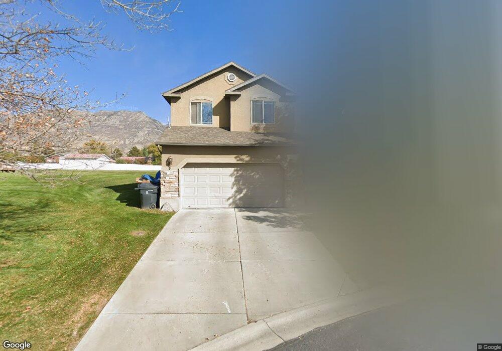
831 Apple Grove Ln Pleasant Grove, UT 84062
Estimated Value: $528,000 - $604,000
4
Beds
4
Baths
2,265
Sq Ft
$248/Sq Ft
Est. Value
About This Home
This home is located at 831 Apple Grove Ln, Pleasant Grove, UT 84062 and is currently estimated at $560,800, approximately $247 per square foot. 831 Apple Grove Ln is a home located in Utah County with nearby schools including Lindon Elementary School, Oak Canyon Junior High School, and Pleasant Grove High School.
Ownership History
Date
Name
Owned For
Owner Type
Purchase Details
Closed on
Dec 15, 2010
Sold by
Loser Adam
Bought by
Loser Adam and Loser Rachel W
Current Estimated Value
Home Financials for this Owner
Home Financials are based on the most recent Mortgage that was taken out on this home.
Original Mortgage
$102,200
Interest Rate
4.21%
Mortgage Type
New Conventional
Create a Home Valuation Report for This Property
The Home Valuation Report is an in-depth analysis detailing your home's value as well as a comparison with similar homes in the area
Home Values in the Area
Average Home Value in this Area
Purchase History
| Date | Buyer | Sale Price | Title Company |
|---|---|---|---|
| Loser Adam | -- | Utah First Title Insurance | |
| Loser Adam | -- | Utah First Title Insurance |
Source: Public Records
Mortgage History
| Date | Status | Borrower | Loan Amount |
|---|---|---|---|
| Closed | Loser Adam | $102,200 |
Source: Public Records
Tax History Compared to Growth
Tax History
| Year | Tax Paid | Tax Assessment Tax Assessment Total Assessment is a certain percentage of the fair market value that is determined by local assessors to be the total taxable value of land and additions on the property. | Land | Improvement |
|---|---|---|---|---|
| 2025 | $2,001 | $275,385 | $171,700 | $329,000 |
| 2024 | $2,001 | $238,755 | $0 | $0 |
| 2023 | $1,947 | $237,875 | $0 | $0 |
| 2022 | $1,972 | $239,690 | $0 | $0 |
| 2021 | $1,735 | $321,200 | $123,200 | $198,000 |
| 2020 | $1,676 | $304,100 | $110,000 | $194,100 |
| 2019 | $1,492 | $279,900 | $100,000 | $179,900 |
| 2018 | $1,389 | $246,400 | $90,000 | $156,400 |
| 2017 | $1,370 | $129,415 | $0 | $0 |
| 2016 | $1,371 | $125,015 | $0 | $0 |
| 2015 | $1,346 | $116,215 | $0 | $0 |
| 2014 | $1,319 | $112,805 | $0 | $0 |
Source: Public Records
Map
Nearby Homes
- 833 S Apple Grove Ln Unit 47
- 833 S Apple Grove Ln
- 833 Apple Grove Ln
- 825 Apple Grove Ln
- 825 S Apple Grove Ln
- 827 S Apple Grove Ln
- 827 Apple Grove Ln
- 835 Apple Grove Ln
- 823 S Apple Grove Ln
- 823 Apple Grove Ln
- 829 S Apple Grove Ln
- 829 Apple Grove Ln
- 610 E 820 S
- 614 E 820 S
- 821 Apple Grove Ln
- 821 S Apple Grove Ln
- 606 E 820 S
- 837 S Apple Grove Ln
- 837 Apple Grove Ln
- 839 Apple Grove Ln