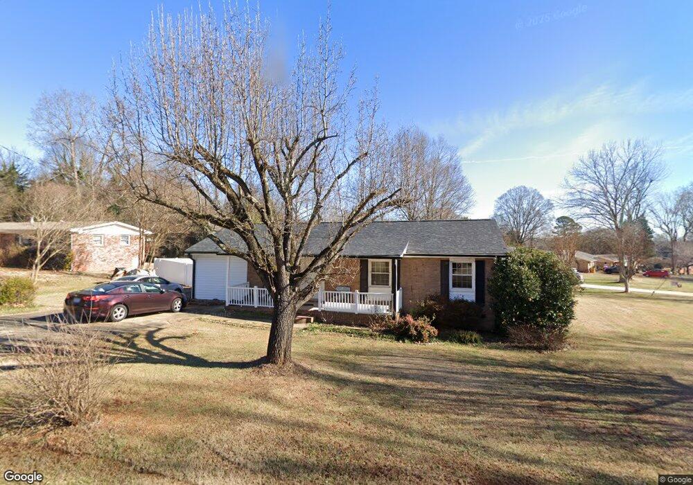
831 Ford Dr Lowell, NC 28098
Estimated Value: $237,000 - $261,612
3
Beds
2
Baths
1,277
Sq Ft
$195/Sq Ft
Est. Value
About This Home
This home is located at 831 Ford Dr, Lowell, NC 28098 and is currently estimated at $248,403, approximately $194 per square foot. 831 Ford Dr is a home located in Gaston County with nearby schools including McAdenville Elementary School, Holbrook Middle School, and Stuart W. Cramer High School.
Ownership History
Date
Name
Owned For
Owner Type
Purchase Details
Closed on
Jun 19, 2025
Sold by
Kimmons Darlene and Kimmons Paul
Bought by
Lyles Gena G and Lyles Timothy
Current Estimated Value
Purchase Details
Closed on
May 16, 2007
Sold by
Federal National Mortgage Association
Bought by
Grant Brenda and Grant William
Purchase Details
Closed on
Mar 14, 2007
Sold by
Vue Xe Lee
Bought by
Federal National Mortgage Association
Create a Home Valuation Report for This Property
The Home Valuation Report is an in-depth analysis detailing your home's value as well as a comparison with similar homes in the area
Home Values in the Area
Average Home Value in this Area
Purchase History
| Date | Buyer | Sale Price | Title Company |
|---|---|---|---|
| Lyles Gena G | -- | None Listed On Document | |
| Lyles Gena G | -- | None Listed On Document | |
| Grant Brenda | -- | Archer Land Title Lc | |
| Federal National Mortgage Association | $97,201 | None Available |
Source: Public Records
Tax History
| Year | Tax Paid | Tax Assessment Tax Assessment Total Assessment is a certain percentage of the fair market value that is determined by local assessors to be the total taxable value of land and additions on the property. | Land | Improvement |
|---|---|---|---|---|
| 2025 | $1,880 | $263,290 | $18,000 | $245,290 |
| 2024 | $1,880 | $263,290 | $18,000 | $245,290 |
| 2023 | $1,830 | $263,290 | $18,000 | $245,290 |
| 2022 | $1,240 | $134,800 | $18,000 | $116,800 |
| 2021 | $671 | $104,500 | $18,000 | $86,500 |
| 2019 | $979 | $107,850 | $18,000 | $89,850 |
| 2018 | $757 | $80,178 | $14,400 | $65,778 |
| 2017 | $757 | $80,178 | $14,400 | $65,778 |
| 2016 | $757 | $80,178 | $0 | $0 |
| 2014 | $729 | $79,223 | $18,000 | $61,223 |
Source: Public Records
Map
Nearby Homes
- 704 McAdenville Rd
- 356 Main St
- 500 Gann St Unit 51-56
- 503 Caroline Ave
- 211 Seigle St Unit 37-38
- 188 Main St
- 506 Academy St
- 116 Kenworthy Ave
- 160 Wesleyan Dr
- 209 Wesleyan Dr
- 308 Rankin Ave
- 131 Church St
- 118 Fir St
- 4636 Lenden Hall Ct
- 148 Forest Heights Dr
- 205 Church St
- 2073 Pin Oak Place
- 448 17th St
- 620 Webster Ln
- 623 Webster Ln
- 1013 Ford Dr
- 829 Ford Rd
- 1024 Avondale Rd
- 1024 Avondale Rd Unit 5
- 1024 Avondale Rd Unit 4
- 1024 Avondale Rd Unit 8
- 1024 Avondale Rd Unit 6
- 1024 Avondale Rd
- 1024 Avondale Rd Unit 2
- 1024 Avondale Rd Unit 3
- 1024 Avondale Rd Unit 7
- 1024 Avondale Rd Unit 1
- 832 Ford Dr
- 828 Ford Dr
- 1021 Ford Dr
- 834 Ford Dr
- 911 Ford Dr
- 1030 Ford Dr
- 1029 Ford Dr
- 1048 Avondale Rd Unit 15
Your Personal Tour Guide
Ask me questions while you tour the home.