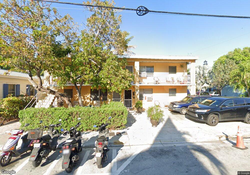
831 Thomas St Key West, FL 33040
Old Town NeighborhoodEstimated Value: $1,432,000 - $2,696,000
12
Beds
4
Baths
3,840
Sq Ft
$518/Sq Ft
Est. Value
About This Home
This home is located at 831 Thomas St, Key West, FL 33040 and is currently estimated at $1,989,667, approximately $518 per square foot. 831 Thomas St is a home located in Monroe County with nearby schools including Gerald Adams Elementary School, Key West High School, and May Sands Montessori School.
Ownership History
Date
Name
Owned For
Owner Type
Purchase Details
Closed on
Nov 24, 2020
Sold by
Barnett Robert Phillip and Barnett Caridad Maria
Bought by
Barnett Robert Phillip and Barnett Caridad Maria
Current Estimated Value
Home Financials for this Owner
Home Financials are based on the most recent Mortgage that was taken out on this home.
Original Mortgage
$260,000
Outstanding Balance
$231,890
Interest Rate
2.8%
Mortgage Type
New Conventional
Estimated Equity
$1,757,777
Purchase Details
Closed on
Nov 15, 2013
Sold by
Bethel Andrea Elaine
Bought by
Barnett Robert Phillip
Purchase Details
Closed on
Sep 19, 2011
Sold by
Linde Matthew A
Bought by
Barnett Robert Phillip and Bethel Andrea Elaine
Purchase Details
Closed on
Sep 12, 2011
Bought by
Barnett Robert Phillip
Purchase Details
Closed on
Feb 1, 1973
Bought by
Barnett Robert Phillip
Create a Home Valuation Report for This Property
The Home Valuation Report is an in-depth analysis detailing your home's value as well as a comparison with similar homes in the area
Home Values in the Area
Average Home Value in this Area
Purchase History
| Date | Buyer | Sale Price | Title Company |
|---|---|---|---|
| Barnett Robert Phillip | -- | First Intl Ttl Key West Bran | |
| Barnett Robert Phillip | -- | First International Title | |
| Barnett Robert Phillip | -- | None Available | |
| Barnett Robert Phillip | -- | Attorney | |
| Barnett Robert Phillip | $100 | -- | |
| Barnett Robert Phillip | $42,000 | -- |
Source: Public Records
Mortgage History
| Date | Status | Borrower | Loan Amount |
|---|---|---|---|
| Open | Barnett Robert Phillip | $260,000 | |
| Closed | Barnett Robert Phillip | $260,000 |
Source: Public Records
Tax History Compared to Growth
Tax History
| Year | Tax Paid | Tax Assessment Tax Assessment Total Assessment is a certain percentage of the fair market value that is determined by local assessors to be the total taxable value of land and additions on the property. | Land | Improvement |
|---|---|---|---|---|
| 2025 | $11,393 | $1,358,475 | -- | -- |
| 2024 | $10,163 | $1,290,163 | -- | -- |
| 2023 | $10,163 | $1,179,262 | $0 | $0 |
| 2022 | $8,848 | $928,911 | $0 | $0 |
| 2021 | $8,425 | $807,313 | $0 | $0 |
| 2020 | $7,879 | $749,442 | $0 | $0 |
| 2019 | $7,570 | $709,447 | $0 | $0 |
| 2018 | $7,647 | $707,241 | $0 | $0 |
| 2017 | $7,636 | $705,427 | $0 | $0 |
| 2016 | $7,586 | $695,691 | $0 | $0 |
| 2015 | $7,450 | $689,567 | $0 | $0 |
| 2014 | $6,871 | $556,972 | $0 | $0 |
Source: Public Records
Map
Nearby Homes
- 813 Thomas St
- 817 Terry Ln
- 909 & 913 Thomas St
- 709 Chapman Ln
- 705 Chapman Ln
- 405 Petronia St
- 919 Thomas St
- 720 Emma St
- 418 Olivia St
- 620 Thomas St Unit 175
- 620 Thomas St Unit 176
- 620 Thomas St Unit 291
- 625 Whitehead St
- 612 Mickens Ln
- 400 Aronovitz Ln
- 206 Truman Ave
- 1012 Howe St
- 212 Southard St
- 204 Southard St Unit 5
- 415 Julia St