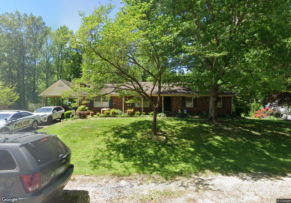
8310 Hunton Cir North Chesterfield, VA 23235
North Chesterfield NeighborhoodEstimated Value: $408,000 - $460,000
4
Beds
3
Baths
2,607
Sq Ft
$167/Sq Ft
Est. Value
About This Home
This home is located at 8310 Hunton Cir, North Chesterfield, VA 23235 and is currently estimated at $434,272, approximately $166 per square foot. 8310 Hunton Cir is a home located in Chesterfield County with nearby schools including Jacobs Road Elementary School, Manchester Middle School, and Clover Hill High.
Ownership History
Date
Name
Owned For
Owner Type
Purchase Details
Closed on
Jun 3, 1996
Sold by
Nesmith Kenneth E and Nesmith Ann D
Bought by
Miller Jonathan W and Miller Amy M
Current Estimated Value
Home Financials for this Owner
Home Financials are based on the most recent Mortgage that was taken out on this home.
Original Mortgage
$112,935
Outstanding Balance
$7,156
Interest Rate
7.91%
Mortgage Type
FHA
Estimated Equity
$427,116
Create a Home Valuation Report for This Property
The Home Valuation Report is an in-depth analysis detailing your home's value as well as a comparison with similar homes in the area
Home Values in the Area
Average Home Value in this Area
Purchase History
| Date | Buyer | Sale Price | Title Company |
|---|---|---|---|
| Miller Jonathan W | $113,000 | -- |
Source: Public Records
Mortgage History
| Date | Status | Borrower | Loan Amount |
|---|---|---|---|
| Open | Miller Jonathan W | $112,935 |
Source: Public Records
Tax History Compared to Growth
Tax History
| Year | Tax Paid | Tax Assessment Tax Assessment Total Assessment is a certain percentage of the fair market value that is determined by local assessors to be the total taxable value of land and additions on the property. | Land | Improvement |
|---|---|---|---|---|
| 2025 | $4,001 | $446,700 | $61,000 | $385,700 |
| 2024 | $4,001 | $414,800 | $56,000 | $358,800 |
| 2023 | $3,500 | $384,600 | $54,000 | $330,600 |
| 2022 | $3,215 | $349,500 | $51,000 | $298,500 |
| 2021 | $2,864 | $294,500 | $49,000 | $245,500 |
| 2020 | $2,589 | $272,500 | $47,000 | $225,500 |
| 2019 | $2,456 | $258,500 | $46,000 | $212,500 |
| 2018 | $2,342 | $246,500 | $44,000 | $202,500 |
| 2017 | $2,285 | $238,000 | $44,000 | $194,000 |
| 2016 | $2,236 | $232,900 | $44,000 | $188,900 |
| 2015 | $2,142 | $220,500 | $42,000 | $178,500 |
| 2014 | $2,010 | $206,800 | $42,000 | $164,800 |
Source: Public Records
Map
Nearby Homes
- Lexington Plan at Wyntrebrooke Village
- Covington Plan at Wyntrebrooke Village
- Arlington Plan at Wyntrebrooke Village
- Shenandoah Plan at Wyntrebrooke Village
- Louisa Plan at Wyntrebrooke Village
- 7961 Lyndale Dr
- 7949 Lyndale Dr
- 4029 Flintridge Rd
- 7931 Lyndale Dr
- 6988 Leire Ln
- 3832 Foxglove Rd
- 4121 Foxglove Rd
- 8003 Sussex Place
- 4201 Kempwood Place
- 3403 Fallbrooke Ct
- 8832 Lyndale Dr
- 7710 Buttermere Ct
- 3929 Litchfield Dr
- 4884 Wedgemere Rd
- 4212 Brixton Rd
- 8320 Hunton Cir
- 8300 Hunton Cir
- 3801 Lyndale Ct
- 8330 Hunton Cir
- 8309 Hunton Cir
- 3913 Lyndale Terrace
- 8230 Hunton Cir
- 8319 Hunton Cir
- 8301 Hunton Cir
- 3800 Lyndale Ct
- 8329 Hunton Cir
- 8340 Hunton Cir
- 3907 Lyndale Terrace
- 3919 Lyndale Terrace
- 8220 Hunton Cir
- 8339 Hunton Cir
- 8357 Lyndale Dr
- 3801 Hunton Ct
- 8350 Hunton Cir
- 8229 Hunton Cir