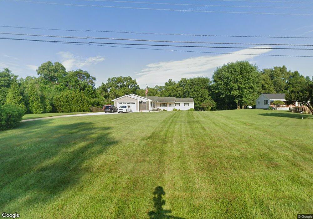
8317 Sagraves Dr Vandalia, OH 45377
Estimated Value: $251,000 - $262,000
3
Beds
1
Bath
1,510
Sq Ft
$170/Sq Ft
Est. Value
About This Home
This home is located at 8317 Sagraves Dr, Vandalia, OH 45377 and is currently estimated at $256,368, approximately $169 per square foot. 8317 Sagraves Dr is a home located in Montgomery County with nearby schools including Demmitt Elementary School, Smith Middle School, and Butler High School.
Ownership History
Date
Name
Owned For
Owner Type
Purchase Details
Closed on
Jan 30, 1998
Sold by
Duty Pamela A
Bought by
Duty Jack D and Duty Pamela A
Current Estimated Value
Home Financials for this Owner
Home Financials are based on the most recent Mortgage that was taken out on this home.
Original Mortgage
$39,500
Interest Rate
7.08%
Create a Home Valuation Report for This Property
The Home Valuation Report is an in-depth analysis detailing your home's value as well as a comparison with similar homes in the area
Home Values in the Area
Average Home Value in this Area
Purchase History
| Date | Buyer | Sale Price | Title Company |
|---|---|---|---|
| Duty Jack D | -- | Safemark Title Agency Inc | |
| Duty Jack D | -- | -- |
Source: Public Records
Mortgage History
| Date | Status | Borrower | Loan Amount |
|---|---|---|---|
| Closed | Duty Jack D | $39,500 |
Source: Public Records
Tax History Compared to Growth
Tax History
| Year | Tax Paid | Tax Assessment Tax Assessment Total Assessment is a certain percentage of the fair market value that is determined by local assessors to be the total taxable value of land and additions on the property. | Land | Improvement |
|---|---|---|---|---|
| 2024 | $3,315 | $63,480 | $19,090 | $44,390 |
| 2023 | $3,315 | $63,480 | $19,090 | $44,390 |
| 2022 | $2,849 | $44,080 | $13,250 | $30,830 |
| 2021 | $2,693 | $41,610 | $13,250 | $28,360 |
| 2020 | $2,527 | $39,150 | $13,250 | $25,900 |
| 2019 | $2,951 | $41,960 | $13,250 | $28,710 |
| 2018 | $2,957 | $41,960 | $13,250 | $28,710 |
| 2017 | $2,934 | $41,960 | $13,250 | $28,710 |
| 2016 | $2,748 | $38,610 | $13,250 | $25,360 |
| 2015 | $2,714 | $38,610 | $13,250 | $25,360 |
| 2014 | $2,714 | $38,610 | $13,250 | $25,360 |
| 2012 | -- | $42,990 | $14,480 | $28,510 |
Source: Public Records
Map
Nearby Homes
- 770 Deer Creek Dr
- 847 Waldsmith Way
- 469 Farrell Rd
- 416 Bent Twig Dr
- 827 Foxfire Trail
- 461 Poplar Grove Dr
- 668 Deerhurst Dr
- Fairfax Plan at Foxfire - Maple Street Collection
- Yosemite Plan at Foxfire - Maple Street Collection
- Cumberland Plan at Foxfire - Maple Street Collection
- Jensen Plan at Foxfire - Maple Street Collection
- Beacon Plan at Foxfire - Maple Street Collection
- Wesley Plan at Foxfire - Maple Street Collection
- Breckenridge Plan at Foxfire - Maple Street Collection
- Danville Plan at Foxfire - Maple Street Collection
- DaVinci Plan at Foxfire - Maple Street Collection
- Greenbriar Plan at Foxfire - Maple Street Collection
- 678 Deerhurst Dr
- 710 Deerhurst Dr
- 715 Deerhurst Dr
- 8331 Sagraves Dr
- 8336 Sagraves Dr
- 8379 Sagraves Dr
- 8379 Sagraves Dr
- 4330 Bonnie Brae Ave
- 8364 Sagraves Dr
- 8100 Sagraves Dr
- 8384 Sagraves Dr
- 8401 Sagraves Dr
- 4341 Bonnie Brae Ave
- 4350 Bonnie Brae Ave
- 8426 Sagraves Dr
- 4447 Bonnie Brae Ave
- 1455 Sagraves Dr
- 4386 Bonnie Brae Ave
- 1450 Sagraves Dr
- 1424 Cole Ct
- 1438 Cole Ct
- 1439 Sagraves Dr
- 8200 Sagraves Dr