Estimated Value: $533,000 - $626,000
4
Beds
4
Baths
2,192
Sq Ft
$261/Sq Ft
Est. Value
About This Home
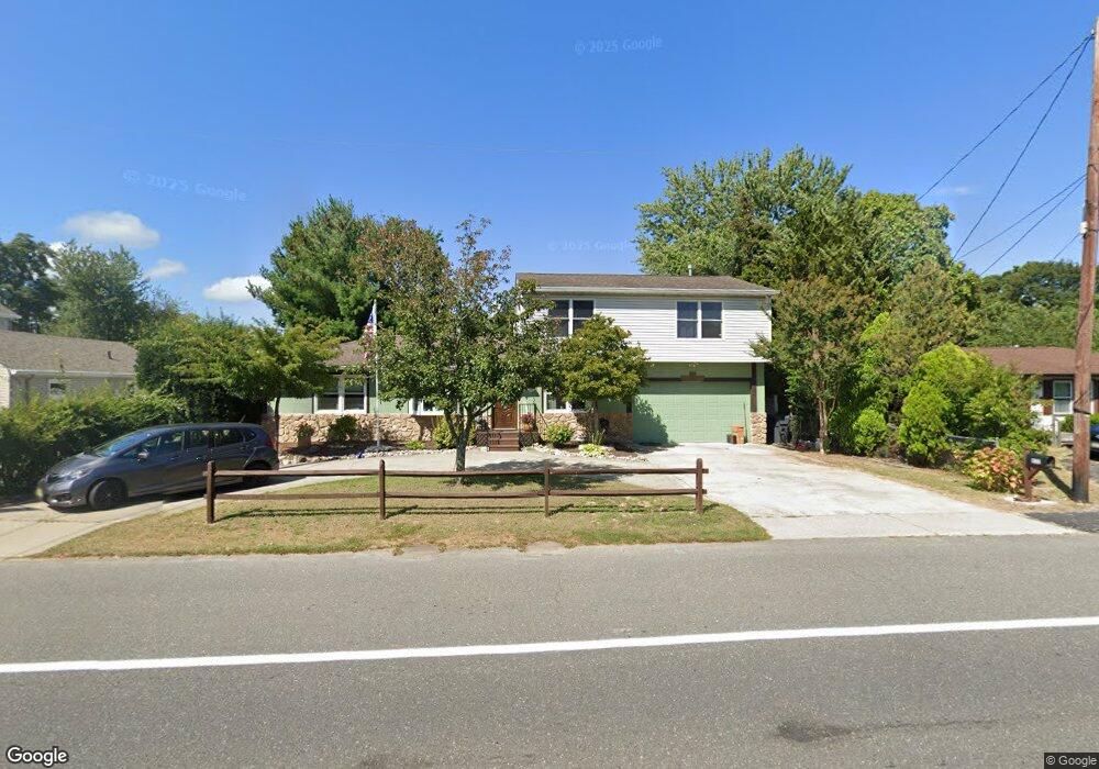
This home is located at 832 Burnt Tavern Rd, Brick, NJ 08724 and is currently estimated at $571,910, approximately $260 per square foot. 832 Burnt Tavern Rd is a home located in Ocean County with nearby schools including Veterans Memorial Elementary School, Veterans Memorial Middle School, and Brick Township Memorial High School.
Ownership History
Date
Name
Owned For
Owner Type
Purchase Details
Closed on
Jul 9, 2015
Sold by
Kaczmarek Thomas A and Kaczmarek Teresa P
Bought by
Kaczmarek Agnes
Current Estimated Value
Purchase Details
Closed on
Dec 15, 1998
Sold by
Jones Harry W
Bought by
Kaczmarek Thomas A
Home Financials for this Owner
Home Financials are based on the most recent Mortgage that was taken out on this home.
Original Mortgage
$86,300
Interest Rate
6.67%
Mortgage Type
Stand Alone First
Create a Home Valuation Report for This Property
The Home Valuation Report is an in-depth analysis detailing your home's value as well as a comparison with similar homes in the area
Home Values in the Area
Average Home Value in this Area
Purchase History
| Date | Buyer | Sale Price | Title Company |
|---|---|---|---|
| Kaczmarek Agnes | $216,000 | Attorney | |
| Kaczmarek Thomas A | $107,900 | Chicago Title Insurance Co |
Source: Public Records
Mortgage History
| Date | Status | Borrower | Loan Amount |
|---|---|---|---|
| Previous Owner | Kaczmarek Thomas A | $86,300 |
Source: Public Records
Tax History
| Year | Tax Paid | Tax Assessment Tax Assessment Total Assessment is a certain percentage of the fair market value that is determined by local assessors to be the total taxable value of land and additions on the property. | Land | Improvement |
|---|---|---|---|---|
| 2025 | $7,744 | $281,600 | $104,000 | $177,600 |
| 2024 | $7,001 | $281,600 | $104,000 | $177,600 |
| 2023 | $6,908 | $281,600 | $104,000 | $177,600 |
| 2022 | $6,908 | $281,600 | $104,000 | $177,600 |
| 2021 | $6,767 | $281,600 | $104,000 | $177,600 |
| 2020 | $6,674 | $281,600 | $104,000 | $177,600 |
| 2019 | $6,544 | $281,600 | $104,000 | $177,600 |
| 2018 | $6,395 | $281,600 | $104,000 | $177,600 |
| 2017 | $6,223 | $281,600 | $104,000 | $177,600 |
| 2016 | $6,178 | $281,600 | $104,000 | $177,600 |
| 2015 | $6,015 | $281,600 | $104,000 | $177,600 |
| 2014 | $5,956 | $281,600 | $104,000 | $177,600 |
Source: Public Records
Map
Nearby Homes
- 823 Maple Ave
- 339 Prospect Dr
- 869 Koches Ave Unit 18
- 21 Chatham Ct
- 15 Brandywine Ct
- 135 Brandywine Ct Unit 1
- 432 18th Ave
- 441 17th Ave
- 393 N Lake Dr
- 48 Northrup Dr Unit 196
- 726 Maple Ave
- 505 5th Ave
- 120 Everest Dr S
- 170 Everest Dr S
- 295 Madison Ct
- 506 Azalea Dr
- 506 Godfrey Lake Dr
- 603 Zinnia Ct Unit 3
- 701 Carnation Dr Unit 1
- 24 Olympus Way
- 830 Burnt Tavern Rd
- 835 Marbro Ave
- 833 Marbro Ave Unit 16
- 836 Burnt Tavern Rd Unit 838
- 828 Burnt Tavern Rd
- 837 Marbro Ave Unit 10
- 840 Burnt Tavern Rd
- 829 Marbro Ave
- 831 Burnt Tavern Rd
- 835 Burnt Tavern Rd
- 1 Sweeney Ave
- 415 Sweeney Ave
- 825 Marbro Ave
- 840 Marbro Ave Unit 11
- 836 Marbro Ave
- 844 Marbro Ave Unit 15
- 5 Sweeney Ave
- 846 Burnt Tavern Rd
- 838 Maple Ave
- 9 Drew Ave
Your Personal Tour Guide
Ask me questions while you tour the home.