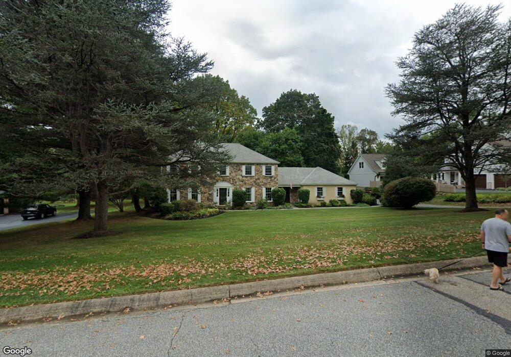
832 Hunt Rd Newtown Square, PA 19073
Estimated Value: $1,091,414 - $1,399,000
4
Beds
3
Baths
2,942
Sq Ft
$419/Sq Ft
Est. Value
About This Home
This home is located at 832 Hunt Rd, Newtown Square, PA 19073 and is currently estimated at $1,233,104, approximately $419 per square foot. 832 Hunt Rd is a home located in Delaware County with nearby schools including Ithan Elementary School, Radnor Middle School, and Radnor Senior High School.
Ownership History
Date
Name
Owned For
Owner Type
Purchase Details
Closed on
Aug 23, 1994
Sold by
Andal Andres H and Andal Nancy F
Bought by
Hill J Alexander and Hill Marianne
Current Estimated Value
Home Financials for this Owner
Home Financials are based on the most recent Mortgage that was taken out on this home.
Original Mortgage
$311,000
Interest Rate
7.87%
Create a Home Valuation Report for This Property
The Home Valuation Report is an in-depth analysis detailing your home's value as well as a comparison with similar homes in the area
Home Values in the Area
Average Home Value in this Area
Purchase History
| Date | Buyer | Sale Price | Title Company |
|---|---|---|---|
| Hill J Alexander | $349,000 | Commonwealth Land Title Ins |
Source: Public Records
Mortgage History
| Date | Status | Borrower | Loan Amount |
|---|---|---|---|
| Closed | Hill J Alexander | $311,000 |
Source: Public Records
Tax History Compared to Growth
Tax History
| Year | Tax Paid | Tax Assessment Tax Assessment Total Assessment is a certain percentage of the fair market value that is determined by local assessors to be the total taxable value of land and additions on the property. | Land | Improvement |
|---|---|---|---|---|
| 2025 | $14,242 | $704,400 | $227,310 | $477,090 |
| 2024 | $14,242 | $704,400 | $227,310 | $477,090 |
| 2023 | $13,677 | $704,400 | $227,310 | $477,090 |
| 2022 | $13,528 | $704,400 | $227,310 | $477,090 |
| 2021 | $21,730 | $704,400 | $227,310 | $477,090 |
| 2020 | $13,991 | $402,180 | $129,340 | $272,840 |
| 2019 | $13,596 | $402,180 | $129,340 | $272,840 |
| 2018 | $13,329 | $402,180 | $0 | $0 |
| 2017 | $13,050 | $402,180 | $0 | $0 |
| 2016 | $2,207 | $402,180 | $0 | $0 |
| 2015 | $2,252 | $402,180 | $0 | $0 |
| 2014 | $2,207 | $402,180 | $0 | $0 |
Source: Public Records
Map
Nearby Homes
- 820 Darby Paoli Rd
- 739 S Roberts Rd
- 726 Darby Paoli Rd
- 119 Bella Dr Unit 2MD
- 117 Bella Dr Unit 3AD
- 202 Barren Rd
- 12 Lincoln Ln
- 212 Aronimink Dr
- 204 Wedgewood Cir
- 66 Northwood Rd
- 3920 Darby Rd
- 217 Jeffrey Ln
- 211 E Chelsea Cir
- 135 Bryn Mawr Ave
- 115 Newby Dr
- 238 E Chelsea Cir Unit 238
- 124 Carli Dr
- 126 Bryn Mawr Ave
- 31 Barren Rd
- 133 Brookside Rd