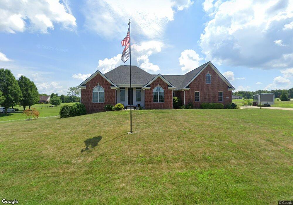
8326 Black Oak Dr Martinsville, IN 46151
Estimated Value: $485,755 - $590,000
3
Beds
4
Baths
2,220
Sq Ft
$235/Sq Ft
Est. Value
About This Home
This home is located at 8326 Black Oak Dr, Martinsville, IN 46151 and is currently estimated at $520,939, approximately $234 per square foot. 8326 Black Oak Dr is a home located in Morgan County with nearby schools including Martinsville High School.
Ownership History
Date
Name
Owned For
Owner Type
Purchase Details
Closed on
Feb 6, 2020
Sold by
Berube Michael M and Berube Diane T
Bought by
Sims Michael L and Sims Lorie E
Current Estimated Value
Home Financials for this Owner
Home Financials are based on the most recent Mortgage that was taken out on this home.
Original Mortgage
$100,000
Outstanding Balance
$88,744
Interest Rate
3.72%
Mortgage Type
New Conventional
Estimated Equity
$432,195
Purchase Details
Closed on
Nov 30, 2018
Sold by
Cole John W
Bought by
Berube Michael M and Berube Diane T
Create a Home Valuation Report for This Property
The Home Valuation Report is an in-depth analysis detailing your home's value as well as a comparison with similar homes in the area
Home Values in the Area
Average Home Value in this Area
Purchase History
| Date | Buyer | Sale Price | Title Company |
|---|---|---|---|
| Sims Michael L | -- | Chicago Title | |
| Berube Michael M | -- | None Available |
Source: Public Records
Mortgage History
| Date | Status | Borrower | Loan Amount |
|---|---|---|---|
| Open | Sims Michael L | $100,000 |
Source: Public Records
Tax History Compared to Growth
Tax History
| Year | Tax Paid | Tax Assessment Tax Assessment Total Assessment is a certain percentage of the fair market value that is determined by local assessors to be the total taxable value of land and additions on the property. | Land | Improvement |
|---|---|---|---|---|
| 2024 | $2,148 | $420,300 | $30,500 | $389,800 |
| 2023 | $2,045 | $424,500 | $30,500 | $394,000 |
| 2022 | $1,791 | $393,700 | $30,500 | $363,200 |
| 2021 | $1,432 | $339,600 | $30,500 | $309,100 |
| 2020 | $1,297 | $322,300 | $30,500 | $291,800 |
| 2019 | $1,325 | $287,800 | $30,100 | $257,700 |
| 2018 | $64 | $30,100 | $30,100 | $0 |
| 2017 | $17 | $2,000 | $2,000 | $0 |
| 2016 | $18 | $2,000 | $2,000 | $0 |
| 2014 | $14 | $1,900 | $1,900 | $0 |
| 2013 | $14 | $1,900 | $1,900 | $0 |
Source: Public Records
Map
Nearby Homes
- 8405 Mcwhorter Rd
- 8385 Mcwhorter Rd
- 8205 Mcwhorter Rd
- 901 Carter Rd
- 7813 W 50 S
- 8577 State Road 44
- 0 Skunk Hollow Rd
- Tract 3 Skunk Hollow Rd
- Tract 2 Skunk Hollow Rd
- 7303 W Division Rd
- 0 Banta Rd Unit MBR21966792
- 4360 Williams Rd
- 7975 New Harmony Rd
- 7158 New Harmony Rd
- 1156 Cope Rd
- TBD Maple Grove Rd
- 583 Old Moore Ln
- 0 Old Moore Rd
- 8000 New Harmony Rd
- 4385 Cragen Rd
- 8325 Cottonwood Dr
- 8450 Black Oak Dr
- 8321 Cottonwood Dr
- 8324 Cottonwood Dr
- 8300 Black Oak Dr
- 8468 Black Oak Dr
- 8327 Black Oak Dr
- 8447 Black Oak Dr
- 8314 Cottonwood Dr
- 8311 Black Oak Dr
- 8463 Black Oak Dr
- 2244 Dillman Rd
- 8484 Black Oak Dr
- 2228 Dillman Rd
- 8298 Cottonwood Dr
- 8295 Black Oak Dr
- 8481 Black Oak Dr
- 8481 Dillman Rd
- 2300 Dillman Rd
- 0 Dillman Rd Unit 2819650