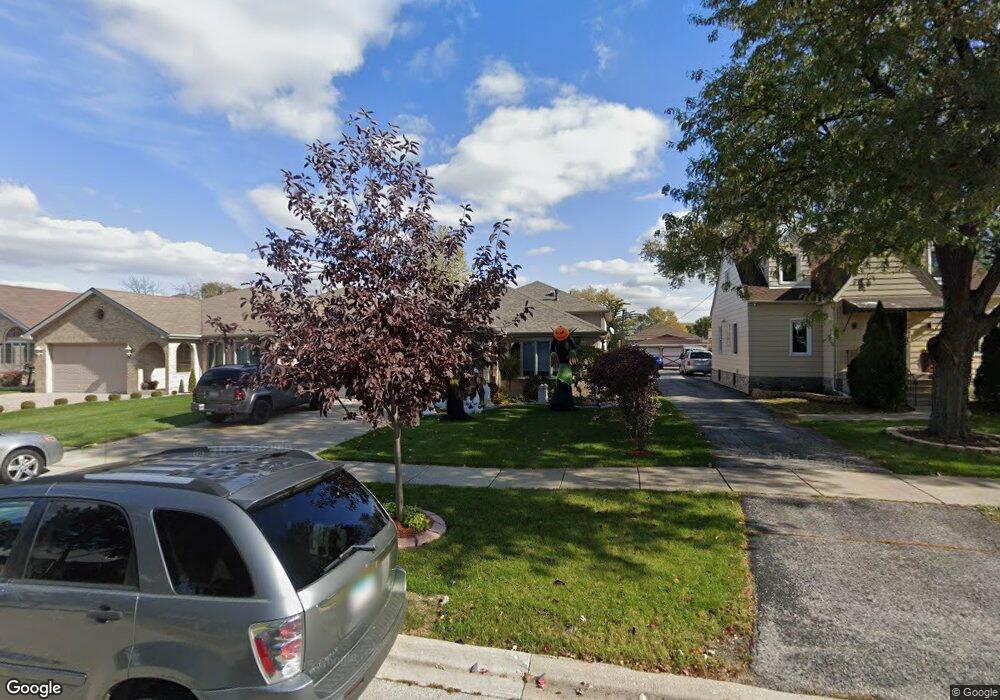
8327 Mayfield Ave Burbank, IL 60459
Estimated Value: $414,000 - $512,000
4
Beds
3
Baths
1,857
Sq Ft
$255/Sq Ft
Est. Value
About This Home
This home is located at 8327 Mayfield Ave, Burbank, IL 60459 and is currently estimated at $473,119, approximately $254 per square foot. 8327 Mayfield Ave is a home located in Cook County with nearby schools including Luther Burbank Elementary School, Reavis High School, and St Albert the Great Catholic School.
Ownership History
Date
Name
Owned For
Owner Type
Purchase Details
Closed on
Nov 4, 1997
Sold by
State Bank Of Countryside
Bought by
Totosz Thomas J and Totosz Judith L
Current Estimated Value
Home Financials for this Owner
Home Financials are based on the most recent Mortgage that was taken out on this home.
Original Mortgage
$145,000
Outstanding Balance
$24,007
Interest Rate
7.38%
Estimated Equity
$449,112
Create a Home Valuation Report for This Property
The Home Valuation Report is an in-depth analysis detailing your home's value as well as a comparison with similar homes in the area
Home Values in the Area
Average Home Value in this Area
Purchase History
| Date | Buyer | Sale Price | Title Company |
|---|---|---|---|
| Totosz Thomas J | $245,000 | -- |
Source: Public Records
Mortgage History
| Date | Status | Borrower | Loan Amount |
|---|---|---|---|
| Open | Totosz Thomas J | $145,000 |
Source: Public Records
Tax History Compared to Growth
Tax History
| Year | Tax Paid | Tax Assessment Tax Assessment Total Assessment is a certain percentage of the fair market value that is determined by local assessors to be the total taxable value of land and additions on the property. | Land | Improvement |
|---|---|---|---|---|
| 2024 | $10,261 | $36,386 | $5,875 | $30,511 |
| 2023 | $9,050 | $36,386 | $5,875 | $30,511 |
| 2022 | $9,050 | $26,888 | $5,170 | $21,718 |
| 2021 | $8,693 | $26,888 | $5,170 | $21,718 |
| 2020 | $8,468 | $26,888 | $5,170 | $21,718 |
| 2019 | $8,659 | $27,597 | $4,700 | $22,897 |
| 2018 | $8,410 | $27,597 | $4,700 | $22,897 |
| 2017 | $8,656 | $29,094 | $4,700 | $24,394 |
| 2016 | $5,927 | $19,320 | $3,995 | $15,325 |
| 2015 | $5,664 | $19,320 | $3,995 | $15,325 |
| 2014 | $5,512 | $19,320 | $3,995 | $15,325 |
| 2013 | $7,076 | $26,169 | $3,995 | $22,174 |
Source: Public Records
Map
Nearby Homes
- 8323 Melvina Ave
- 8325 Melvina Ave
- 8436 Moody Ave
- 8525 Massasoit Ave
- 8405 Melvina Ave
- 5613 W 84th Place
- 8033 Austin Ave
- 5610 W 85th St
- 5543 W 83rd St
- 8218 Linder Ave
- 8743 Austin Ave
- 6040 W 79th St
- 6241 W 80th St
- 6048 W 79th St
- 7836 Monitor Ave
- 8744 Central Ave
- 7850 Mcvicker Ave
- 7948 Merrimac Ave
- 8619 Linder Ave
- 5400 W 85th St
- 8325 Mayfield Ave
- 8335 Mayfield Ave
- 8323 Mansfield Ave
- 8343 Mayfield Ave
- 8321 Mayfield Ave
- 8310 Mansfield Ave
- 8351 Mayfield Ave
- 8320 Mansfield Ave
- 8303 Mayfield Ave
- 8340 Mayfield Ave
- 8330 Mansfield Ave
- 8322 Mayfield Ave
- 8308 Mansfield Ave
- 8308 Mansfield Ave
- 8334 Mansfield Ave
- 8301 Mayfield Ave
- 8342 Mayfield Ave
- 8336 Mansfield Ave
- 8359 Mayfield Ave
- 8359 Mayfield Ave Unit 1