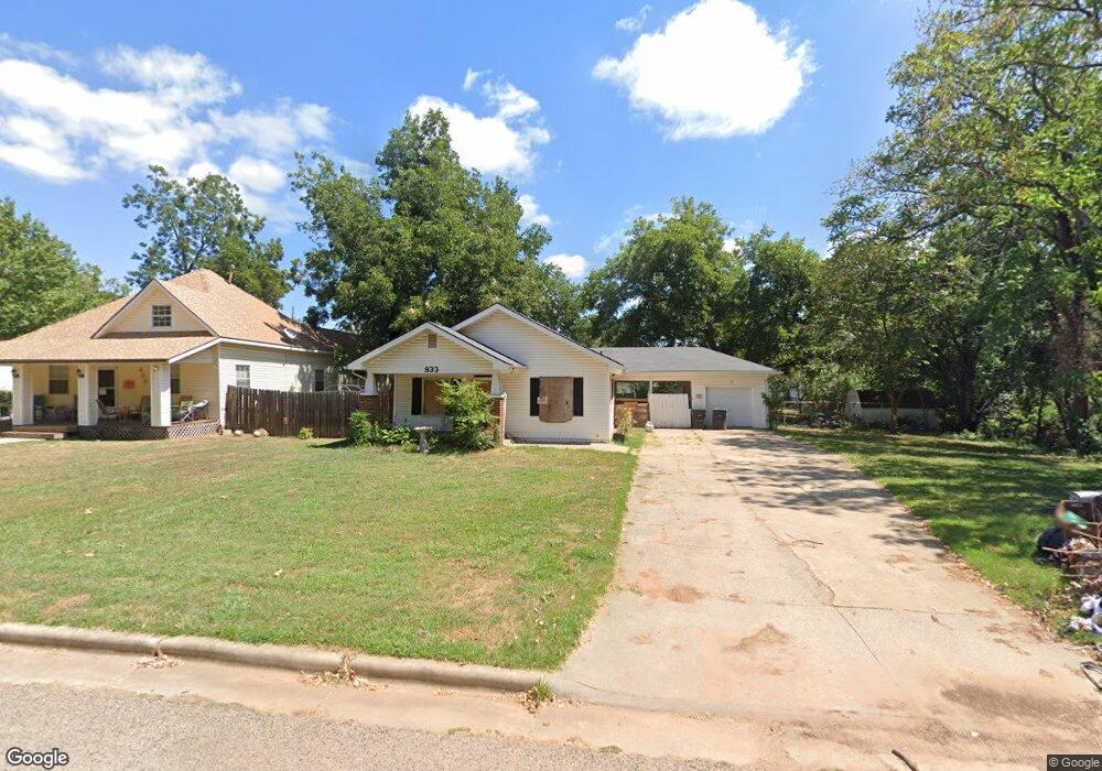
833 Hobson St Shawnee, OK 74801
Estimated Value: $26,000 - $113,513
3
Beds
1
Bath
1,300
Sq Ft
$63/Sq Ft
Est. Value
About This Home
This home is located at 833 Hobson St, Shawnee, OK 74801 and is currently estimated at $82,128, approximately $63 per square foot. 833 Hobson St is a home located in Pottawatomie County with nearby schools including Sequoyah Elementary School, Shawnee Middle School, and Shawnee High School.
Ownership History
Date
Name
Owned For
Owner Type
Purchase Details
Closed on
Jun 3, 2025
Sold by
Midfirst Bank
Bought by
Dap Enterprises Inc
Current Estimated Value
Purchase Details
Closed on
May 15, 2024
Sold by
Sheriff/Pottawatomie Cnty St/O
Bought by
Midfirst Bank
Purchase Details
Closed on
Feb 22, 2023
Sold by
Winterowd Buddy Allen
Bought by
Guenthner Jan Rochelle
Purchase Details
Closed on
Nov 30, 2021
Sold by
Winterowd Sylvia Jan
Bought by
Winterowd Buddy Allen
Purchase Details
Closed on
Jun 11, 1992
Sold by
Bland Bland B and Bland L
Bought by
Winterowd Sylvia
Create a Home Valuation Report for This Property
The Home Valuation Report is an in-depth analysis detailing your home's value as well as a comparison with similar homes in the area
Home Values in the Area
Average Home Value in this Area
Purchase History
| Date | Buyer | Sale Price | Title Company |
|---|---|---|---|
| Dap Enterprises Inc | $27,000 | First American Title Insurance | |
| Midfirst Bank | -- | None Listed On Document | |
| Guenthner Jan Rochelle | -- | -- | |
| Winterowd Buddy Allen | -- | None Available | |
| Winterowd Sylvia | $28,000 | -- |
Source: Public Records
Tax History Compared to Growth
Tax History
| Year | Tax Paid | Tax Assessment Tax Assessment Total Assessment is a certain percentage of the fair market value that is determined by local assessors to be the total taxable value of land and additions on the property. | Land | Improvement |
|---|---|---|---|---|
| 2024 | $444 | $9,533 | $668 | $8,865 |
| 2023 | $444 | $4,251 | $324 | $3,927 |
| 2022 | $415 | $4,048 | $307 | $3,741 |
| 2021 | $288 | $4,048 | $306 | $3,742 |
| 2020 | $277 | $3,743 | $282 | $3,461 |
| 2019 | $275 | $3,635 | $265 | $3,370 |
| 2018 | $259 | $3,529 | $259 | $3,270 |
| 2017 | $245 | $3,426 | $245 | $3,181 |
| 2016 | $237 | $3,327 | $237 | $3,090 |
| 2015 | $223 | $3,230 | $226 | $3,004 |
| 2014 | $214 | $3,136 | $207 | $2,929 |
Source: Public Records
Map
Nearby Homes
- 1017 N Bdwy Ave
- 824 N Beard Ave
- 434 E Wallace St
- 727 N Beard Ave
- 717 N Broadway Ave
- 1006 N Market Ave
- 1003 N Minnesota Ave
- 735 N Park Ave
- 318 W Dill St
- 1217 N Market Ave
- 718 N Park Ave
- 128 W Ridgewood St
- 810 N Kickapoo Ave
- 615 N Park Ave
- 1324 N Park Ave
- 634 N Louisa Ave
- 730 N Tucker Ave
- 0 Independence and Minnesota St
- 1510 N Union Ave
- 710 N Tucker Ave
- 835 Hobson St
- 815 N Hobson Ave
- 835 N Hobson Ave
- 815 Hobson St
- 828 N Union Ave
- 824 N Union Ave
- 811 N Hobson Ave
- 901 Hobson St
- 804 N Union Ave
- 814 Hobson St
- 809 Hobson St
- 909 Hobson St
- 910 N Hobson Ave
- 812 Hobson St
- 902 N Union Ave
- 923 Hobson St
- 810 Hobson St
- 807 Hobson St
- 906 Hobson St
- 808 N Union Ave