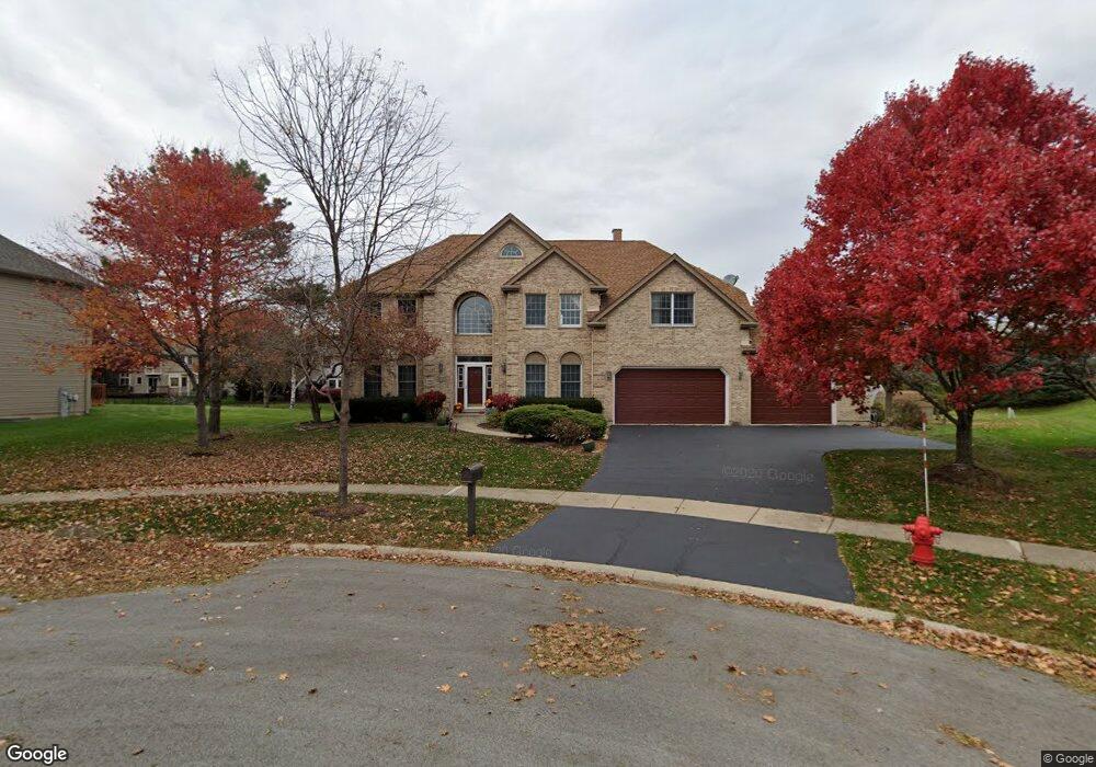
833 Simon Ct Geneva, IL 60134
Southwest Geneva NeighborhoodEstimated Value: $680,143 - $756,000
4
Beds
5
Baths
3,383
Sq Ft
$216/Sq Ft
Est. Value
About This Home
This home is located at 833 Simon Ct, Geneva, IL 60134 and is currently estimated at $732,036, approximately $216 per square foot. 833 Simon Ct is a home located in Kane County with nearby schools including Heartland Elementary School, Geneva Community High School, and St. Peter School.
Ownership History
Date
Name
Owned For
Owner Type
Purchase Details
Closed on
Jul 23, 2009
Sold by
Lin Kuang H and Lin Lina C
Bought by
Sarangabany Perumal and Ghotra Tejinder
Current Estimated Value
Home Financials for this Owner
Home Financials are based on the most recent Mortgage that was taken out on this home.
Original Mortgage
$324,800
Outstanding Balance
$213,274
Interest Rate
5.43%
Mortgage Type
Purchase Money Mortgage
Estimated Equity
$518,762
Create a Home Valuation Report for This Property
The Home Valuation Report is an in-depth analysis detailing your home's value as well as a comparison with similar homes in the area
Home Values in the Area
Average Home Value in this Area
Purchase History
| Date | Buyer | Sale Price | Title Company |
|---|---|---|---|
| Sarangabany Perumal | $406,000 | Chicago Title Insurance Co |
Source: Public Records
Mortgage History
| Date | Status | Borrower | Loan Amount |
|---|---|---|---|
| Open | Sarangabany Perumal | $324,800 |
Source: Public Records
Tax History
| Year | Tax Paid | Tax Assessment Tax Assessment Total Assessment is a certain percentage of the fair market value that is determined by local assessors to be the total taxable value of land and additions on the property. | Land | Improvement |
|---|---|---|---|---|
| 2024 | $14,163 | $194,133 | $50,049 | $144,084 |
| 2023 | $13,823 | $176,484 | $45,499 | $130,985 |
| 2022 | $13,191 | $163,988 | $42,277 | $121,711 |
| 2021 | $12,810 | $157,894 | $40,706 | $117,188 |
| 2020 | $12,666 | $155,484 | $40,085 | $115,399 |
| 2019 | $12,635 | $152,540 | $39,326 | $113,214 |
| 2018 | $12,618 | $152,540 | $39,326 | $113,214 |
| 2017 | $12,480 | $148,472 | $38,277 | $110,195 |
| 2016 | $12,544 | $146,466 | $37,760 | $108,706 |
| 2015 | -- | $139,252 | $35,900 | $103,352 |
| 2014 | -- | $129,111 | $35,900 | $93,211 |
| 2013 | -- | $129,111 | $35,900 | $93,211 |
Source: Public Records
Map
Nearby Homes
- 2685 Cedar Ave
- Unit 8A Prairie Grove Dr
- Unit 6A Prairie Grove Dr
- Unit 4B Prairie Grove Dr
- Unit 5B Prairie Grove Dr
- Unit 8B Prairie Grove Dr
- Unit 4A Prairie Grove Dr
- Unit 5A Prairie Grove Dr
- Unit 7A Prairie Grove Dr
- Unit 6C Prairie Grove Dr
- Unit 5C Prairie Grove Dr
- Unit 6B Prairie Grove Dr
- Unit 4C Prairie Grove Dr
- Unit 7C Prairie Grove Dr
- 948 Bluestem Dr
- 839 S Randall Rd
- 2782 Miller Rd
- 2707 Stone Cir
- 2767 Stone Cir
- 2771 Stone Cir
- 855 Simon Ct
- 2679 Cedar Ave
- 811 Simon Ct
- 2673 Cedar Ave
- 2757 Patten Ave Unit 1
- 877 Simon Ct
- 2667 Cedar Ave
- 2691 Cedar Ave
- 899 Simon Ct
- 2684 Cedar Ave
- 2751 Patten Ave
- 2663 Cedar Ave Unit 1
- 2800 Brighton Ct Unit 2
- 2787 Brighton Ct
- 896 Wood Ave Unit 1
- 2760 Patten Ave Unit 1
- 2775 Patten Ave
- 903 Stonewood Glen Dr
- 2666 Cedar Ave
- 884 Wood Ave Unit 1
Your Personal Tour Guide
Ask me questions while you tour the home.