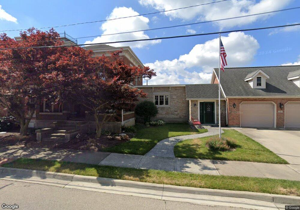
8333 N Mulberry Grv Rake Rd Covington, OH 45318
Estimated Value: $301,000 - $467,285
2
Beds
2
Baths
2,299
Sq Ft
$162/Sq Ft
Est. Value
About This Home
This home is located at 8333 N Mulberry Grv Rake Rd, Covington, OH 45318 and is currently estimated at $373,571, approximately $162 per square foot. 8333 N Mulberry Grv Rake Rd is a home located in Miami County with nearby schools including Covington Elementary/Junior High School, Covington Junior High School, and Covington High School.
Ownership History
Date
Name
Owned For
Owner Type
Purchase Details
Closed on
Jun 19, 2000
Sold by
Williamson Frances K
Bought by
Grissom Scott D and Grissom Carol A
Current Estimated Value
Purchase Details
Closed on
Jul 1, 1987
Bought by
Williamson Joseph H
Create a Home Valuation Report for This Property
The Home Valuation Report is an in-depth analysis detailing your home's value as well as a comparison with similar homes in the area
Home Values in the Area
Average Home Value in this Area
Purchase History
| Date | Buyer | Sale Price | Title Company |
|---|---|---|---|
| Grissom Scott D | $143,000 | -- | |
| Williamson Joseph H | $18,500 | -- |
Source: Public Records
Mortgage History
| Date | Status | Borrower | Loan Amount |
|---|---|---|---|
| Closed | Grissom Scott D | $0 |
Source: Public Records
Tax History Compared to Growth
Tax History
| Year | Tax Paid | Tax Assessment Tax Assessment Total Assessment is a certain percentage of the fair market value that is determined by local assessors to be the total taxable value of land and additions on the property. | Land | Improvement |
|---|---|---|---|---|
| 2024 | $4,171 | $124,050 | $26,640 | $97,410 |
| 2023 | $4,171 | $119,040 | $26,640 | $92,400 |
| 2022 | $4,052 | $119,040 | $26,640 | $92,400 |
| 2021 | $3,248 | $89,850 | $20,480 | $69,370 |
| 2020 | $3,283 | $89,850 | $20,480 | $69,370 |
| 2019 | $3,274 | $89,850 | $20,480 | $69,370 |
| 2018 | $2,808 | $78,330 | $17,570 | $60,760 |
| 2017 | $2,864 | $78,330 | $17,570 | $60,760 |
| 2016 | $2,751 | $78,330 | $17,570 | $60,760 |
| 2015 | $2,262 | $64,260 | $16,590 | $47,670 |
| 2014 | $2,262 | $64,260 | $16,590 | $47,670 |
| 2013 | $2,274 | $64,260 | $16,590 | $47,670 |
Source: Public Records
Map
Nearby Homes
- 6110 Ohio 185
- 5882 W Versailles Rd
- 7648 Piqua-Clayton Rd
- 4528 W State Route 185
- 4510 W State Route 185
- 513 Spotted Doe Trail
- 8490 Bennett Dr
- 731 N Pearl St
- 520 N Pearl St
- 1821 Wilshire Dr
- 698 E Broadway St
- 0 Robert M Davis Pkwy
- 501 N Main St Unit C1
- 1337 Stratford Dr
- 271 N Ludlow St
- 1708 Dubois Dr
- 3 Lake Ridge Dr
- 133 W Broadway St
- 1616 Echo Lake Dr
- 124 N Main St
- 7335 Rakestraw Rd
- 8285 Rakestraw Rd
- 6336 W State Route 185
- 8501 Mulberry Grove Rakestr Rd
- 8501 Mulberry Grove Rakestr Rd
- 6564 W State Route 185
- 6222 W State Route 185
- 6222 Ohio 185
- 6154 W State Route 185
- 6154 Ohio 185
- 8058 Mulberry Grove Rakestraw Rd N
- 8605 Mulberry Grove Rakestr Rd
- 8058 Mulberry Grove-Rakestraw Rd
- 8015 Rakestraw Rd
- 8015 Rakestraw Rd
- 8015 Rakestraw Rd
- 8015 Rakestraw Rd
- 6100 W State Route 185
- 8026 N Mulberry Grv Rake Rd
- 6072 W State Route 185