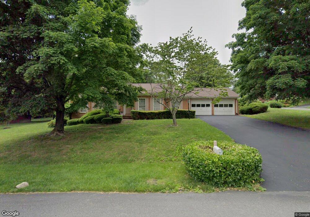
8334 Webster Dr Roanoke, VA 24019
Estimated Value: $322,000 - $403,000
3
Beds
2
Baths
1,933
Sq Ft
$188/Sq Ft
Est. Value
About This Home
This home is located at 8334 Webster Dr, Roanoke, VA 24019 and is currently estimated at $364,192, approximately $188 per square foot. 8334 Webster Dr is a home located in Roanoke County with nearby schools including Burlington Elementary School, Northside Middle School, and Northside High School.
Ownership History
Date
Name
Owned For
Owner Type
Purchase Details
Closed on
Sep 5, 2018
Sold by
Sanders Irma D
Bought by
Sanders Irma D and Sanders Nefertiti Shanice
Current Estimated Value
Home Financials for this Owner
Home Financials are based on the most recent Mortgage that was taken out on this home.
Original Mortgage
$219,000
Outstanding Balance
$193,067
Interest Rate
5.12%
Mortgage Type
New Conventional
Estimated Equity
$171,125
Purchase Details
Closed on
Apr 26, 2005
Sold by
Caldwell Hugh E
Bought by
Sanders Irma D
Home Financials for this Owner
Home Financials are based on the most recent Mortgage that was taken out on this home.
Original Mortgage
$43,800
Interest Rate
6.05%
Mortgage Type
Stand Alone Second
Create a Home Valuation Report for This Property
The Home Valuation Report is an in-depth analysis detailing your home's value as well as a comparison with similar homes in the area
Purchase History
| Date | Buyer | Sale Price | Title Company |
|---|---|---|---|
| Sanders Irma D | -- | Mortgage Connect Lp | |
| Sanders Irma D | $219,000 | None Available |
Source: Public Records
Mortgage History
| Date | Status | Borrower | Loan Amount |
|---|---|---|---|
| Open | Sanders Irma D | $219,000 | |
| Closed | Sanders Irma D | $43,800 | |
| Closed | Sanders Irma D | $175,200 |
Source: Public Records
Tax History
| Year | Tax Paid | Tax Assessment Tax Assessment Total Assessment is a certain percentage of the fair market value that is determined by local assessors to be the total taxable value of land and additions on the property. | Land | Improvement |
|---|---|---|---|---|
| 2025 | $3,391 | $329,200 | $65,000 | $264,200 |
| 2024 | $3,095 | $297,600 | $65,000 | $232,600 |
| 2023 | $2,918 | $275,300 | $60,000 | $215,300 |
| 2022 | $2,753 | $252,600 | $55,000 | $197,600 |
| 2021 | $2,540 | $233,000 | $50,000 | $183,000 |
| 2020 | $2,521 | $231,300 | $50,000 | $181,300 |
| 2019 | $2,457 | $225,400 | $42,000 | $183,400 |
| 2018 | $2,381 | $221,400 | $42,000 | $179,400 |
| 2017 | $2,381 | $218,400 | $42,000 | $176,400 |
| 2016 | $2,332 | $213,900 | $42,000 | $171,900 |
| 2015 | $2,279 | $209,100 | $45,000 | $164,100 |
| 2014 | $2,225 | $204,100 | $40,000 | $164,100 |
Source: Public Records
Map
Nearby Homes
- 8355 Leighburn Dr
- 5873 Buckland Mill Rd
- 7951 Barrens Rd
- 0 Tinkerdale Rd
- 7937 Enon Dr
- 6510 Brookfield Rd
- 7522 New Barrens Ct
- 8286 Cardington Dr
- 7923 Carriage Park Dr
- 7226 Scarlet Oak Dr
- 210 Post Rd
- 7191 Scarlet Oak Dr
- 6849 Woodcreeper Dr
- 6673 Jojo Ln
- 6663 Jojo Ln
- 6653 Jojo Ln
- 6633 Jojo Ln
- 6623 Jojo Ln
- 7372 Chester Dr
- 7043 Northway Dr
- 6017 Buckland Mill Rd
- 8326 Webster Dr
- 6011 Buckland Mill Rd
- 8335 Webster Dr
- 8327 Webster Dr
- 6022 Buckland Mill Rd
- 6028 Buckland Mill Rd
- 8318 Webster Dr
- 7008 Irondale Cir
- 6016 Buckland Mill Rd
- 6007 Buckland Mill Rd
- 6104 Buckland Mill Rd
- 7014 Irondale Cir
- 8319 Webster Dr
- 6008 Buckland Mill Rd
- 6112 Buckland Mill Rd
- 6121 Buckland Mill Rd
- 7022 Irondale Cir
- 8312 Webster Dr
- 6000 Buckland Mill Rd
Your Personal Tour Guide
Ask me questions while you tour the home.