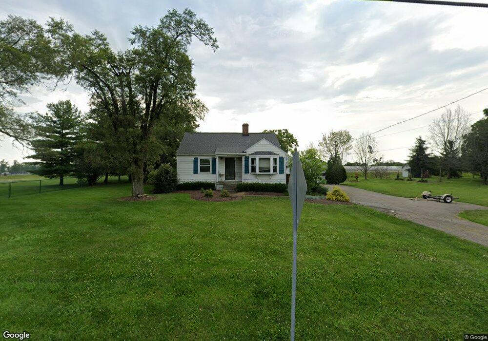
8339 Snider Rd Mason, OH 45040
Deerfield Township NeighborhoodEstimated Value: $224,923 - $297,000
2
Beds
1
Bath
880
Sq Ft
$299/Sq Ft
Est. Value
About This Home
This home is located at 8339 Snider Rd, Mason, OH 45040 and is currently estimated at $262,981, approximately $298 per square foot. 8339 Snider Rd is a home located in Warren County with nearby schools including Mason Intermediate Elementary School, Mason Middle School, and William Mason High School.
Ownership History
Date
Name
Owned For
Owner Type
Purchase Details
Closed on
Apr 22, 2008
Sold by
Langford Jim Paul and Richardson Vicki Lynn
Bought by
The Wm A Natorp Co
Current Estimated Value
Purchase Details
Closed on
Sep 7, 2006
Sold by
Langford Jim Paul
Bought by
Langford Jim Paul and Richardson Vicki Lynn
Purchase Details
Closed on
Feb 29, 1988
Sold by
Langford James P and Langford Faye
Bought by
Langford and Jim Paul
Purchase Details
Closed on
May 25, 1979
Sold by
Langford Langford and Langford Clemerance
Create a Home Valuation Report for This Property
The Home Valuation Report is an in-depth analysis detailing your home's value as well as a comparison with similar homes in the area
Home Values in the Area
Average Home Value in this Area
Purchase History
| Date | Buyer | Sale Price | Title Company |
|---|---|---|---|
| The Wm A Natorp Co | $175,000 | Multi State Title Agency Ltd | |
| Langford Jim Paul | -- | None Available | |
| Langford | -- | -- | |
| -- | $40,000 | -- |
Source: Public Records
Tax History Compared to Growth
Tax History
| Year | Tax Paid | Tax Assessment Tax Assessment Total Assessment is a certain percentage of the fair market value that is determined by local assessors to be the total taxable value of land and additions on the property. | Land | Improvement |
|---|---|---|---|---|
| 2024 | $2,159 | $49,580 | $19,390 | $30,190 |
| 2023 | $2,087 | $40,208 | $12,551 | $27,657 |
| 2022 | $2,087 | $40,208 | $12,551 | $27,657 |
| 2021 | $1,984 | $40,208 | $12,551 | $27,657 |
| 2020 | $1,904 | $32,687 | $10,203 | $22,484 |
| 2019 | $1,767 | $32,687 | $10,203 | $22,484 |
| 2018 | $1,774 | $32,687 | $10,203 | $22,484 |
| 2017 | $1,644 | $27,934 | $7,067 | $20,867 |
| 2016 | $1,691 | $27,934 | $7,067 | $20,867 |
| 2015 | $1,623 | $27,934 | $7,067 | $20,867 |
| 2014 | $1,623 | $24,720 | $6,250 | $18,470 |
| 2013 | $1,627 | $29,570 | $7,480 | $22,090 |
Source: Public Records
Map
Nearby Homes
- 8421 Cameron Ct
- 5754 Trailside Ct
- 8659 Coveview Ct
- 5661 Baywatch Way
- 5626 Baywatch Way
- 7911 Meadowbrook Dr
- 7839 Meadowbrook Dr
- 5532 Winding Cape Way
- 5369 N Shore Place
- 8881 Suncrest Ln
- 7725 Livingston Dr
- 5398 Harbourwatch Way
- 8900 Suncrest Ln
- 8851 Suncrest Ln
- 8905 Suncrest Ln
- Winslow Plan at Losh Landing - Masterpiece Collection
- Paxton Plan at Losh Landing - Masterpiece Collection
- Huxley Plan at Losh Landing - Masterpiece Collection
- Pearson Plan at Losh Landing - Masterpiece Collection
- Beckett Plan at Losh Landing - Masterpiece Collection
- 8301 Snider Rd
- 8302 Snider Rd
- 8253 Snider Rd
- 8276 Snider Rd
- 8260 Snider Rd
- 5908 Stone Trace Dr
- 5907 Stone Trace Dr
- 5906 Stone Trace Dr
- 5901 Stone Trace Dr
- 5895 Windwood Ct
- 5902 Stone Trace Dr
- 5889 Windwood Ct
- 5931 Socialville Foster Rd
- 5894 Windwood Ct
- 5893 Stone Trace Dr
- 5894 Stone Trace Dr
- 5982 Socialville Foster Rd
- 5885 Stone Trace Dr
- 5881 Windwood Ct
- 5892 Windwood Ct