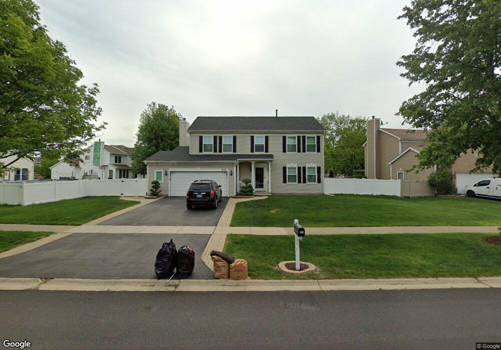
834 Dalton Ln Bolingbrook, IL 60490
Sunset Park-Old Plank NeighborhoodEstimated Value: $425,452 - $479,000
Studio
1
Bath
2,108
Sq Ft
$217/Sq Ft
Est. Value
About This Home
This home is located at 834 Dalton Ln, Bolingbrook, IL 60490 and is currently estimated at $457,113, approximately $216 per square foot. 834 Dalton Ln is a home located in Will County with nearby schools including Liberty Elementary School, John F Kennedy Middle School, and Plainfield East High School.
Ownership History
Date
Name
Owned For
Owner Type
Purchase Details
Closed on
Aug 28, 2002
Sold by
Piotrowski Jeffrey L and Piotrowski Christina
Bought by
Mcelroy Elijah and Mcelroy Rosemarie
Current Estimated Value
Home Financials for this Owner
Home Financials are based on the most recent Mortgage that was taken out on this home.
Original Mortgage
$187,200
Outstanding Balance
$79,055
Interest Rate
6.39%
Estimated Equity
$378,058
Purchase Details
Closed on
Oct 1, 1999
Sold by
The Ryland Group Inc
Bought by
Piotrowski Jeffrey L and Piotrowski Christina
Home Financials for this Owner
Home Financials are based on the most recent Mortgage that was taken out on this home.
Original Mortgage
$165,050
Interest Rate
7.87%
Create a Home Valuation Report for This Property
The Home Valuation Report is an in-depth analysis detailing your home's value as well as a comparison with similar homes in the area
Home Values in the Area
Average Home Value in this Area
Purchase History
| Date | Buyer | Sale Price | Title Company |
|---|---|---|---|
| Mcelroy Elijah | $234,000 | Law Title | |
| Piotrowski Jeffrey L | $190,500 | -- |
Source: Public Records
Mortgage History
| Date | Status | Borrower | Loan Amount |
|---|---|---|---|
| Open | Mcelroy Elijah | $187,200 | |
| Previous Owner | Piotrowski Jeffrey L | $165,050 |
Source: Public Records
Tax History
| Year | Tax Paid | Tax Assessment Tax Assessment Total Assessment is a certain percentage of the fair market value that is determined by local assessors to be the total taxable value of land and additions on the property. | Land | Improvement |
|---|---|---|---|---|
| 2024 | $8,812 | $134,921 | $20,056 | $114,865 |
| 2023 | $8,812 | $121,398 | $18,046 | $103,352 |
| 2022 | $8,388 | $109,446 | $16,269 | $93,177 |
| 2021 | $7,915 | $102,334 | $15,212 | $87,122 |
| 2020 | $7,740 | $98,969 | $14,712 | $84,257 |
| 2019 | $7,535 | $94,256 | $14,011 | $80,245 |
| 2018 | $7,290 | $90,214 | $13,410 | $76,804 |
| 2017 | $7,114 | $85,511 | $12,711 | $72,800 |
| 2016 | $7,019 | $81,400 | $12,100 | $69,300 |
| 2015 | $6,576 | $78,100 | $11,600 | $66,500 |
| 2014 | $6,576 | $73,600 | $10,900 | $62,700 |
| 2013 | $6,576 | $70,500 | $10,500 | $60,000 |
Source: Public Records
Map
Nearby Homes
- 1445 Somerfield Dr
- 1404 Waterside Dr
- 803 Lenox Ave
- 1582 Arlington St
- 725 Delacourte Ave
- 1568 Woodland Ln
- 402 Marshall Ash St Unit 3
- 402 S Palmer Dr Unit 2B
- 1472 Misty Ln Unit 2B
- 452 Pheasant Chase Dr
- 1156 Partridge Ave
- 1963 Norwich Ln
- 301 Inner Circle Dr
- 1404 Lily Cache Ln
- 13 Callery Ct
- 329 Chick Evans St
- 309 Blackfoot Dr
- 310 Chick Evans St
- 1290 W Normantown Rd
- 305 Chick Evans St
- 838 Dalton Ln
- 1464 Waterside Dr
- 1460 Waterside Dr
- 1 Scarlet Ct
- 1456 Waterside Dr
- 1452 Waterside Dr
- 2 Scarlet Ct
- 1448 Waterside Dr
- 1465 Waterside Dr Unit 1
- 3 Scarlet Ct
- 1457 Waterside Dr
- 846 Dalton Ln
- 1469 Waterside Dr
- 1444 Waterside Dr
- 1473 Waterside Dr
- 1449 Waterside Dr
- 1477 Waterside Dr Unit 3
- 1525 Scarlet Dr
- 7 Scarlet Ct
- 4 Scarlet Ct
Your Personal Tour Guide
Ask me questions while you tour the home.