
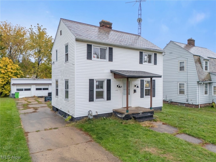
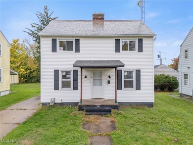
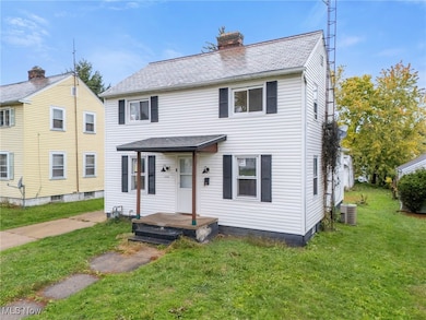
834 Devine St Alliance, OH 44601
Estimated payment $778/month
Total Views
139,226
3
Beds
1.5
Baths
1,079
Sq Ft
$120
Price per Sq Ft
Highlights
- Colonial Architecture
- 1 Fireplace
- 2.5 Car Detached Garage
- Deck
- No HOA
- Forced Air Heating and Cooling System
About This Home
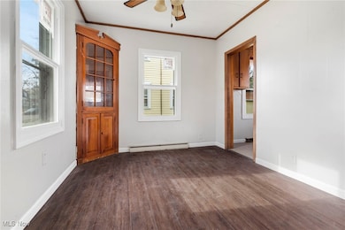
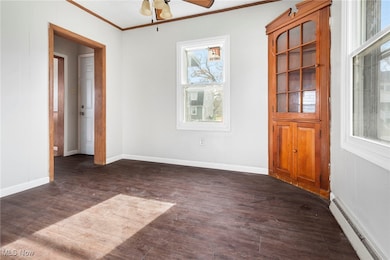
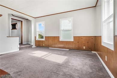
Move right in! This freshly updated 3-bedroom, 1.5-bath home is neat, bright, and ready for its next owner. Recent improvements include fresh paint throughout, new carpet in the upstairs bedrooms, new vinyl insulated windows, and a hot water heater replaced in 2024, offering comfort and efficiency. The spacious layout feels warm and welcoming, with plenty of potential to make it your own. Outside, you’ll love the oversized 2.5-car detached garage, perfect for a workshop, storage, or your dream man cave. Clean, move-in ready, and conveniently located—this home is a great find!
Listing Agent
Tarter Realty Brokerage Email: TarterRealty@aol.com, 330-221-3585 License #2008001912 Listed on: 10/31/2025
Home Details
Home Type
- Single Family
Est. Annual Taxes
- $952
Year Built
- Built in 1919
Parking
- 2.5 Car Detached Garage
Home Design
- Colonial Architecture
- Slate Roof
- Vinyl Siding
Interior Spaces
- 1,079 Sq Ft Home
- 2-Story Property
- 1 Fireplace
- Insulated Windows
- Basement Fills Entire Space Under The House
Bedrooms and Bathrooms
- 3 Bedrooms | 1 Main Level Bedroom
- 1.5 Bathrooms
Utilities
- Forced Air Heating and Cooling System
- Heating System Uses Gas
Additional Features
- Deck
- 5,807 Sq Ft Lot
Community Details
- No Home Owners Association
- Alliance Subdivision
Listing and Financial Details
- Assessor Parcel Number 00102155
Map
Create a Home Valuation Report for This Property
The Home Valuation Report is an in-depth analysis detailing your home's value as well as a comparison with similar homes in the area
Home Values in the Area
Average Home Value in this Area
Tax History
| Year | Tax Paid | Tax Assessment Tax Assessment Total Assessment is a certain percentage of the fair market value that is determined by local assessors to be the total taxable value of land and additions on the property. | Land | Improvement |
|---|---|---|---|---|
| 2025 | -- | $24,990 | $5,110 | $19,880 |
| 2024 | -- | $24,990 | $5,110 | $19,880 |
| 2023 | $703 | $17,500 | $4,900 | $12,600 |
| 2022 | $708 | $17,500 | $4,900 | $12,600 |
| 2021 | $709 | $17,500 | $4,900 | $12,600 |
| 2020 | $630 | $14,530 | $4,270 | $10,260 |
| 2019 | $621 | $14,530 | $4,270 | $10,260 |
| 2018 | $624 | $14,530 | $4,270 | $10,260 |
| 2017 | $550 | $12,610 | $3,570 | $9,040 |
| 2016 | $555 | $12,610 | $3,570 | $9,040 |
| 2015 | $731 | $15,690 | $3,610 | $12,080 |
| 2014 | $670 | $14,360 | $3,290 | $11,070 |
| 2013 | $334 | $14,360 | $3,290 | $11,070 |
Source: Public Records
Property History
| Date | Event | Price | List to Sale | Price per Sq Ft |
|---|---|---|---|---|
| 04/02/2026 04/02/26 | Pending | -- | -- | -- |
| 10/31/2025 10/31/25 | For Sale | $129,900 | -- | $120 / Sq Ft |
Source: MLS Now
Purchase History
| Date | Type | Sale Price | Title Company |
|---|---|---|---|
| Administrators Deed | $59,000 | -- |
Source: Public Records
Mortgage History
| Date | Status | Loan Amount | Loan Type |
|---|---|---|---|
| Closed | $53,100 | Purchase Money Mortgage |
Source: Public Records
About the Listing Agent
As the daughter of George and Vera Tarter, I grew up in real estate and had incredible mentors to learn from. I earned my real estate license in 1986 after graduating from Southeast High School, and later completed my bachelor’s degree in finance and real estate from Kent State University. I worked full-time alongside my parents for 25 years serving buyers and sellers across Portage, Stark, Summit, and surrounding counties.
In 2008, I became a licensed real estate broker and proudly took
Shirley's Other Listings
Source: MLS Now
MLS Number: 5167359
APN: 00102155
Disclaimer: Certain information contained herein is derived from information provided by parties other than Homes.com. All information provided is deemed reliable, but is not guaranteed to be accurate and should be independently verified.
![]() IDX information is provided exclusively for personal, non-commercial use, and may not be used for any purpose other than to identify prospective properties consumers may be interested in purchasing. Information is deemed reliable but not guaranteed.
IDX information is provided exclusively for personal, non-commercial use, and may not be used for any purpose other than to identify prospective properties consumers may be interested in purchasing. Information is deemed reliable but not guaranteed.
Nearby Homes
- 1511 Grace St
- 1522 Wade Ave
- 1350 S Freedom Ave
- 1841 S Freedom Ave
- 935 S Morgan Ave
- 225 Shadyside Ct
- 167 11th St
- 231 Rosenberry St
- 134 11th St
- 234 Rosenberry St
- 955 E Summit St
- 152 E Mill St
- 452 E Summit St
- 22862 Norman Ave
- 726 S Arch Ave
- 2464 S Freedom Ave
- 46 Rosenberry St
- 853 Fairway Dr
- 442 S Liberty Ave
- 807 S Union Ave
Your Personal Tour Guide
Ask me questions while you tour the home.