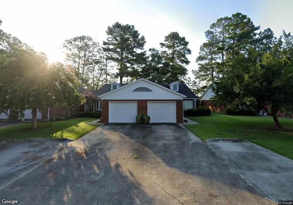
834 Saint Marys Dr Waycross, GA 31501
Estimated Value: $171,417 - $207,000
3
Beds
3
Baths
1,544
Sq Ft
$124/Sq Ft
Est. Value
About This Home
This home is located at 834 Saint Marys Dr, Waycross, GA 31501 and is currently estimated at $191,604, approximately $124 per square foot. 834 Saint Marys Dr is a home located in Ware County with nearby schools including Williams Heights Elementary School, Waycross Middle School, and Ware County High School.
Ownership History
Date
Name
Owned For
Owner Type
Purchase Details
Closed on
Aug 24, 2005
Sold by
Mauch Alys Dawn
Bought by
Sapp Lowell H and Sapp Fern Deen
Current Estimated Value
Purchase Details
Closed on
May 30, 2002
Sold by
Mauch Ayls
Bought by
Midyette Marlianne
Purchase Details
Closed on
Jun 21, 1996
Sold by
Bradshaw Rebecca W
Bought by
Mauch Ayls
Purchase Details
Closed on
Jan 13, 1993
Bought by
Bradshaw Rebecca W
Purchase Details
Closed on
Mar 28, 1985
Create a Home Valuation Report for This Property
The Home Valuation Report is an in-depth analysis detailing your home's value as well as a comparison with similar homes in the area
Home Values in the Area
Average Home Value in this Area
Purchase History
| Date | Buyer | Sale Price | Title Company |
|---|---|---|---|
| Sapp Lowell H | $103,000 | -- | |
| Midyette Marlianne | -- | -- | |
| Mauch Ayls | $67,500 | -- | |
| Bradshaw Rebecca W | $68,000 | -- | |
| -- | $66,000 | -- |
Source: Public Records
Tax History Compared to Growth
Tax History
| Year | Tax Paid | Tax Assessment Tax Assessment Total Assessment is a certain percentage of the fair market value that is determined by local assessors to be the total taxable value of land and additions on the property. | Land | Improvement |
|---|---|---|---|---|
| 2024 | $827 | $61,548 | $7,200 | $54,348 |
| 2023 | $844 | $53,282 | $2,616 | $50,666 |
| 2022 | $958 | $53,282 | $2,616 | $50,666 |
| 2021 | $970 | $51,461 | $2,616 | $48,845 |
| 2020 | $978 | $49,018 | $2,616 | $46,402 |
| 2019 | $991 | $45,355 | $2,616 | $42,739 |
| 2018 | $1,891 | $43,829 | $2,616 | $41,213 |
| 2017 | $1,911 | $43,829 | $2,616 | $41,213 |
| 2016 | $1,911 | $43,829 | $2,616 | $41,213 |
| 2015 | $1,924 | $43,828 | $2,616 | $41,213 |
| 2014 | $1,922 | $43,829 | $2,616 | $41,213 |
| 2013 | -- | $46,404 | $2,616 | $43,788 |
Source: Public Records
Map
Nearby Homes
- 713 Magnolia Dr
- 903 Atlantic Ave
- 808 Satilla Blvd
- 1100 Atlantic Ave
- 506 Magnolia Dr
- 1101 Cherokee Dr
- 0 Saint Marys Dr Unit (TRACT 2 0.25 ACRES)
- 511 Richmond Ave
- 7438 Central Ave
- 1205 Dean Dr
- 707 Euclid Ave
- 907 Euclid Ave
- 0 Goodwin St
- 1002 Baltimore Ave
- 1009 Euclid Ave
- 1100 Euclid Ave
- 1204 Richmond Ave
- 807 City Blvd
- 1001 Coral Rd
- 807 College St
- 836 Saint Marys Dr
- 830 Saint Marys Dr
- 838 Saint Marys Dr
- 828 Saint Marys Dr
- 828 St Marys Dr
- 840 Saint Marys Dr
- 826 Saint Marys Dr
- 842 Saint Marys Dr
- 824 Saint Marys Dr
- 844 Saint Marys Dr
- 822 Saint Marys Dr
- 820 Saint Marys Dr
- 820 St Mary's Dr
- 816 Saint Marys Dr
- 901 Saint Marys Dr
- 814 Saint Marys Dr
- 834 St Mary's Dr
- 812 Saint Marys Dr
- 809 Saint Marys Dr
- 800 Atlantic Ave