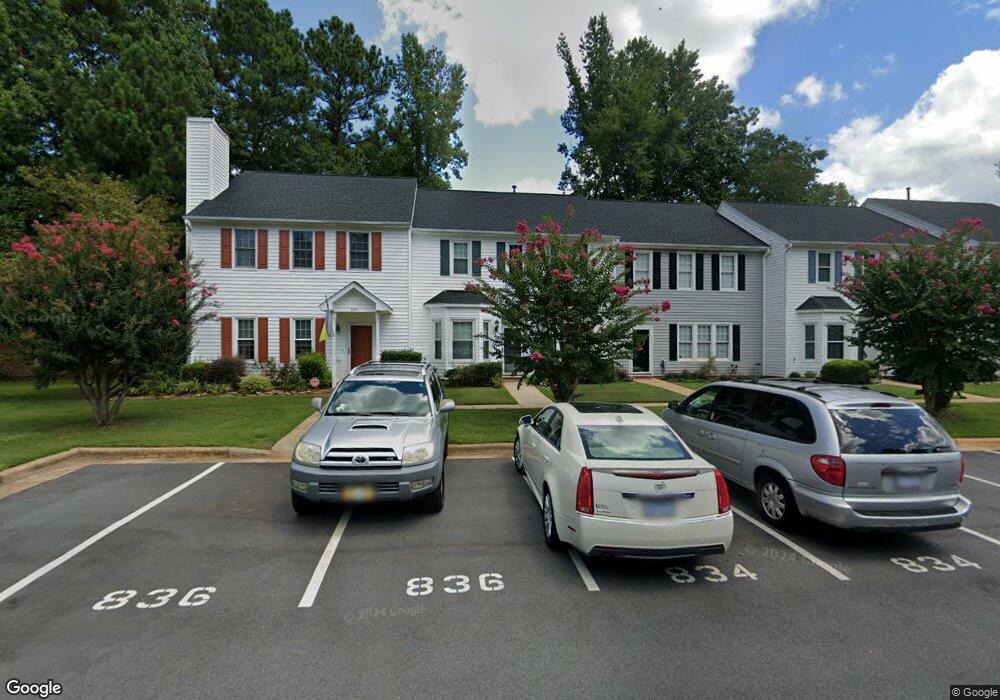
834 St Catherines Dr Wake Forest, NC 27587
Estimated Value: $280,000 - $325,000
3
Beds
3
Baths
1,752
Sq Ft
$175/Sq Ft
Est. Value
About This Home
This home is located at 834 St Catherines Dr, Wake Forest, NC 27587 and is currently estimated at $306,365, approximately $174 per square foot. 834 St Catherines Dr is a home located in Wake County with nearby schools including Richland Creek Elementary School, Wake Forest-Rolesville Middle School, and Wake Forest High School.
Ownership History
Date
Name
Owned For
Owner Type
Purchase Details
Closed on
Nov 13, 2005
Sold by
Houp Kathleen A
Bought by
Nicholson Wilbur and Nicholson Virginia
Current Estimated Value
Purchase Details
Closed on
Aug 29, 2001
Sold by
Brown Bill and Brown Kathy
Bought by
Houp Kathleen A
Home Financials for this Owner
Home Financials are based on the most recent Mortgage that was taken out on this home.
Original Mortgage
$95,150
Interest Rate
7.08%
Mortgage Type
Balloon
Create a Home Valuation Report for This Property
The Home Valuation Report is an in-depth analysis detailing your home's value as well as a comparison with similar homes in the area
Home Values in the Area
Average Home Value in this Area
Purchase History
| Date | Buyer | Sale Price | Title Company |
|---|---|---|---|
| Nicholson Wilbur | $135,000 | None Available | |
| Houp Kathleen A | $127,000 | -- |
Source: Public Records
Mortgage History
| Date | Status | Borrower | Loan Amount |
|---|---|---|---|
| Previous Owner | Houp Kathleen A | $95,150 |
Source: Public Records
Tax History Compared to Growth
Tax History
| Year | Tax Paid | Tax Assessment Tax Assessment Total Assessment is a certain percentage of the fair market value that is determined by local assessors to be the total taxable value of land and additions on the property. | Land | Improvement |
|---|---|---|---|---|
| 2025 | $3,037 | $309,072 | $40,000 | $269,072 |
| 2024 | $2,949 | $309,072 | $40,000 | $269,072 |
| 2023 | $2,163 | $184,457 | $26,000 | $158,457 |
| 2022 | $2,076 | $184,457 | $26,000 | $158,457 |
| 2021 | $2,040 | $184,457 | $26,000 | $158,457 |
| 2020 | $2,040 | $184,457 | $26,000 | $158,457 |
| 2019 | $1,637 | $130,332 | $16,000 | $114,332 |
| 2018 | $1,551 | $130,332 | $16,000 | $114,332 |
| 2017 | $1,499 | $130,332 | $16,000 | $114,332 |
| 2016 | $1,480 | $130,332 | $16,000 | $114,332 |
| 2015 | $1,604 | $139,661 | $24,000 | $115,661 |
| 2014 | $1,553 | $139,661 | $24,000 | $115,661 |
Source: Public Records
Map
Nearby Homes
- 719 Saint Catherines Dr
- 713 Saint Catherines Dr
- 647 Guinness Place
- 930 Saint Catherines Dr
- 321 Glencoe Dr Unit B
- 333 Natsam Woods Way
- 335 Spaight Acres Way
- 361 Natsam Woods Way
- 404 Shannonford Ct
- 372 Natsam Woods Way
- 995 Saint Catherines Dr
- 738 Cormiche Ln
- 317 Devon Dr
- 317 Devon Cliffs Dr
- 321 Devon Cliffs Dr
- 601 Gimari Dr
- 777 Cormiche Ln
- 781 Cormiche Ln
- 521 Brushford Ln
- 411 W Oak Ave
- 834 Saint Catherines Dr
- 836 Saint Catherines Dr
- 836 St Catherines Dr
- 832 Saint Catherines Dr
- 830 Saint Catherines Dr
- 828 St Catherines Dr
- 828 Saint Catherines Dr
- 842 Saint Catherines Dr
- 844 Saint Catherines Dr
- 844 St Catherines Dr
- 822 St Catherines Dr
- 822 Saint Catherines Dr
- 846 Saint Catherines Dr
- 800 Saint Catherines Dr
- 846 St Catherines Dr
- 820 St Catherines Dr
- 820 Saint Catherines Dr
- 848 Saint Catherines Dr
- 818 St Catherines Dr
- 818 Saint Catherines Dr