Estimated Value: $543,000 - $651,000
4
Beds
4
Baths
2,685
Sq Ft
$218/Sq Ft
Est. Value
About This Home
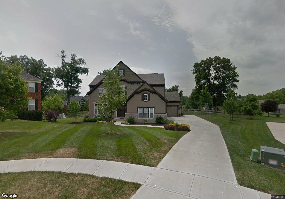
This home is located at 834 Tim Tam Ct, Union, KY 41091 and is currently estimated at $586,141, approximately $218 per square foot. 834 Tim Tam Ct is a home located in Boone County with nearby schools including Shirley Mann Elementary School, Gray Middle School, and Larry A. Ryle High School.
Ownership History
Date
Name
Owned For
Owner Type
Purchase Details
Closed on
May 14, 2015
Sold by
Kushmaul Chris A and Kushmaul Amy J
Bought by
Brophy Emily K
Current Estimated Value
Home Financials for this Owner
Home Financials are based on the most recent Mortgage that was taken out on this home.
Original Mortgage
$302,100
Outstanding Balance
$231,975
Interest Rate
3.75%
Mortgage Type
New Conventional
Estimated Equity
$354,166
Purchase Details
Closed on
Nov 11, 2010
Sold by
Fischer Single Family Homes Ii L L C
Bought by
Kushmaul Chris A and Kushmaul Amy J
Home Financials for this Owner
Home Financials are based on the most recent Mortgage that was taken out on this home.
Original Mortgage
$262,615
Interest Rate
4.2%
Mortgage Type
New Conventional
Purchase Details
Closed on
Aug 13, 2010
Sold by
Triple Crown Developers Llc
Bought by
Fischer Single Family Homes Ii Llc
Create a Home Valuation Report for This Property
The Home Valuation Report is an in-depth analysis detailing your home's value as well as a comparison with similar homes in the area
Home Values in the Area
Average Home Value in this Area
Purchase History
| Date | Buyer | Sale Price | Title Company |
|---|---|---|---|
| Brophy Emily K | $318,000 | 360 American Title Svcs Llc | |
| Kushmaul Chris A | $328,269 | Homestead Title Agency Ltd | |
| Fischer Single Family Homes Ii Llc | $54,000 | None Available |
Source: Public Records
Mortgage History
| Date | Status | Borrower | Loan Amount |
|---|---|---|---|
| Open | Brophy Emily K | $302,100 | |
| Previous Owner | Kushmaul Chris A | $262,615 |
Source: Public Records
Tax History
| Year | Tax Paid | Tax Assessment Tax Assessment Total Assessment is a certain percentage of the fair market value that is determined by local assessors to be the total taxable value of land and additions on the property. | Land | Improvement |
|---|---|---|---|---|
| 2025 | $5,032 | $443,600 | $80,000 | $363,600 |
| 2024 | $4,010 | $358,200 | $60,000 | $298,200 |
| 2023 | $4,076 | $358,200 | $60,000 | $298,200 |
| 2022 | $4,022 | $358,200 | $60,000 | $298,200 |
| 2021 | $4,105 | $358,200 | $60,000 | $298,200 |
| 2020 | $3,640 | $318,000 | $58,800 | $259,200 |
| 2019 | $3,683 | $318,000 | $58,800 | $259,200 |
| 2018 | $3,703 | $318,000 | $58,800 | $259,200 |
| 2017 | $3,628 | $318,000 | $58,800 | $259,200 |
| 2015 | $3,700 | $328,270 | $58,800 | $269,470 |
| 2013 | -- | $328,270 | $58,800 | $269,470 |
Source: Public Records
Map
Nearby Homes
- 1096 Whirlaway Dr
- 1068 Charley Ct
- 10730 Stone St
- 1049 Swale Ct
- 909 Riva Ridge Ln
- 6813 Green Isle Ln
- 10802 Doral Ct
- 928 Dustwhirl Dr
- 1095 Bold Forbes Ct
- 10803 Muirfield Ct
- 10878 Saint Andrews Dr
- 1316 Oxley Ct
- 10759 Crown Pointe Dr
- 10771 Crown Pointe Dr
- 809 Hancock Ct
- 1152 Monarchos Ridge
- 854 Hancock Ct
- 10826 Omaha Trace
- 631 Coaltown Ct
- 701 Keeneland Green Dr
- 835 Tim Tam Ct
- 830 Tim Tam Ct
- 830 Tim Tam Ct Unit 56
- 10880 Eddie Ct
- 10831 Arcaro Ln
- 10882 War Admiral Dr
- 831 Tim Tam Ct
- 10891 Eddie Ct
- 10886 Eddie Ct
- 10888 War Admiral Dr
- 10827 Arcaro Ln
- 10843 Arcaro Ln
- 10892 Eddie Ct
- 10888 Eddie Ct
- 10838 Arcaro Ln
- 10878 War Admiral Dr
- 10870 War Admiral Dr
- 10894 War Admiral Dr
- 10899 Eddie Ct
- 10830 Arcaro Ln
Your Personal Tour Guide
Ask me questions while you tour the home.