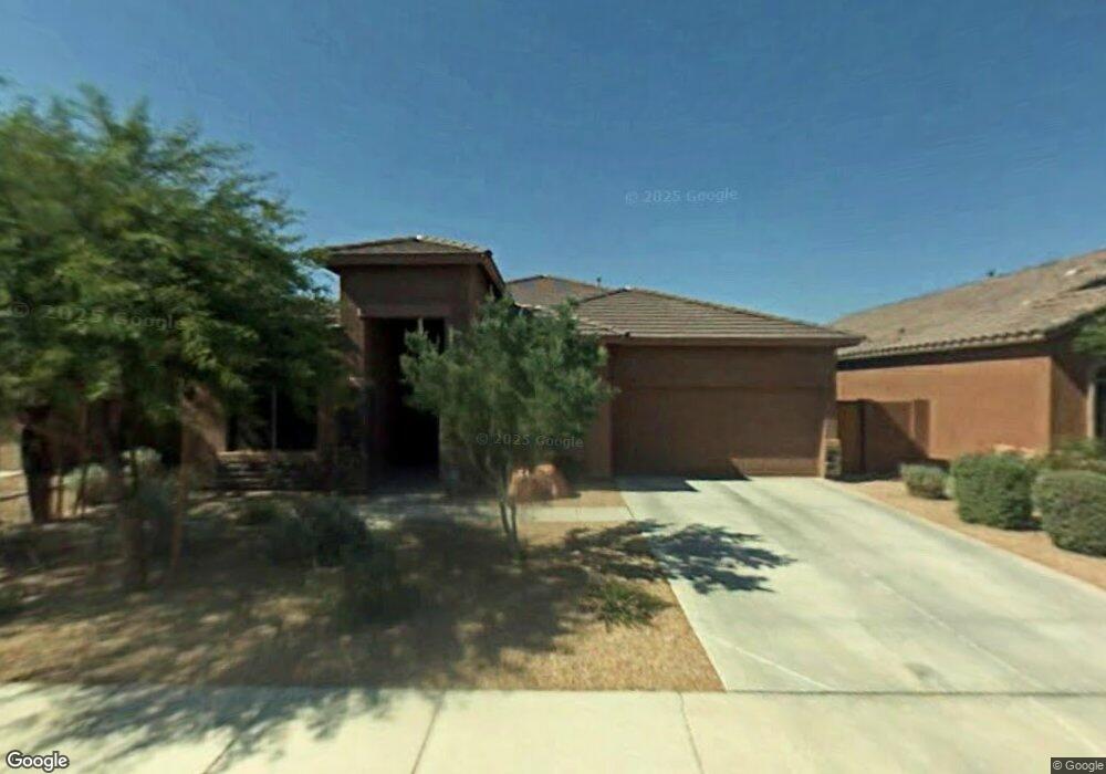
8344 W Maya Dr Peoria, AZ 85383
Estimated Value: $476,334 - $575,000
--
Bed
3
Baths
2,147
Sq Ft
$247/Sq Ft
Est. Value
About This Home
This home is located at 8344 W Maya Dr, Peoria, AZ 85383 and is currently estimated at $530,084, approximately $246 per square foot. 8344 W Maya Dr is a home located in Maricopa County with nearby schools including West Wing Elementary School, Mountain Ridge High School, and Archway Classical Academy Glendale - Great Hearts.
Ownership History
Date
Name
Owned For
Owner Type
Purchase Details
Closed on
Nov 20, 2020
Sold by
Neal John F
Bought by
Neal John F and John F Neal Trust
Current Estimated Value
Purchase Details
Closed on
May 25, 2004
Sold by
Tousa Homes Inc
Bought by
Neal John F and Neal Jean D
Home Financials for this Owner
Home Financials are based on the most recent Mortgage that was taken out on this home.
Original Mortgage
$200,000
Interest Rate
5.86%
Mortgage Type
New Conventional
Create a Home Valuation Report for This Property
The Home Valuation Report is an in-depth analysis detailing your home's value as well as a comparison with similar homes in the area
Home Values in the Area
Average Home Value in this Area
Purchase History
| Date | Buyer | Sale Price | Title Company |
|---|---|---|---|
| Neal John F | -- | None Listed On Document | |
| Neal John F | $274,412 | First American Title Ins Co |
Source: Public Records
Mortgage History
| Date | Status | Borrower | Loan Amount |
|---|---|---|---|
| Previous Owner | Neal John F | $200,000 |
Source: Public Records
Tax History Compared to Growth
Tax History
| Year | Tax Paid | Tax Assessment Tax Assessment Total Assessment is a certain percentage of the fair market value that is determined by local assessors to be the total taxable value of land and additions on the property. | Land | Improvement |
|---|---|---|---|---|
| 2025 | $2,212 | $27,205 | -- | -- |
| 2024 | $2,157 | $25,909 | -- | -- |
| 2023 | $2,157 | $39,230 | $7,840 | $31,390 |
| 2022 | $2,075 | $30,320 | $6,060 | $24,260 |
| 2021 | $2,179 | $28,230 | $5,640 | $22,590 |
| 2020 | $2,142 | $25,850 | $5,170 | $20,680 |
| 2019 | $2,080 | $24,450 | $4,890 | $19,560 |
| 2018 | $2,001 | $23,910 | $4,780 | $19,130 |
| 2017 | $1,932 | $22,260 | $4,450 | $17,810 |
| 2016 | $1,820 | $20,800 | $4,160 | $16,640 |
| 2015 | $1,676 | $19,830 | $3,960 | $15,870 |
Source: Public Records
Map
Nearby Homes
- 8351 W Rosewood Ln
- 26947 N 84th Ave
- 8374 W Rosewood Ln
- 26477 N 84th Ave
- 8448 W Maya Dr
- 26892 N 84th Ln
- 7830 W Tether Trail
- 7819 W Tether Trail
- 7842 W Tether Trail
- 7854 W Tether Trail
- 27562 N 83rd Glen
- 8337 W Lariat Ln
- 26099 N 83rd Dr
- 7975 W Andrea Dr
- 8357 W Staghorn Rd
- 26087 N 83rd Dr
- 8687 W Bajada Rd
- Aurora Plan 5580 at Aloravita - Destiny
- Explorer Plan 5583 at Aloravita - Destiny
- Evolution Plan 5582 at Aloravita - Destiny
- 8346 W Maya Dr
- 8342 W Maya Dr
- 8348 W Maya Dr
- 8340 W Maya Dr
- 8343 W Maya Dr
- 8345 W Maya Dr
- 8341 W Maya Dr
- 8347 W Maya Dr
- 8338 W Maya Dr
- 8350 W Maya Dr
- 8339 W Maya Dr
- 8351 W Maya Dr
- 8336 W Maya Dr
- 8337 W Maya Dr
- 8352 W Maya Dr
- 8342 W Molly Ln
- 8340 W Molly Ln
- 8348 W Molly Ln
- 8338 W Molly Ln
- 8355 W Maya Dr