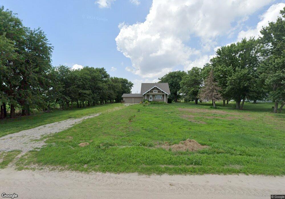
83441 557th Ave Unit 83445 Norfolk, NE 68701
Estimated Value: $249,000 - $417,713
4
Beds
3
Baths
2,152
Sq Ft
$155/Sq Ft
Est. Value
About This Home
This home is located at 83441 557th Ave Unit 83445, Norfolk, NE 68701 and is currently estimated at $332,678, approximately $154 per square foot. 83441 557th Ave Unit 83445 is a home located in Madison County with nearby schools including Madison Elementary School, Madison Middle School, and Madison High School.
Ownership History
Date
Name
Owned For
Owner Type
Purchase Details
Closed on
Sep 11, 2023
Sold by
Hastreiter Peter Louis and Hastreiter Kathryn Sue
Bought by
D & R Heritage Farms Llc
Current Estimated Value
Purchase Details
Closed on
Sep 6, 2023
Sold by
Davis Darlene B
Bought by
D & R Heritage Farms
Purchase Details
Closed on
Apr 4, 2006
Sold by
Hintz Tr Deon A Hintz and Hintz August F
Bought by
Hintz Deon A
Purchase Details
Closed on
Oct 6, 2004
Sold by
Hintz Trs August F and Hintz Elsie E
Bought by
Hintz Trs August F
Create a Home Valuation Report for This Property
The Home Valuation Report is an in-depth analysis detailing your home's value as well as a comparison with similar homes in the area
Home Values in the Area
Average Home Value in this Area
Purchase History
| Date | Buyer | Sale Price | Title Company |
|---|---|---|---|
| D & R Heritage Farms Llc | $350,000 | Stewart Title | |
| D & R Heritage Farms | $291,000 | Stewart Title | |
| Hintz Deon A | -- | -- | |
| Hintz Trs August F | $80,000 | -- |
Source: Public Records
Tax History Compared to Growth
Tax History
| Year | Tax Paid | Tax Assessment Tax Assessment Total Assessment is a certain percentage of the fair market value that is determined by local assessors to be the total taxable value of land and additions on the property. | Land | Improvement |
|---|---|---|---|---|
| 2024 | $2,418 | $277,189 | $85,050 | $192,139 |
| 2023 | $3,595 | $254,798 | $73,535 | $181,263 |
| 2022 | $3,281 | $232,538 | $73,535 | $159,003 |
| 2021 | $2,732 | $195,502 | $53,535 | $141,967 |
| 2020 | $2,690 | $195,502 | $53,535 | $141,967 |
| 2019 | $2,315 | $173,471 | $42,020 | $131,451 |
| 2018 | $2,070 | $162,617 | $42,020 | $120,597 |
| 2017 | $1,971 | $152,659 | $42,020 | $110,639 |
| 2016 | $1,863 | $143,524 | $42,020 | $101,504 |
| 2015 | $1,730 | $133,524 | $32,020 | $101,504 |
| 2014 | $1,798 | $125,143 | $32,020 | $93,123 |
| 2013 | $11,727 | $724,341 | $611,252 | $113,089 |
Source: Public Records
Map
Nearby Homes
- 837 Rd
- 837th Rd
- 808 Andy's Shore N
- 100 Helen Ave
- 101 Henry Ave
- 100 Henry Ave
- 101 Adealia Ave
- 101 Frank Ave
- 1201 S Victory Rd
- 1101 S Victory Rd
- 1100 S Victory Rd
- 2208 S 1st St
- 1406 S 2nd St
- 1405 S 2nd St
- 1001 Prime Stop Way
- 1303 S 3rd St
- 1210 Prime Stop Way
- 1100 Prime Stop Way
- 83148 563rd Ave
- 1104 S 2nd St