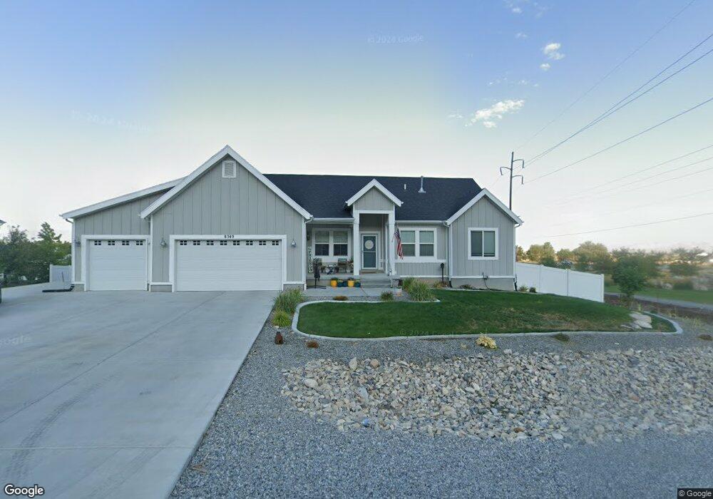
8349 N Lakeshore Dr Unit 734 Lake Point, UT 84074
Estimated Value: $642,000 - $696,000
3
Beds
3
Baths
4,086
Sq Ft
$162/Sq Ft
Est. Value
About This Home
This home is located at 8349 N Lakeshore Dr Unit 734, Lake Point, UT 84074 and is currently estimated at $662,317, approximately $162 per square foot. 8349 N Lakeshore Dr Unit 734 is a home located in Tooele County with nearby schools including Old Mill Elementary School, Clarke N. Johnsen Junior High School, and Stansbury High School.
Ownership History
Date
Name
Owned For
Owner Type
Purchase Details
Closed on
Oct 1, 2019
Sold by
D R Horton Inc
Bought by
Shaw Jessica and Zeddis Christopher
Current Estimated Value
Home Financials for this Owner
Home Financials are based on the most recent Mortgage that was taken out on this home.
Original Mortgage
$377,096
Outstanding Balance
$330,355
Interest Rate
3.5%
Mortgage Type
FHA
Estimated Equity
$331,962
Purchase Details
Closed on
Feb 1, 2019
Sold by
Forestar Real Estate Group Inc
Bought by
Dr Horton Inc
Purchase Details
Closed on
Sep 4, 2018
Sold by
Saddleback Pastures Llc
Bought by
Forestar Real Estate Group Inc
Create a Home Valuation Report for This Property
The Home Valuation Report is an in-depth analysis detailing your home's value as well as a comparison with similar homes in the area
Home Values in the Area
Average Home Value in this Area
Purchase History
| Date | Buyer | Sale Price | Title Company |
|---|---|---|---|
| Shaw Jessica | -- | Cottonwood Title Ins Agcy | |
| Dr Horton Inc | -- | Cottonwood Title Ins Agcy | |
| Forestar Real Estate Group Inc | -- | Cottonwood Title Insurance A |
Source: Public Records
Mortgage History
| Date | Status | Borrower | Loan Amount |
|---|---|---|---|
| Open | Shaw Jessica | $377,096 |
Source: Public Records
Tax History Compared to Growth
Tax History
| Year | Tax Paid | Tax Assessment Tax Assessment Total Assessment is a certain percentage of the fair market value that is determined by local assessors to be the total taxable value of land and additions on the property. | Land | Improvement |
|---|---|---|---|---|
| 2025 | $4,385 | $677,737 | $168,800 | $508,937 |
| 2024 | $4,231 | $329,438 | $92,840 | $236,598 |
| 2023 | $4,231 | $362,359 | $95,150 | $267,209 |
| 2022 | $4,115 | $363,727 | $109,076 | $254,651 |
| 2021 | $2,931 | $216,825 | $56,474 | $160,351 |
| 2020 | $2,855 | $371,061 | $79,400 | $291,661 |
| 2019 | $1,122 | $79,400 | $79,400 | $0 |
| 2018 | $0 | $0 | $0 | $0 |
Source: Public Records
Map
Nearby Homes
- Ponderosa Plan at Pastures at Saddleback
- Bedford Plan at Pastures at Saddleback
- 8635 N Halloran Ct Unit 1322
- Anika Plan at Pastures at Saddleback
- Hemingway Plan at Pastures at Saddleback
- Coronado Plan at Pastures at Saddleback
- 8761 N Lakeshore Dr Unit 1203
- 8635 N Halloran Ct
- Presley Plan at Pastures at Saddleback
- Bryce Plan at Pastures at Saddleback
- Helena II Plan at Pastures at Saddleback
- Avril Plan at Pastures at Saddleback
- 2080 E Colette St
- 8483 N Colette St
- 8537 N Tiffany Ln
- 2080 E Dolan Dr Unit 1332
- 2080 E Dolan Dr
- 2056 E Dolan Dr Unit 1334
- 2056 E Dolan Dr
- 2068 E Dolan Dr
- 8107 Lake Shore Dr
- 1993 Antonio Dr
- 2029 Antonio Dr
- 1970 Antonio Dr
- 1946 Antonio Dr Unit 1221
- 1970 Antonio Dr Unit 1230
- 1980 E Burger St
- 1969 Antonio Dr
- 1969 Antonio Dr Unit 1222
- 8595 N Weston Way
- 1946 Antonio Dr
- 8487 N Tiffany Ln Unit 1304
- 8333 N Lakeshore Dr Unit 733
- 8346 N Lakeshore Dr Unit 718
- 8325 N Lakeshore Dr
- 8325 N Lakeshore Dr Unit 732
- 8330 N Lakeshore Dr Unit 719
- 8380 N Lakeshore Dr Unit 323
- 8380 N Lakeshore Dr Unit 323
- 8305 N Lakeshore Dr Unit 731