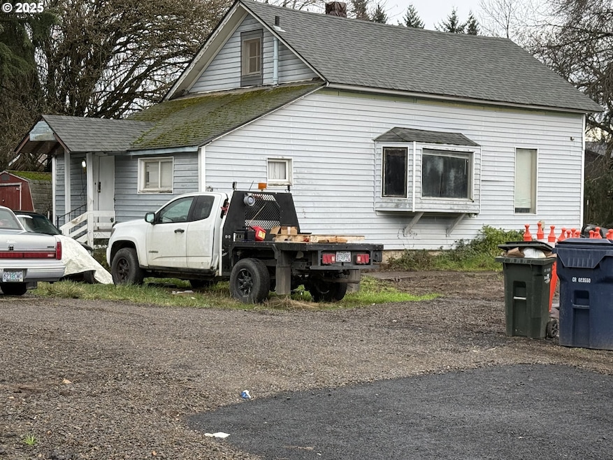


835 Anderson Ln Springfield, OR 97477
West Springfield NeighborhoodEstimated payment $1,731/month
Highlights
- No HOA
- Zoned Heating
- Family Room
- Living Room
- Dining Room
- Level Lot
About This Home
Fantastic Investment Opportunity Near Autzen Stadium! Solid, existing home offering multiple paths to build equity. Renovate and update for instant appreciation, continue operating as a successful rental, or explore the potential to add additional units under Oregon’s Middle Housing rules (buyer to verify).The lot was recently partitioned, and new construction is planned on both sides—positioning this home in a growing infill corridor with excellent long-term upside. Centrally located near hospitals, grocery stores, restaurants, and the bus line. Walk or bike to Autzen Stadium and enjoy direct access to the extensive bike paths, running, and walking trails along the Willamette River—a major draw for tenants, outdoor enthusiasts, and visiting guests.A rare opportunity to secure an income-producing property with strong development potential in one of the area’s most desirable and convenient locations. Don’t miss this chance to invest where demand remains high and possibilities are plentiful!
Listing Agent
ICON Real Estate Group Brokerage Email: ICON@TheICONREGroup.com License #201208715 Listed on: 12/09/2025

Home Details
Home Type
- Single Family
Est. Annual Taxes
- $2,317
Year Built
- Built in 1910
Lot Details
- 6,969 Sq Ft Lot
- Level Lot
Parking
- Driveway
Interior Spaces
- 1,316 Sq Ft Home
- 2-Story Property
- Family Room
- Living Room
- Dining Room
- Crawl Space
Bedrooms and Bathrooms
- 3 Bedrooms
- 1 Full Bathroom
Schools
- Centennial Elementary School
- Hamlin Middle School
- Springfield High School
Utilities
- No Cooling
- Zoned Heating
- Electric Water Heater
Community Details
- No Home Owners Association
Listing and Financial Details
- Assessor Parcel Number 0289643
Map
Home Values in the Area
Average Home Value in this Area
Tax History
We collect this data history from publicly available records. To have your information removed, we recommend requesting removal directly through your county’s website.
| Year | Tax Paid | Tax Assessment Tax Assessment Total Assessment is a certain percentage of the fair market value that is determined by local assessors to be the total taxable value of land and additions on the property. | Land | Improvement |
|---|---|---|---|---|
| 2024 | $2,317 | $124,683 | -- | -- |
| 2023 | $2,317 | $121,052 | $0 | $0 |
| 2022 | $2,146 | $117,527 | $0 | $0 |
| 2021 | $2,107 | $114,104 | $0 | $0 |
| 2020 | $2,046 | $110,781 | $0 | $0 |
| 2019 | $1,984 | $107,555 | $0 | $0 |
| 2018 | $1,870 | $101,382 | $0 | $0 |
| 2017 | $1,799 | $101,382 | $0 | $0 |
| 2016 | $1,761 | $98,429 | $0 | $0 |
| 2015 | $1,711 | $95,562 | $0 | $0 |
| 2014 | $1,685 | $92,779 | $0 | $0 |
Property History
We collect this data history from publicly available records. To have your information removed, we recommend requesting removal directly through your county’s website.
| Date | Event | Price | List to Sale | Price per Sq Ft |
|---|---|---|---|---|
| 02/10/2026 02/10/26 | Price Changed | $285,000 | -4.7% | $217 / Sq Ft |
| 12/09/2025 12/09/25 | For Sale | $299,000 | -- | $227 / Sq Ft |
Source: Regional Multiple Listing Service (RMLS)
MLS Number: 743769164
APN: 17-03-33-11-00600-000
Disclaimer: Certain information contained herein is derived from information provided by parties other than Homes.com. All information provided is deemed reliable, but is not guaranteed to be accurate and should be independently verified.
![]() The content relating to real estate for sale on this web site comes in part from the IDX program of the RMLS™ of Portland, Oregon. Real estate listings held by brokerage firms other than Ten-X are marked with the RMLS™ logo, and detailed information about these properties includes the names of the listing brokers. Listing content is copyright © 2026 RMLS™, Portland, Oregon. Some properties which appear for sale on this web site may subsequently have sold or may no longer be available. All information provided is deemed reliable but is not guaranteed and should be independently verified.
The content relating to real estate for sale on this web site comes in part from the IDX program of the RMLS™ of Portland, Oregon. Real estate listings held by brokerage firms other than Ten-X are marked with the RMLS™ logo, and detailed information about these properties includes the names of the listing brokers. Listing content is copyright © 2026 RMLS™, Portland, Oregon. Some properties which appear for sale on this web site may subsequently have sold or may no longer be available. All information provided is deemed reliable but is not guaranteed and should be independently verified.
- 502 Covey Ln
- 482 Covey Ln
- 1130 Anderson Ln
- 885 Aspen St
- 1171 Lodgepole Ct
- 1074 Hamilton St
- 812 Marilyn Ct
- 977 Island St
- 1444 Menlo Loop
- 962 Rainbow Dr
- 967 Rainbow Dr
- 3365 Buckingham Ave
- 940 W M St
- 1310 W Quinalt St
- 1120 W Fairview Dr Unit 48
- 930 Prescott Ln
- 804 W N St
- 992 Sunset Dr
- 1758 Rainbow Dr
- 1735 Rainbow Dr
- 429 Lindley Ln
- 275 S Garden Way
- 506 W Centennial Blvd
- 956 W Olympic St
- 90 Commons Dr
- 3230 Kinsrow Ave
- 3225 Kinsrow Ave
- 375 Marche Chase Dr
- 369 W D St Unit 2
- 3485-3489 Westward ho Ave Unit 3485
- 2050 E 15th Ave
- 1590 Walnut St
- 3109 Kinsrow Ave
- 1965 E 15th Ave
- 1425 Villard St
- 22 E St
- 562 Fenster St
- 475 Lindale Dr
- 2555 Gateway St
- 3160 Harlow Rd
Ask me questions while you tour the home.