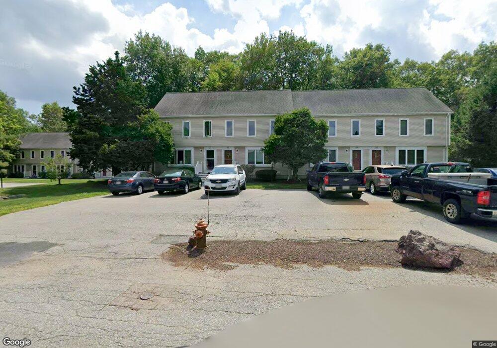
835 Mt Hope St Unit 20 North Attleboro, MA 02760
North Attleboro NeighborhoodEstimated Value: $407,855 - $423,000
2
Beds
2
Baths
1,376
Sq Ft
$302/Sq Ft
Est. Value
About This Home
This home is located at 835 Mt Hope St Unit 20, North Attleboro, MA 02760 and is currently estimated at $415,214, approximately $301 per square foot. 835 Mt Hope St Unit 20 is a home located in Bristol County with nearby schools including North Attleboro High School.
Ownership History
Date
Name
Owned For
Owner Type
Purchase Details
Closed on
Oct 17, 2021
Sold by
Carter Gene
Bought by
Int Gene Carter
Current Estimated Value
Purchase Details
Closed on
May 14, 1999
Sold by
Weber David T and Weber Janet M
Bought by
Carter Gene
Home Financials for this Owner
Home Financials are based on the most recent Mortgage that was taken out on this home.
Original Mortgage
$80,000
Interest Rate
6.92%
Mortgage Type
Purchase Money Mortgage
Create a Home Valuation Report for This Property
The Home Valuation Report is an in-depth analysis detailing your home's value as well as a comparison with similar homes in the area
Home Values in the Area
Average Home Value in this Area
Purchase History
| Date | Buyer | Sale Price | Title Company |
|---|---|---|---|
| Int Gene Carter | -- | None Available | |
| Carter Gene | $100,000 | -- |
Source: Public Records
Mortgage History
| Date | Status | Borrower | Loan Amount |
|---|---|---|---|
| Previous Owner | Carter Gene | $80,000 |
Source: Public Records
Tax History Compared to Growth
Tax History
| Year | Tax Paid | Tax Assessment Tax Assessment Total Assessment is a certain percentage of the fair market value that is determined by local assessors to be the total taxable value of land and additions on the property. | Land | Improvement |
|---|---|---|---|---|
| 2025 | $3,923 | $332,700 | $0 | $332,700 |
| 2024 | $3,891 | $337,200 | $0 | $337,200 |
| 2023 | $3,435 | $268,600 | $0 | $268,600 |
| 2022 | $3,431 | $246,300 | $0 | $246,300 |
| 2021 | $3,254 | $228,000 | $0 | $228,000 |
| 2020 | $3,227 | $224,900 | $0 | $224,900 |
| 2019 | $3,043 | $213,700 | $0 | $213,700 |
| 2018 | $2,502 | $213,700 | $0 | $213,700 |
| 2017 | $2,570 | $194,400 | $0 | $194,400 |
| 2016 | $2,706 | $204,700 | $0 | $204,700 |
| 2015 | $2,624 | $199,700 | $0 | $199,700 |
| 2014 | $2,545 | $192,200 | $0 | $192,200 |
Source: Public Records
Map
Nearby Homes
- 3 Serengeti Dr
- 12 Houde St
- 217 Fisher St
- 212 Fisher St Unit A5
- 8 Al Pace Dr Unit 8
- 1066 Mount Hope St
- 711 Mount Hope St Unit 7
- 711 Mount Hope St Unit 6
- 711 Mount Hope St Unit 8
- 711 Mount Hope St Unit 5
- 711 Mount Hope St Unit 12
- 711 Mount Hope St Unit 9
- 711 Mount Hope St Unit 11
- 711 Mount Hope St Unit 10
- 711 Mount Hope St Unit 16
- 711 Mount Hope St Unit 15
- 711 Mount Hope St Unit 14
- 711 Mount Hope St Unit 13
- 711 Mount Hope St Unit 19
- 711 Mount Hope St Unit 20
- 835 Mount Hope St Unit 54
- 835 Mount Hope St Unit 53
- 835 Mount Hope St Unit 52
- 835 Mount Hope St Unit 51
- 835 Mount Hope St Unit 49
- 835 Mount Hope St Unit 48
- 835 Mount Hope St Unit 47
- 835 Mount Hope St Unit 46
- 835 Mount Hope St Unit 45
- 835 Mount Hope St Unit 44
- 835 Mount Hope St Unit 43
- 835 Mount Hope St Unit 42
- 835 Mount Hope St Unit 41
- 835 Mount Hope St Unit 40
- 835 Mount Hope St Unit 39
- 835 Mount Hope St Unit 38
- 835 Mount Hope St Unit 37
- 835 Mount Hope St Unit 35
- 835 Mount Hope St Unit 34
- 835 Mount Hope St Unit 33