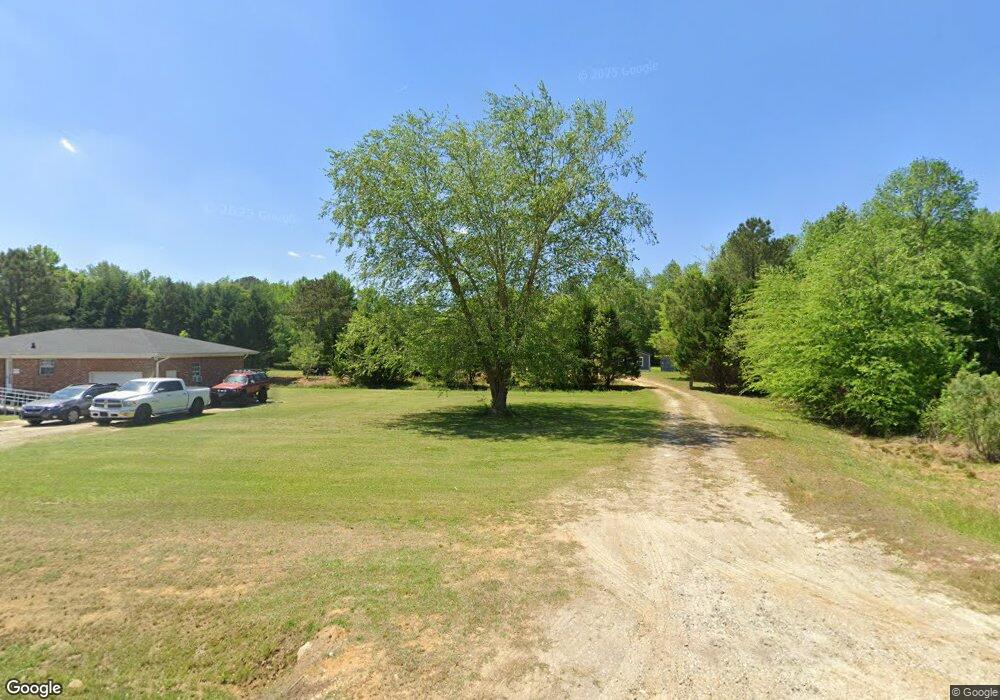
835 Powhatan Rd Clayton, NC 27527
Estimated Value: $637,000 - $1,037,904
3
Beds
4
Baths
4,601
Sq Ft
$170/Sq Ft
Est. Value
About This Home
This home is located at 835 Powhatan Rd, Clayton, NC 27527 and is currently estimated at $781,301, approximately $169 per square foot. 835 Powhatan Rd is a home located in Johnston County with nearby schools including Smithfield Middle School, Smithfield-Selma High School, and Star Christian Academy.
Ownership History
Date
Name
Owned For
Owner Type
Purchase Details
Closed on
Apr 5, 2012
Sold by
Mouser Anthony J and Mouser Camille H
Bought by
M Family Investments Llc
Current Estimated Value
Home Financials for this Owner
Home Financials are based on the most recent Mortgage that was taken out on this home.
Original Mortgage
$500,000
Outstanding Balance
$345,029
Interest Rate
3.89%
Mortgage Type
Future Advance Clause Open End Mortgage
Estimated Equity
$436,272
Create a Home Valuation Report for This Property
The Home Valuation Report is an in-depth analysis detailing your home's value as well as a comparison with similar homes in the area
Home Values in the Area
Average Home Value in this Area
Purchase History
| Date | Buyer | Sale Price | Title Company |
|---|---|---|---|
| M Family Investments Llc | -- | None Available |
Source: Public Records
Mortgage History
| Date | Status | Borrower | Loan Amount |
|---|---|---|---|
| Open | M Family Investments Llc | $500,000 |
Source: Public Records
Tax History Compared to Growth
Tax History
| Year | Tax Paid | Tax Assessment Tax Assessment Total Assessment is a certain percentage of the fair market value that is determined by local assessors to be the total taxable value of land and additions on the property. | Land | Improvement |
|---|---|---|---|---|
| 2025 | $6,053 | $953,150 | $259,450 | $693,700 |
| 2024 | $4,374 | $540,020 | $99,410 | $440,610 |
| 2023 | $4,158 | $540,020 | $99,410 | $440,610 |
| 2022 | $4,266 | $540,020 | $99,410 | $440,610 |
| 2021 | $4,266 | $540,020 | $99,410 | $440,610 |
| 2020 | $4,428 | $540,020 | $99,410 | $440,610 |
| 2019 | $4,428 | $540,020 | $99,410 | $440,610 |
| 2018 | $562 | $532,920 | $82,850 | $450,070 |
| 2017 | $4,477 | $532,920 | $82,850 | $450,070 |
| 2016 | $4,477 | $532,920 | $82,850 | $450,070 |
| 2015 | $2,914 | $532,920 | $82,850 | $450,070 |
| 2014 | $1,880 | $532,920 | $82,850 | $450,070 |
Source: Public Records
Map
Nearby Homes
- 113 Maple Tree Ln
- 128 Maple Tree Ln
- 143 Maple Tree Ln
- 285 Eason Creek Way
- 265 Eason Creek Way
- 255 Eason Creek Way
- 290 Eason Creek Way
- 110 Wicklow Ct
- 172 Westchase Dr
- 102 Pear Tree Ln
- 630 Southerland Rd
- 532 Southerland Rd
- 118 Christian St
- 0 Powhatan Rd Unit 10126540
- 130 Nevada Ct
- 505 Vinson Rd
- 352 Riverstone Dr
- 260 Wilson Farm Ln
- 0 Fire Department Rd Unit 751554
- 0 Fire Department Rd Unit 25173580
- 1025 Powhatan Rd
- 1019 Powhatan Rd
- 1017 Powhatan Rd
- 1021 Powhatan Rd
- 1015 Powhatan Rd
- 808 Powhatan Rd
- 800 Powhatan Rd
- 1030 Powhatan Rd
- 895 Powhatan Rd
- 1280 Powhatan Rd
- 799 Powhatan Rd
- 111 Maple Tree Ln
- 115 Maple Tree Ln
- 109 Maple Tree Ln
- 117 Maple Tree Ln
- 119 Maple Tree Ln
- 121 Maple Tree Ln
- 105 Maple Tree Ln
- 753 Powhatan Rd
- 107 Maple Tree Ln
